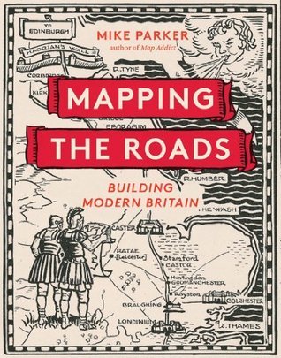
The story of Britain's road development—graphically and beautifully illustrated on our maps—is also the story of its political, economic, and social history. And the car, more than any other single factor, has shaped our landscape and changed our maps. Busy, bustling, often creaking at the seams, most of us have a love-hate relationship with our roads. Like it or not, our modern lifestyles depend on them—not only for getting from A to B, but for the distribution of almost everything we buy. Yet once upon a time, the building of roads was seen as a glorious and heroic enterprise. Britain's motorways—"the cathedrals of the modern world"—are the ultimate expression of our modern age. From the old ways to the motorways, Mapping the Roads charts the ambitions and hopes of the nation through our maps.
An entertaining, interesting, and excellently illustrated history of road development in Britain from Roman times and before to SatNav and Google Maps. I say Britain. It’s mainly England with the odd nod to Wales, Glasgow and Edinburgh. I particularly enjoyed the early chapters, taking us up to the post war years. The foolhardy and shortsighted near destruction of towns and villages in the 1970s, many of them with listed medieval buildings, just made me angry. Or should I say fume which is what we’re breathing in most of the time now. It’s a bad pun - I hear the groans! - but it’s also sadly true.
The history of mapping is fascinating. I enjoyed the author’s earlier book, Map Addict: A Tale of Obsession, Fudge & the Ordnance Survey, and this is written with the same attention to detail, enthusiasm and humour. For example, on SatNav users.......The spokesperson for the Loch Lomond and Trossachs National Park says that they are regularly asked for the post code of the top of Ben Lomond (3,196 feet) by people who intend walking up it armed with only their SatNav. Mike Parker says of these requisite numpties in flip-flops......if it weren’t for the inconvenience to mountain rescue teams, my hunch would be to let them go for it. There’s a lot to be said for natural selection.
4 stars because I wearied towards the end. I enjoyed it very much, however. The edition I have is a lovely book to own, even though a magnifying glass is required for some of the older maps. Or that might just be me!
PS. Here is a marvellous piece of trivia. 2.5 million pulped Mills and Boons lie beneath the M6 toll road to help with drainage. Who knew?!
The last book I got out of my most local library before the Event, and looking at the loans from there, they have a definite concentration on travel as a theme. So as well as the general accumulation of unread books to nag my magical thinking as a potential trigger for all this, I can add that irony – all those books about places I was never going to go, a category now expanded to encompass literally everywhere more than a mile or two away, that library included. Still, even if it's become substitute for instead of adjunct to spring excursions, it's a gently entertaining read, alternately nostalgic and catty. While it begins before the Romans (as did metalled and cambered roads, apparently!), we're less than halfway through before the automobile arrives and the changes really begin – as Parker says, right into the 20th century people were still publishing maps plagiarised from John Cary's 18th century work, and for the most part they were still accurate. Cary's is one of several names that recur here, whether individuals like him and Ogilby, or firms such as the "majestic" work of Bartholomew & Son, who hold pole position in Parker's affections for a surprisingly long time before today's frontrunners, Ordnance Survey, finally get their act together.
If the mockery of various plagiarisms, ill-advised colour schemes and loose relations of maps to actual geography provides much of the book's humour, its heart comes in occasional hymns to Britishness, often made manifest in unexpected forms, such as the Great North Road. Parker admits it's hardly a beautiful drive, but is still moved by "the route of Dick Whittington and Dick Turpin, Robert Louis Stevenson and Charles Dickens, greasy spoons and Stilton cheese, Holy Island and the Angel of the North, of belligerent marching armies and poet John Clare's demented northward stumble. The Great North Road is truly the only real British rival to Route 66." Or how about this, on suburbs (where, as he points out, the Metroland myth might be right there in the name, but they're unimaginable without the automobile): "Somewhere in the middle will be a boulevard or a parade, with its trim selection of shops, a 'Tudorbethan' pub, and either a railway station straight out of a Hornby model train set or a Tube station buit as an improbable Modernsist dare."
Not that the book is all so rosy, despite being published by an arm of the AA. Bridget Driscoll is here too, the woman who in 1896, while the speed limit was still 4pmh, and within that tiny radius of home to which I can still voyage, became the first person killed by an automobile on a British road. Witnesses said the driver was speeding, but "Finding Mrs Driscoll's death an accident, coroner Percy Morrison said he hoped 'such a thing would never happen again'." An approach to risk management which I'm sure we can still recognise in our leaders' handling of PPE shortages today. See also Conservative MP Lieutenant Colonel John Moore-Brabazon, who between the wars pooh-poohed road fatalities as an issue, pointing out that nowadays even chickens and dogs knew to get out of the way of cars, and soon enough so would the lower orders – "These things will right themselves". He subsequently became Minister of Transport. Though another, more sympathetic transport minister has been better remembered, Leslie Hore-Belisha. Obviously I was aware of his namesake beacons, but not that they came about after he was almost flattened in Camden by a motorist ignoring a new crossing - during a photocall, no less.
As the story gets closer to the present day, I inevitably knew more and more of it, and the postwar boom in roadbuilding can't help but feel a little like the slow courtship of Anne of Cleves in The Mirror And The Light, reading through one's fingers because with hindsight the fallout is so painfully obvious. Still, first there's the comic interlude with the CPRE recommending thatched petrol stations, and even a picture of one, despite the idea quite understandably being labelled "incomprehensible and dangerous" even at the time. Soon, less incomprehensible but more damaging plans are being greeted with open arms, as bypasses and motorways blossom across the land, initially welcomed as emblems of speed, progress and the future – Hell, even the service stations were glamorous! Before long, the legacy of blight, noise and pollution becomes clearer, and while the machine tries to power on through, objections mount; for all the kings, cartographers and ministers in this story, the only individual who gets their name in a chapter title is Swampy. While he's clearly susceptible to the old romance of the open road, Parker doesn't remotely regret this correction; there's even one painfully prescient moment when this 2013 book asks whether time spent fuming in a car helps breed a dangerous sense of the country being full. Which, when you look at the map of where voted how three years later, is a surprisingly good predictor, isn't it? Very few places where people favour public transport voted out...
Along the way we get all sorts of odds and sods, like Terry Jones' idea of the strange priorities in Ogilby's Britannia as suggesting it was a literal roadmap for a French invasion with the connivance of Charles II. Parker reminds us of the incontrovertible yet somehow intuitively wrong fact that the automobile and the aeroplane are roughly the same age – you just expect flying to be much harder work, don't you? And in strict mapping terms, we get everything from the Upside Down Map to a bold if doomed 1909 attempt at something not unlike a dashboard satnav. The book isn't perfect – I noticed one caption saying a satellite photograph includes Ireland when it clearly doesn't, and a reference to a supermarket-sponsored map eventually having to give up on including "smaller Tesco Extra stores" almost certainly intended Tesco Express – but there was definitely enough here to draw the sting of my cabin fever even while stoking it.
Also, this is the second book I've read in lockdown to remind me that the name Brighton is an unlovely contraction of the beautiful Brighthelmstone. Maybe that, more than the uncomfortable beach or the general air of Shoreditch-on-Sea, is why I've never taken to the place? It'd be like Crystal Palace sacrificing its shining name to become Chris.
My 4 star is based on a simple fact, I picked this one up from a friends coffee table and did not put it down until read cover to cover. Mike Parker's Map Addict I found disappointing, far too self focused. But Mapping the Roads is a joy. It has the appearances of a pretty coffee table book, but don't be deceived, I found some fascinating insights to British History, and its relationship to its maps and roads within its pages.
This book appealed to my inner geek on so many levels it's like it was written just for me.
Map geek - check. Quite obviously, if you're also one, this is for you. Transport geek - not as much so, but still, check. One of my first jobs was digitising a road network - roads and maps - geek heaven! Social history geek - yep, got me again.
It's well written and very interesting. It's also very prettily put together, and would grace any coffee table.