* The only Colorado Trail guide available for thru-hikers, day hikers, mountain bikers, trail runners, XC skiers, and horse people
* 120 color pictures, 28 segment maps, elevation profiles, integrated GPS waypoints, town maps, and mountain bike detours of Wilderness areas
* More than 50,000 copies sold
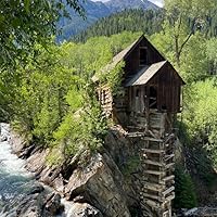
The Colorado Trail (CT) is the premier scenic long trail in North America. It winds its way through endless fields of wildflowers to wind-swept mountain passes, from wild mountain rivers and streams to quiet trails through old growth forests. The CT crosses eight mountain ranges, seven National Forests, six Wilderness Areas, and five river systems. Starting near Denver at 5,500 feet and ending near Durango at 7,000 feet, the CT gains and loses almost 76,000 feet in elevation over 468 miles.
This eighth edition of the official CT guide has all the information a thru-hiker needs to plan and complete his or her trek. New to this edition are updated GPS waypoints, maps, and rewritten descriptions for the 28 segments, as well as new photographs of spots along the segments.
Each segment provides distance, elevation gain, and an overview; a list of trailhead and access points; maps needed; a list of supply points; services and accommodations; detailed trail descriptions; a map; and an elevation gain and loss chart. Additional town maps and mountain bike detour maps (around Wilderness Areas) have been added where applicable.
An extensive introduction includes information on planning, supplying, safety, mountain biking, regulations, and backcountry ethics--plus chapters on Colorado Trail heritage, natural history, and geology. At the back of the book you will find a graphic summary of the trail, equipment list, ranger districts with contact information, bibliography, and index.
This won't tell you everything you need to know about the CT, but it's the first stop for forging a plan. The book opens with a tribute to Gudy Gaskill, "The Mother of the Colorado Trail," followed by several informative chapters on the CT Foundation, logistics for hiking the CT, history of Colorado in the CT regions, flora, fauna, and geology of the CT. The bulk of the book provides a section-by-section overview, including important statistics, trailhead directions and parking, water and resupply locations, and points of interest. It contains helpful links and bibliography to other resources. The volume is 26.8 ounces (762 g), for those counting.
I wish I had known prior to buying this guide that it wouldn't have the most up to date water information. Besides that, it was really useful while I hiked the Colorado Trail! However, we were the only ones on the trail using this guide. Most people just used Guthook, an app that doesn't weigh anything.
As of now, the eighth edition is the latest. Full of essential and ancillary notes of interest for anyone wanting to hike/bike the CT, either in segments or as a through hike. August, 2014.