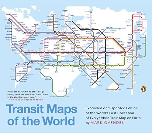
A completely updated and expanded edition of the cult bestseller, featuring subway, light rail, and streetcar maps from New York to Nizhny Novgorod.
Transit Maps of the World is the first and only comprehensive collection of historical and current maps of every rapid-transit system on earth. In glorious, colorful graphics, Mark Ovenden traces the cartographic history of mass transit—including rare and historic maps, diagrams, and photographs, some available for the first time since their original publication.
Now expanded with thirty-six more pages, 250 city maps revised from previous editions, and listings given from almost a thousand systems in total, this is the graphic designer’s new bible, the transport enthusiast’s dream collection, and a coffee-table essential for everyone who’s ever traveled in a city.
Mark Ovenden is a British writer and broadcaster whose previous books include Transit Maps of the World and Paris Underground: The Maps, Stations and Designs of the Metro. He lives in Paris, France."
OK, maybe I've been cuddling with it too long (those of you who know me will understand). Or is possible that this is a book I might have written myself if I'd thought anyone else gave a good goddamn about this topic? (The Brits, to their credit, are far less self-conscious about eccentric/loony interests, have a greater tradition of ministering to like-minded loons, and seem less hell-bent on publishing only best-sellers to sustain the publishing industry.)
While seeming like a straightforward collection of transit maps for systems throughout the planet, this book is a broader look at the art of designing maps (& transit systems) for optimal wayfinding. The colorful assembly of squiggly lines into an aid for navigating [mostly] rail systems - in this book - is more than an exercise in aesthetics or accurate displays of a select topography.
Well-designed maps are highlighted here, but aren't the only ones to make an appearance; the matter of evaluating a map is considered, but there's a greater emphasis on the historical evolution of maps within transit systems - especially the larger, well-established systems like the subways in NYC, London, Paris, Berlin & Tokyo, but also up-&-coming and/or newer systems like those in LA, Beijing, Munich, Mexico City & Sao Paulo.
I might've appreciated more Edward Tufte-like analysis of how much data is being conveyed by the presence [or absence] of ink, but this was still an incredible book to find. If you travel like the locals, like maps, or pay attention to graphic design, have yourself a gander at Mark Ovenden's fine work.
(Just you wait, maybe I'll write a companion volume that focuses more on non-rail transit maps; OR I could try doing that definitive work on vexillology I'd been considering....)
Not what I expected or what I was looking for. It was great to be able to see Kiev and understand it's distance from Russia and the counties of Easter Europe. Great details of transportation in various cities around the world, which might have helped me when I traveled for work some years back. What it didn't provide is what kind of accommodations and the different classes of travel and cost of fares. It might be an interesting read for those folks that travel internationally, but with the Internet But online information is more thorough and convenient.
I’ve discovered a love for oversized coffee table books. Unwieldy troves of trivia, in them novelty wins. I’d buy one browse it for a couple months. They’re books to enjoy slowly, over time, digesting niblets of facts on some geeky, specialized subject. Mark Ovenden’s Transit Maps of the World fills this niche, it makes the journey worthwhile.
In the preface, he smartly defines a transit system. Urban transit maps remain the book’s primary focus, though, while questionable to some, he defends the inclusion of other mixed systems – those with above ground as well as below ground transit systems.
The book is divided into six zones or sections, the first three of which being the richest. The zones are further divided into cities. Ovenden details histories, from the inception of a city’s urban system to its recent model and also includes proposed plans. These biographies of the cities are filled with beautiful reproductions of the maps as they change, grow, and become standardized.
Yes, standardized. Not only is the book interest in the development of the urban systems, but the maps themselves. Some include topography, landmarks to orient travelers where they are aboveground. Standardized, for cleaner looking maps, rids itself of topography and settles instead for standard angles, equal station distant, black station ticks with open circles, among other practices. The book becomes even more interesting where the cities take risks on the maps, trying out a new design. Some experiments early on are phased out, others became the standard.
For most major cities, the development of the systems started in the late nineteenth century, where exponential population growth created demand. Faced with the population surge above, engineers went underground. This was when the maps appeared. The systems grew, some massively. During the Depression, many plans were scrapped, and some systems were put on hold indefinitely. Several of the cities in the later zones had plans before the Depression, but were hit so hard that nothing was done until as recently as twenty years ago.
The book, for all its geeky pleasure, is not serendipitous. After such richly detailed early zones, the latter zones feel included simply for the tagline across the front cover: “The World’s First Collection of Every Urban Train Map on Earth.” It drags once you understand the transit map’s history and trajectory. Even Ovenden has to devise creative ways to say the same thing over and over.
I adore maps, the stuff that travelers' dreams are made of. This book is a delight both as eye candy (what, pray tell, is more satisfying than the London Tube map?) and as food for thought. Consider, dear reader, the humble subway map. So many forms, so much history in a simple line drawing.
The material on the history of various transit systems is a real treat for those whose journeys are, not infrequently, subterranean. This is a geography lesson as well as a transit lesson. I pull this book from the shelf now and again to look up the map for a place I've recently been (Rome, most recently, "one of the world's most complex places archeologically to build a subway"), or to research a place I'm planning to go (Bangalore, whose urban rail is still in the "planning stage," it seems).
Anyone who sometimes finds themselves during a long flight contemplating the back section of the in-flight magazine with the terminal layouts -- yes, you know who you are -- needs this lovely book.
This book is fascinating and fabulous. The transit maps of every (or close to every) metro/subway/light rail/etc. in the world, with commentary (ranging from a paragraph for the small ones to several pages for New York, etc) about each one. The sheer number of transit maps all by itself is great, but the details of how the larger systems evolve (Berlin had an interesting history, for example) really makes the book shine.
We picked this up at the museum store of the Walters Art Gallery, which has a really neat Maps exhibition going on.
It’s the ultimate picture book for over-grown adults, it’s a coffee table book to end all coffee table books, and it’s a collection of graphic design genius. If reading a book aspires to be a sensual experience, Transit Maps of the World takes such ambition to its logical conclusion. Mind you, all of this could simply be the opinion of my four year old self…a boy with the burning ambition to become a bus driver. ;-)
I saw this book at a museum and I went and bought that bitch instantly because if you combine world geography and transportation design, you have my attention.
This book features all the major metro systems in the world. A daunting task indeed, but a task that was accomplished. I loved seeing how location takes part in the stylings of not only the maps, but the architecture. Amazing for a nerd like me!
The only thing I’d want in a book like this is more of the “why” factor: why did this location choose certain shapes for their routes? Why did the artist choose certain angles and colours for their maps, if not purely for aesthetic reasons? There are a few spread out here and there, but I feel knowing more about the cities’ personalities would’ve helped out a bit.
Metros are a convenient if slightly dull way to go from A to B in big cities. Metro maps are cool though. This books collects hundred of metro (and, more generally, urban transport) maps. The maps are great, but it doesn't tell much of a story, neither about urban transport maps in general, nor about the individual cities' maps in particular.
It was such a treat to get to lose myself in the details of the maps presented in Transit Maps of the World. Almost immediately I was made to think about so many now-standard features that I had always taken for granted and never considered before, such as the 45-degree diagonals, the avoidance of station names crossing transit lines, exclusion of street-level details, and the geographical distortion of distances to allow for equal station spacing on maps; once brought to mind, such details seemed both obvious and essential, and were added one by one to the sizeable list of design considerations that need to be kept in mind when translating a transit system to a map (and to be kept track of while examining those maps!). Even for the designers of the system maps included here, the merits of these principles were certainly not always obvious, and the primary arc traced throughout Transit Maps of the World with great thoroughness is that of the trial and adoption of new techniques en route from system representation that was heavily geographical—with early transit maps often literally overlain on existing city maps—to a much more diagrammatic set of prevailing conventions. (It’s especially nice when there are both highly geographical maps and highly diagrammatic ones available of the same system, and even more so when the two styles of map were contemporaneously produced [or when the system in question has not been developed significantly in the interim], so that they are more directly comparable, without significant expansion in between periods affecting the comparison.)
That general progression, however, is merely the general narrative underlying a set of maps that reflect so much variety and so many idiosyncrasies, not only between different systems, but between the historical versions of maps for a given system, for those with histories long enough. Over time, we see innovations introduced for a given system, before its map reverts to an earlier style, before the innovation makes a reappearance later on; as we are exposed to the maps of different cities’ and countries’ systems, we also get a sense of whence non-native innovations were borrowed (and sometimes what is happily adopted in one place is rejected elsewhere—see the case of designer Harry Beck, who overhauled the map of the London Underground, birthing its current, iconic iteration, but whose equally superb, and rather distinct, speculative design for a schematic of the Paris Metro was rejected [and is not even the only included example of an uncommissioned speculative diagram that would make for an apparent improvement upon the status quo]). The maps of a system like Buenos Aires’s are very interesting to track over time, since the lines themselves have changed very little, if at all, for almost 50 years, whereas the maps themselves have all been quite distinctive (and effective); to contrast, see Lisbon’s system, which has also been largely unchanged for nearly 50 years, but whose maps have been highly consistent over time, thanks to the longevity of designer Maria Keil, who had been producing the majority of the system’s for 48 years and counting, since its inception.
The maps in Transit Maps of the World that most appealed to me tended to date to between 1920 and 1975, a transitional period between the busyness of maps reflecting the full geographical layout of the city and the somewhat ruthlessly efficient (if still beautiful, in a more limited sense) where the greatest sense of artistry was allowed to flourish (without sacrificing clarity), helped in part by the fact that many systems were still lightly developed enough in that period to allow for this sort of room on maps. I particularly enjoyed the illustrations of nearby landmarks and attractions; one of the best showcases for these is the stylized 1908 map of a 1908, already very diagrammatic, and vertically oriented, allowing for full-color rectangular illustrations on either side of the central spine, giving a sense of the local offerings by most stations (while the commonly accepted format these days doesn’t allow for such delights, a few systems, like Munich’s, have maintained a few such illustrations, though in much less detail). A London map of 12 years later features gorgeous hand-lettered station names and a stylish zigzag border; a late 1960s San Francisco map indicates each stop not with a circle, tick, or icon, but with a number reflecting travel time in minutes from a system hub; a 1970 Osaka map is very appealing and effective despite lack of accordance to nearly any of the typical guidelines of standardization (as are some of the early in-car Glasgow maps, which incorporate a great deal of street-level detail); a 1973 Oslo map has a delightful illustrated legend which shows color-coded drawings of the four vehicles (train and three types of tram) carrying the four transit lines; and a 1975 St. Petersburg map, breathtaking in its beauty and simplicity, comprises three chords of a circle, each intersecting the other two and creating a striking map that is nearly rotationally symmetrical. Some systems have hung on to distinctive graphical designs even to the present moment; Rio de Janeiro’s current map, and the one from 1995, represent aerial views in a one-of-a-kind approach that represents a huge, and hugely successful, departure from accepted norms of the era, and Stuttgart’s current map, all 60- and 120-degree angles, is highly refreshing, even if it is a departure from the more traditional and instantly recognizable design of German map that I love, an endlessly satisfying blend of visual and logistical complexity.
In addition to discussing specifics of the design of the transit system diagrams, he text conveys a great deal of information that I would otherwise never have known—that visitors to New York City are often surprised by the fact that the map of such a significant system is not a more traditional transit-style diagram, but rather one that hews closely to a geographical and topographical layout of city; that each of Chicago’s subway lines has a single platform that can be walked for the full length of the line, with stairwells to the sidewalk even between stations; that Moscow’s transit system has the most historical maps, is the world’s busiest, and is noted for its cathedral like stations, which, rather than other landmarks, were represented by drawings on two very pleasing system diagrams, in 1938 and 1958; and that Mexico City uses individual pictograms for each station to aid the illiterate (similar images are used in Fukuoka, though not for the same reason), as well as historical context, charting alongside the progression of diagram styles not only technological advances made in terms of the rolling stock but also the social and cultural influences that affected system development and the maps reflecting it (perhaps the section that I found most interesting in this regard was the one on Berlin’s system, discussing the treatment of a divided city, especially for lines that passed through East Berlin but had both termini in West Berlin).
Nevertheless, perhaps inevitably, the text lags somewhat compared to the typical glory of the maps themselves, sometimes stretching comparisons or feeling superfluous, as if there is little further to be added. Once the numerous design considerations to be taken into account have been established, some of the commentary on the maps themselves can feel rather rote, as if grading on an already well-established rubric instead of enlightening new angles of approach; though this tendency fades again towards the end of the book—as the focus moves to systems (or plans therefor) that are more limited in scope, and space constraints lead to more specific discussion of the lines in questions—one can’t help but think that the time might be better used spent explaining certain anomalies or unusual details, or clarifying what phase of development is represented by a certain map, given that the book has previously done such a good job of establishing a framework of positive design principles that—similarly to how I became able to suspect the origins of maps at a glance, based on regional styles like “Russian Metro,” prevalent in former Soviet-bloc countries, and the predominance of colored wards and numbered stations in the transit maps used in Southeast Asia—I was already able to get, on my own, the enjoyment of making assessments of both the functional usefulness and the aesthetic appeal of each map and working out why I found particular ones so satisfying and pleasing.
If someone asks you what your favorite TV show is and your answer is 'Modern Marvels' get in your car and drive REAL FAST down to the nearest decent bookstore and get yourself a copy of this book. It is a veritable pig-wallow of pleasure for people who risk divorce when they stop walking forward to take pictures in subway stations. This book has everything for the enthusiast. First of all you can track the development of your favorite subway systems (those of you who have favorite subway systems, the rest of you can search for the Danielle Steele products that you enjoy) you can spend hours with your atlas and this book traveling vicariously to places you'll never visit. But best of all, the actual systems themselves are an inconvenient subtext to the main action of this book which is the history of the graphic representations of transit systems that are understandable to people with minimal reading and map skills. The giant leap was to abandon literal distance and any reference to surface geography as an element in the map. Only direction and order are important. From there the methods and evolutions of graphic stylization are related. So there you have it. Go and buy!
This book provides a good overview of the history of metro systems around the world. The cities with the longest history of a metro system are at the beginning and each get about four pages of coverage. Seattle is at the very end of the book (page 138 of 139).
Here is the entry for Seattle: "An ambitious plan, with a promising diagram, to build a new monorail network has recenlty collapsed, and light rail is proposed."
This entire review has been hidden because of spoilers.
Not only is it a terrific reference of every urban train map on Earth; it gives an added historical background of each, showing examples of earlier versions as well. A must-have for designers, cartographers, and subway buffs.
Cada ciudad es un mundo y dentro del ese mundo existen mundos subterráneos, los “metros” de las ciudades del mundo hablan mucho de su composición urbana, su pasado y su futuro. Existen siempre ángulos diferentes de acercamiento para el estudio del fenómeno que son las grandes ciudades, la comprensión de las soluciones urbanas que cada nación adopta sirven siempre como referencia y aprendizaje. Este libro reúne los mapas de los sistemas de transporte de más de 250 ciudades de todo el orbe lo que resulta en una colección insólita y muy ilustrativa. Existen evidentemente muchos puntos en común y por supuesto no dejan de ser interesantes las diferencias. Resulta curioso ver las soluciones cartográficas que se aplican en cada caso e identificar por supuesto las mejores, las conocidas y comenzar a planear futuros viajes con las más intrincadas en mente. Sin duda lo que más me llamó la atención de esta colorida edición es la colección misma de mapas, es en ella que encontramos el mayor valor de esta extenuante labor editorial. El fenómeno de los sistemas de transporte masivo está en franca expansión y en particular en las ciudades de asía. Es impactante ver como estas “radiografías” de las entrañas de cada ciudad hablan de la ciudad misma, no se puede negar que a mejor y mayor sistema de transporte público más eficiente y prospera la urbe que lo contiene.
I'm not sure what I was expecting with this book, but it wasn't as interesting as I had hoped. It had a ton of full-color images and some interesting history, which I enjoyed thoroughly, but overall it felt like a rather flat, dull book. I think this is due to the fact that the same information was shared for each city, so it was a lot of names (companies who managed/manage transport and map designers), dates, and numbers. I think I was hoping for more anecdotes, surprising tidbits, or trivia. This wasn't that. I was also looking for an explanation of how transport maps are designed--what kinds of things need to be taken into consideration, how many people and drafts it takes to get one right, why and how the layout of the routes on a map in no way reflects where the routes actually go around the city. This also wasn't that.
Ovenden has collected in one place a seriously impressive number of train maps, and the sheer intensity of the work map designers have in many places is overwhelming and intimidating. Hats off to those who make it happen so the rest of us can get around, even in unfamiliar territory.
As a fan of maps and metros, I quite liked this book ans its informative look at transit maps from systems around the world.
The text was unfortunately marred by typos (e.g "rapdily" (page 9), "sytsem" (page 27), "adpoted" (page 39), "deacdes" (page 71)) and incorrect apostrophe use ("it's" for "its" (page 22), "continents'" for "continent's" (page 34), "countrys'" for "country's" (page 71), "worlds'" for "world's" (page 135), "its'" (page 157) to name a few.
Loved the maps of historical systems, like London and New York, where you can see how areas developed. Less interested in tiny, recently developed public systems without commentary--didn't know what I was looking at!