The Mind Game of Interpreting Mythology:
The book is a monument.. a big fat volume with small fonts and compressed spacing, of exactly 674 pages –if you excuse yourself from the postscripts and appendices, and at the end of the book, Hancock rues “ even so, there has not been space in this book for me to recount the results and experiences of all my own dives and expeditions – let alone all the dives and explorations that should be done in the future if we really want to know what’s out there”
The book divided into six parts:
Part 1: Initiation : 80 pages
Part 2: India-1: ~100 pages
Part 3: India-2: ~100 pages
Part 4: Malta : ~150 pages
Part 5: Ancient Maps : ~100 pages
Part 6: Japan, Taiwan, China: ~120 pages
The author is by no means an armchair theorist : one who learnt diving only to experience the subjects of his book & has gone through the entire unabridged six volume set of Ralph Griffith’s translations of the Rig, Atharva, Yajur & Sama Vedas, could hardly be called so. Not only he has undertaken expensive trips to far-away places to explore and co-relate the evidences , he had hired a dedicated research assistant from Oxford : Sharif Sakr to research the book’s subject & a ‘resident expert’ on sea level changes : Dr Glenn Milne of Durham University. And to top it all, dealing with the red tape and ancient bureaucracy of India, is a feat in itself!
Neither the books is targeted for casual readers.
Packed with more in-depth and hands-on research than the FOTG, the book may sometimes read like a textbook demanding skim-reading, but I felt those portions are equally important in a sense that the book is written in two layers : the first layer is the author’s travelogue and photographic co-relations making a fast reading pace & once through with all the interesting anecdotes and challenging incidents the author undertook in exploring the underworld, the reader may well re-read and uncover the second layer of the book : the book of mythology and scientific explanations.
His dive explorations can be chronologically mentioned as below:
- Leant Diving : Nov 1996
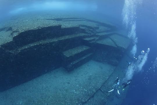
- Yonaguni, Japan: March1997
- Kerama, Japan: April 1999
- Yonaguni, Japan: June 1999,
- Bimini Road, Bahamas: Aug 1999
- Alexandria, Egypt : Sept 1999
- Dwarka, Western India : March 2000
- Kerama, Japan: April 2000
- Yonaguni, Japan: Sept 2000,
- Maldives: Feb 2001
- Poompuhur, South India: Feb 2001
- Yonaguni, Japan: March 2001
- Kerama, Japan: March 2001
- Qawra Point, Malta: June 2001
- Taiwan: August 2001
The history of pre-history:
- Modern human beings appeared around 40,000 years back. Inaccessible European cave arts ( e.g. Chauvet Cave in France) are attributed to an age of 30,000 to 12,000 years back.
- LCM ( Last Glacial Maximum) is referred to the time between 22000 years and 17000 years back, when the ice sheets were at their maximum cover
- Palaeo-lithic or Old Stone Age refers to all history before 12000 years ago. Neo-lithic refers to New Stone Age from 12,000 years ago ( 10,000 BC) onwards. Copper Age started in 3000 BC ; Bronze Age in 2000 BC; and Iron Age began in 1000 BC
- Palaelithic human activities are believed to be that of hunter gatherers, while the onset of agriculture & farming are attributed to neo-lithic humans.
- Global super-floods of huge 100 meter high Ocean wave rise caused due to rapid ice melting; accompanied by un-imaginable volcanoes and earth quakes gripped the planet from 17000 years back upto 7000 years back. Almost 25 million square kilometres of earth’s surface was inundated during this period.
- Specifically, there were three Global super-floods: around 14000 years back, 11000 years back and again 7000 years back; that caused disappearance of many lands and life-forms & made seemingly safe places as beachfront properties.
The Indian hypothesis:
North India:
- At the end of the Ice Age, a costal civilization on the Western shores (may be in the present day Gulf of Cambay/Khambat where an underwater city spreading 9 km has recently been discovered in 2001 and wooden pieces from the site has been carbon dated to 7500 BC) who memorized the Vedas from an earlier epoch and practiced Yoga, and was lost by the Great Global Floods.
- The survivors migrated northwards and set up fully-functional village farming communities at Mehrgarh ( in Pakistan) and other Indus-Saraswati civilizations in the foothills of Hindukush, Karakoram & Himalayas at around 7000BC – a precursor to Cities like Mohenjodaro & Harappa . Legends suggest Manu and the Seven Sages ( Viswamitra, Jamadagni, Bharadvaja, Gotama, Atri, Vasistha & Kasyapa) survived the flood and, migrated to the Himalayas along with plant seeds for a new agricultural beginning, and they were responsible for renewing life and reproducing the four Veda’s from their memories. Moreover, the similarity of the Vedic flood and the Seven sages with Sumerian & Egyptian mythology suggests that the seven sages in the retreat of the Himalayas, not only manipulated the kingdoms in India but in Egypt, Mesopotamia, South India and elsewhere as well.
- That the Vedas were written by the ancients of Indus-Saraswati civilization, rules out the theory that Europeans called as “Aryas” once migrated to India and took control and therefore are the creators of these ancient texts such as Vedas, Mahabharata, Ramayan, Puranas etc.
South India:
- An ancient civilization called Kumari Kandam once spread upto 1500 km into the Ocean, from present day Kanya Kumari upto a much larger Maldives. The cities of Ten-madurai, Kavatapuram & Uttara Madurai played role as seats of Academic learnings respectively around 11600, 7200 and 3500 years ago-coinciding with the three Great Global Floods. When the Kumari Kandam civilization that also included Ravana’s kingdom was destroyed by rising oceans, the surviving Seven Sages( Marichi, Atri, Angiras, Pulastya, Pulaha, Kratu & Vasistha) retreated to Arunachela mountain at Tiruvannamalai. By precession concepts, Arunachela lies 48 degrees east of Giza and 24 degrees east of Angkor Wat : other sites of flood survival.
- Both the Dravidian civilization of Kumari Kandam & the Vedic civilization of Indus & the North Western India seem to be intimately inter-related. Also the ancient Redins of the Maldives are found to share their culture with the olden civilization on the Gulf of Cambay. Obliquely enough, Maldives is theorised to be the remains of a lost island, Taprobana, or Tribubhana because the references of this lost island to Sri Lanka looks misplaced because of their offset in ancient maps.
The Malta hypothesis:
- An ancient palaeo-lithic civilization once lived on the Plaines of Europe, well skilled with building megalithic structures with astronomical precision, and at the end of the Ice Age between 17000 years ago and 12000 years ago, they migrated to the warm climate of the southern point of Europe- via Italy, Sicily -to the present day disjointed island of Malta.
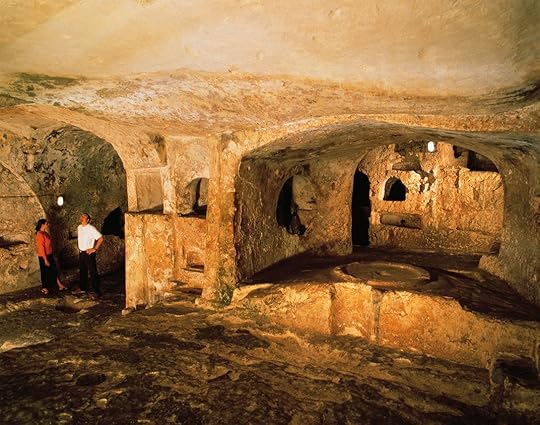
- Skills of the ancients are evident from the gigantic Gigantija; the Hypogeum – representative of a vast underground network of tunnels; and the solar temple of Mnajdra – where the sunrays follow a cyclical pre-designed pendulum path between the summer and winter solstices. But still un-interpreted are the submerged cart-ruts. Hypogeum was found to be filled with human skeletons in an earthen mixture, that may be due to the Global Floods pushing the human remains into the underground caves.
The Japanese hypothesis:
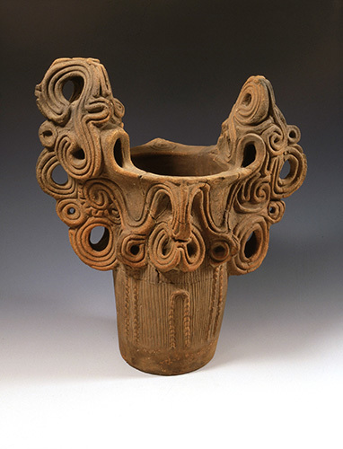
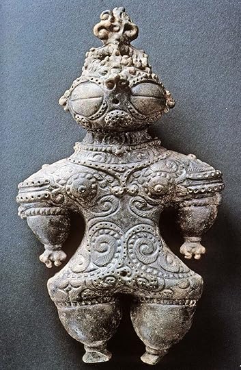
- Japan, the land beloved of the Gods, is one of those rare lands which did not suffer the complete annihilation of its ancient culture at the end of the Ice Age due to reverse floods and tectonic re-adjustments between 17000 & 7000 years ago. Japan and Taiwan appear in old Ice Age maps as Antilia & Santanaze, the lure of which drew Columbus erroneously to set out westwards on the Atlantic but he made the obvious landfall at America, and not Japan. Japan was home to the Jomon who inhabited that land some 16500 years ago, deep in the palaeo-lithic pre-history. The Jomon were a sea-faring civilization frequenting and migrating to North and South Americas, Fiji and other places; and are believed to be a rice-cultivating and makers of exquisite potteries.
- There existed a large landmass near the yellow sea and Korean peninsula that figure in ancient Japanese and Chinese mythology, now under the sea, which was populated by Yayoi tribe of the Koreas, and there existed an increasing inter-cultural fusion between the Yayoi and Jomon.
- The Japanese mythology of the sea-king sanctuary, the enchanted Spirit island and the Land of Yomi described in Kojiki and Nihongi texts; the Chinese mythological íslands of the Sea Mage’ recorded in the Shih Chi & Hua I Thu.. all point to a place under the sea somewhere between Okinawa, Taiwan and the Yellow Sea.
Theories not fully developed:
There are few theories that demand a detailed treatment:
- The ancient landmass of Sunda Shelf that covered the present geographies of Malaysia & Indonesia: what are their myths and ancient civilization. Were they having regular interaction with ancient civilizations in the Indian continent, as evident from Hindu icons in Balinese & other south eastern mythologies.
- The story of Ramayan and the mythology of creating the land bridge between India and Sri Lanka by the monkey army of Lord Hanuman: how does it gel with the scientific finding that the two lands were once connected. And if it is one of those cases of corruption in the re-telling the fables, do we have some evidence of the original pre-history?
- The story of Mahabharat & that of Lord Krishna need more close inter-relation with the suggested pre-history of Indus valley, in view of the steatite tablets unearthed at Mohenjo Daro depicting Krishna & also the iconography of Lord Krishna appearing in other religions such as the Todaiji temple at Nara,Japan and in Balinese texts and temples
- The pre-history of Orissa & the Solar temple of Konark built by Lord Krishna’s son, Samba.
A strong cocktail of geology, archaeology, pre-history, mythology, ancient texts and maps, and science of inundation mapping; the book grips the reader in its flow with every swirl of its audacious sweep of pre-history. Slowly but surely. The very ancient maps like the Ptolemic maps, Reinal’s map, Cantino planispheres, Hereford mappamundi – though gives the general idea of the ancient’s knowledge, the details and the texts in the maps themselves are hardly readable, may be due to the fact that they are copies of copies of ancient copies that have landed in the book- surely if we could have the maps re-drawn and presented with all their details, it would have made it more enjoyable.
Finally, as the author says..”one of the problems with the game of interpreting myth : the meaning ascribed may be more in the eye of the beholder than anything else..”