In this true story of adventure, author Jack Nisbet re-creates the life and times of David Thompson—fur trader, explorer, surveyor, and mapmaker. From 1784 to 1812, Thompson explored western North America, and his field journals provide the earliest written accounts of the natural history and indigenous cultures of the what is now British Columbia, Alberta, Montana, Idaho, Washington, and Oregon. Thompson was the first person to chart the entire route of the Columbia river, and his wilderness expeditions have become the stuff of legend. Jack Nisbet tracks the explorer across the content, interweaving his own observations with Thompson’s historical writings. The result is a fascinating story of two men discovering the Northwest territory almost two hundred years apart.
Sources of the River tells the story of David Thompson, the fur trader who was the first European to explore the northern Rocky Mountain region in the U.S. and Canada. Thompson was born in 1770 and grew up in an orphanage in London before going to work for the Hudson Bay Company in 1784. Thompson entered the business just as increased competition in the fur trade was forcing fur companies to explore further inland from Hudson Bay and the east coast of North America. Early on, Thompson picked up astronomical and cartography skills which made him very useful in the exploration of uncharted territory. He was the first to survey and map the headwaters of the Mississippi and much of the east side of the Rocky Mountains in Canada. In 1797 he switched from the Hudson Bay Co. to work for Canada’s Northwest Co. He later explored an overland route over the Rocky Mountains with the hope of discovering the rumored great river to the Pacific Ocean. The Lewis & Clark expedition of 1804-1806 provoked the Northwest Company to speed up exploration west of the Rockies. Thompson was then the first European to explore the entire length of the Columbia River and many of its northern tributary headwaters including the Kootenai, Clark Fork, Flathead, Spokane, Colville and Pend Oreille rivers. Of course, his explorations would not likely have been possible without the assistance of the native population. In 1812, just as the U.S. and British war was beginning, Thompson retired and moved near Montreal where he made several maps of the northern Rocky Mountain region that became the standard maps used by fur traders and others. He then contracted to help survey the U.S. – Canadian border. He had earned a lot of money but died in poverty in 1857 at the age of 87 due to a series of bad investments. Later a surveyor in the Rockies was relying on some old maps that he realized were surprisingly accurate given their age. He researched the creator of the maps, David Thompson, and in 1916 published a book of his experiences that made Thompson famous as one of the continents early and most successful explorers.
The book is appealing because one gets a glimpse of native culture and the western region before the influx of Europeans. Thompson did encounter evidence that the native population had been much larger but had been culled by small pox epidemics in advance of the explorers. There are also signs of how disruptive the fur trade was to native culture and politics as various tribes went to war with one another over who had access to the fur traders and the guns and ammo that they traded for furs. It is also interesting that Thompson’s wife and kids were with him on the frontier and even on perilous trips over the Rockies and yet Thompson rarely mentions them in his journals. There is even an extensive story of a native transgender person that was almost more fascinating than Thompson’s story.
The biggest complaint I have about the book is that the author weaves in his own stories of traveling in the areas that Thompson explored. These stories are most often pointless and boring and added nothing to the narrative. Aside from these side stories, the book is a good read for anyone interested in the early exploration of the region.
I've lived in the Inland Northwest for eight years now since first crossing the continent from the East Coast to attend college in Spokane. Since then I have seen the natural sights and heard of David Thompson. While as a teacher in Seattle I even briefly taught on Thompson as part of my 8th grade regional history class.
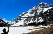
This, however, was the first chance I had to learn about the adventures of America's forgotten trailblazer. I loved the author's way of weaving biographical chapters with accounts of his own adventures in the same regions. Living in North Idaho now, I was fascinated by the many familiar places described by Thompson decades ago.
Reading this work reminded me of reading the journals of Lewis and Clark. A great work.
Solid research (with extensive notes and references) interspersed with the author's own travel to key locations. David Thompson, the first to explore the length of the Columbia river, had a very interesting life. If his government had known and listened more to this man, most of the state I call home would have been a thriving part of Canada.
Thompson's journals are the source material for the travels, and portions of his hand drawn maps are recreated in these pages. His efforts to establish trading posts and his interactions with indigenous peoples are well described. In some cases, we get a feel for how these folk worked closely with the river. I started this book a year ago near Kettle Falls, and finished it this year in the same place. The way these tribes fished this unique location is really interesting.
This is a really good read that combines extracts from Thompson's own journals, accounts from the time and Nisbet's own travels following in his footsteps. Nisbet avoids getting bogged down in too much detail but gives enough to give the reader a true sense of the time and of the enormity of Thompson's travels and explorations, including his role in trading with and taking advantage of the First Nations Tribes, however in keeping this was with the attitudes of times. The story is well supported by various maps and plans that show Thompson's progression across North America, which prove immensely useful for those of us not familiar with the area or its history. This really is an excellent read as well as being informative, although I suspect there's a lot more to the story too.
A proper adventure adequately translated from notes and shorthand that illustrates the life and journey of one of the most capable early surveyors in the United States. Thompson's mapping techniques, personal and professional endeavors, relationships with indigenous groups, and thirst for discovery are well illustrated. This feels like an accurate portrayal of what life as a fur trader and surveyor was like.
David Thompson was arguably the first person ever to travel the entire Columbia River, certainly the first one of European descent. Thompson worked for different British trading companies and his duties included exploring, searching for a river passage to the Pacific, and surveying the lands he explored. In "Sources of the River" author Jack Nisbet describes Thompson's journeys based mainly on Thompson's journals and maps and intersperses Thompson's descriptions with his own descriptions of the same areas in present time as Nisbet retraces Thompson's journeys. The main differences of course are the falls and rapids that posed such challenges to the canoe traveling Thompson parties that have been replaced by reservoirs behind the series of dams along the Columbia. There are great historical tidbits. Thompson reached the confluence of the Columbia and Snake six years after Lewis and Clark, when he reached the mouth of the Columbia he met Astor's expedition that was building the fort at Astoria with their plans for fur trading and exploration. I was struck by the difference between Thompson's relationships with Native Americans with those of Lewis and Clark and the Astoria parties. Thompson respected their culture and heritage much more, an example was that when he got to the confluence with the Snake River he named the Shawpatin river after the people who lived in its vicinity, six years earlier Lewis and Clark named it "Lewis's River"(The current name Snake is derived from Shawpatin). Thompson was also a diplomat between warring tribes and while he arguably took sides at times, he largely avoided fatal encounters in the many years he lived and traveled among the tribes. In contrast, Lewis, killed a Blackfoot within days of first meeting the tribe, similarly the Astoria party had numerous fatal encounters with different Native American tribes within a short period of time. I recommend this well researched, well written book, especially for those interested in our regional history.
Interesting read. Begins with Thompson's orphaned beginnings in England, his employ by the Hudson Bay Company, beginning in Churchill, then, York Factory, and progression West. He ended up with the North West Company (competitor of the HBC) and explored many of the river systems across the Prairies and even into the US - the Missouri in particular. He had taught himself navigational and mapmaking skills, becoming so particular, fastidious and accurate that he would take three shoots, sometimes by different methods (sun, stars) to ensure accuracy. Lewis & Clark used his maps for part of their trip up the Missouri. He became a resident at Rocky Mountain House and spent five years finding the source of the Columbia River and mapping its course, tributaries and surroundings. A phenomenal feat, especially as you read about the conditions under which he did it. He retired to Montreal where he took all of his raw data (readings / notes / narratives) and developed highly detailed and accurate maps from the Hudson's Bay all the way to the Pacific, even filling in Native American villages, what languages they spoke, who they traded with, local habitat and game, mineral sources, and more. Despite the reduction of this incredible wealth of information into concise but comprehensive maps, he received little if any recognition or remuneration for his efforts. It was not till decades after his death that the magnitude of his explorations, record keeping and map making skills came to be recognized and given its due. A very even tempered, intelligent, and wise man, consistent and relentless in his pursuit of knowledge and the explorer's curiousity, yet very patient and pragmatic. The book is worth reading just for a glimpse at his personality and character traits, admirable in many ways.
Most surprising to me is how friendly and cooperative the Natives were for the most part. Everywhere he went he was on peaceful relations with them. It may have had something to do with the fact that the Canadian (at the time British & French colonists) made efforts to learn the Native language, to be familiar with their customs and to respect them. On page 78 we read of how Lewis & Clark, rather than recognizing Indians' custom of borrowing things, simply killed the Piegans who took things. The Blackfeet tribes thereafter called the Canadian traders "Northern White Men" and the American white men "Big Knives". It is interesting how, in his later years of exploration in the areas of northern Washington and Idaho and Montana where Lewis & Clark had been, embittered Natives would be calmed or, at least submitted, by Thompson's demeanor, fairness, sterness and even-handed treatment of them.
I was thoroughly captivated by this well-written account of the life and explorations of David Thompson. So much is known and written about the travels of Lewis and Clark, yet Thompson is rarely mentioned. Jack Nisbet has a gift!
Real explorers eat their horses and build canoes. Great history of the Lewis and Clark contemporary looking for the source and mouth of the Columbia while trying to earn a living as a fur trader.
As a fairly new resident of the US Pacific Northwest, only 30 miles from the border, I have noticed that Canada is rarely covered in local news or weather. It's like a country that could be half a globe away. The same might be said for Canadian history. David Thompson might be called the Canadian Lewis and Clarke. Unlike Lewis and Clarke though, Thompson spent the better part of his life living in and continuing to explore and probe the rivers and lands he discovered and mapped.
Starting as a 14-year-old orphan dropped off by ship in the Hudson Bay in 1784, he traveled the western expanses of Canada for close to 30 years. His mapping skills provided the first accurate assessment of the Canadian Rockies and the source of dozens of mighty Canadian rivers. But perhaps his greatest contribution was tracing the meanderings of the Columbia River to its mouth on the Pacific Ocean.
This is a great book for anyone who loves stories of exploration and would be an excellent read for anyone travelling northern Washington, Idaho or Montana, or in the Canadian Rockies. It left me wanting to see more of the locations where Thompson and his rotating troupe of voyageurs trudged through snow, canoed, staved off raiding Indians, starved and hunted.
This book is primarily about the life of David Thompson, a man who mapped much of Northwest America. The book contains three interspersed and related but different portions: quotes from some of Thompson’s original narrative, a summary or retelling of Thompson’s adventures by Nisbet, and some contemporary scenes where Nisbet is on site at places Thompson visited during his travels.
The book was enjoyable for me, but I have a bias living in the Northwest. The last 20% of the book is composed of a chronology of the period Thompson lived, a whole lot of primary and secondary sources, some end notes on the chapters, and an index. It is a well researched book. The maps included are of interest and helpful in placing where Thompson was at given times.
Having read two books on the Lewis & Clark expedition and one on John Jacob Astor’s men establishing Astoria by land and sea, it was interesting to get a British perspective on the times and places. Thompson never lost a man in all his work in the Northwest; that says much about his abilities. He was a businessman but also a map maker, adventurer, and somewhat of a philosopher, quite an interesting fellow really. He did eventually find the source of the Columbia and traveled down it to the mouth and back again. Thompson had a long and productive life, and it was both fun and informative to read about him.
Wow--Life is sooo easy and comfortable! Fascinating tale of David Thompson and the expanding Canadian fur trade across the continent. Nisbet has condensed and woven the journals of Thompson with how the land looks like now, as he traveled to many key places across the plains, then mountains and upper Columbia River that have changed little in 200 years. I am thrilled to not subsist basically on a diet of meat, from porcupine and beaver to deer and buffalo with their only vegetables what they gathered in the wild, gardens with turnips or the pemmican traded with native Americans! Nisbet fills in the blanks about what happened to the natives and the land in Oregon, Washington, Idaho, Montana, British Columbia area after Lewis and Clark came through and Astor landed a party at the mouth of the Columbia River, how letters years old helped form decisions and discovery.
A book club selection, this is a wonderful tale of David Thompson's explorations in the late 18th and early 19th century, seeking a viable route through the Rocky Mountains in the land that became Canada and the United States. While Lewis and Clark ultimately beat Thompson to the Columbia River, the story of Thompson's many years of fur-trading journeys - particularly the focus on interactions with Native Americans - is beautifully told in conjunction with passages from Thompson's own lengthy diaries and the author's days traveling along Thompson's routes. The inclusion of many maps - both Thompson's and more modern versions - make this a great read for anyone interested in understanding the history and geography of the inland Northwest.
At length the Rocky Mountains came in sight like shining white clouds on the horizon, but we doubted what our guide said; but as we proceeded, they rose in height, their immense masses of snow appeared above the clouds, and formed an impassable barrier, even to the Eagle.
David Thompson a Canadian explorer with the NorthWest Company - travelled 90,000 kms and mapped 4.9 million sq. kms or 1/5th of the North American continent.
Maps that were so accurate they were used for a century and by the Lewis & Clark expedition in the US. The first European to travel the Columbia River from end to end and pioneered the Athabasca Pass between Howse and Yellowhead Pass.
If you've read about Lewis & Clark and the Astor Company then you should read this story of David Thompson to round out your overview of European exploration of western North America. Since most of his travels were north of the 49th parallel, most Americans haven't heard of David Thompson. His extensive travels and mapping of the west had a great influence on those that followed in the westward expansion of Canada and the Untied States. A an enjoyable read that will leave you in awe of his accomplishments.
The parallels between Thompson's encounters and the country he traveled compared to the author's following Thompson's footsteps was very interesting. The changes wrought have been immense. I found the accounts that Thompson left fascinating and wished there were more of his journal entries although as the author described that may have been very difficult to include or understand. He certainly knew how to navigate, survive and make friends with whomever he met. I would have loved to have been on those travels.
A swatch from the life, thoughts, and discoveries of the educated British explorer, naturalist & mapmaker, David Thompson. He became a Canadian hero before Canada was founded as a nation! Explored and wrote accounts of the Columbia River & tributaries, and some of the indigenous cultures, in what is now Alberta, British Columbia, then down into what is now western U.S. where it flows into the Pacific, at Astoria, Oregon.
I really liked this book. I’m in Montana and the book gave great information about the exploration of the NW and all of the rivers. The only thing that might have gotten it 5 stars was if they had put current maps along side the explorer’s maps to give a better idea maps to give a clearer picture of the area.
Glad to know more about this individual and the particular time and place. Although it was not the most dramatic or exciting sequence of events, there was constant danger, beauty, and the occasional irony.
fantastic! If you like local history & are from the North West this is a must read. Thompson shaped so much of this area it's a disservice to not know his story. Nisbet does a wonderful job of being detailed while not getting bogged down in them.
David Thompson was the first European to explore and map the full reach of the Columbia River from its source in the northern Rocky Mountains in what is now British Columbia. He ranged over the inland upper northwest, setting up trade houses and surveying for the NorthWest Company, a competitor to Hudson's Bay Company for the fur trade. His sharp eye and meticulous practices lead to such accurate latitude and longitude readings that they stand up to modern techniques. He also observed the social practices of the First Nations he encountered (sometimes as the first white man they'd seen). He was able to record the locations of the tribes he encountered, mineral deposits, forests, and other geographic details. His work was motivated by a curiosity for the land and a desire to do a good job. The stories of his travels -- compiled from several remaining notebooks, and a "Narrative" unfinished at the time of his death -- are riveting, I can barely imagine the difficulties he and his crews faced as a matter of course. Unfortunately, after retirement, he was unable to get his maps published during his lifetime, and they have languished half forgotten. Nisbet interposes his own travels in the modern day inland NW, on a heavily dammed Columbia River.
This is a book my Dad read a couple of times because he enjoyed it so much, and then he gave me his copy because he knew I was interested in books about explorers and about travel in remote places. In the days of David Thompson, western North America was indeed remote! When David Thompson first crossed the Rockies in 1801, he was the first to survey and chart the rivers and landmarks west of the Great Divide, and his teams were the first white men that many aboriginal tribes encountered. And though the adventures that such wilderness exploration created made for great reading, it was Thompson's warm and teachable manner with the indigenous peoples of the region that made his travels so engaging.
Jack Nisbet takes us on two journeys with his book, Sources of the River: Tracking David Thompson Across North America. One journey is his personal trek to find David Thompson; to track his movements across the Northwestern part of the American continent during the first years of the 19th century and to connect with him. The other journey comes from Thompson's journals and the written and mapped record of his treks through Western Canada and the Pacific Northwest. Nisbet makes a wonderful narrative and weaves these two journeys together into an enjoyable historical experience. I relished every moment of this book.
Excellent historical geography/biography told by jack nisbett as he retraces the path of david thompson, explorer and navigator for the hbc and nwc, mapping the source of the columbia in the expansion of the furmen across the inland northwest. jack inserts occasional modern narrative, bringing the past into present. With maps of the incredible breadth of country explored. Amazing recounting from Thompson's journals and other sources of the wild country, many tribes, interesting individuals, and challenges of contact and establishing trade routes.