
Andie LaComb's Blog
October 12, 2025
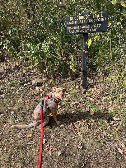
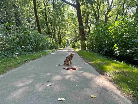
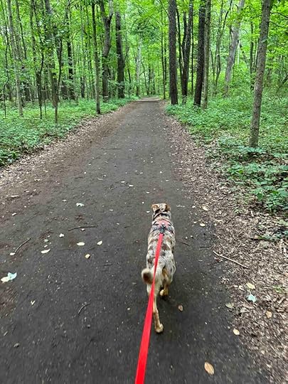
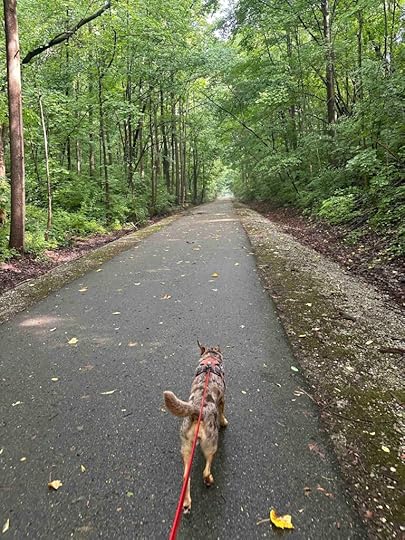
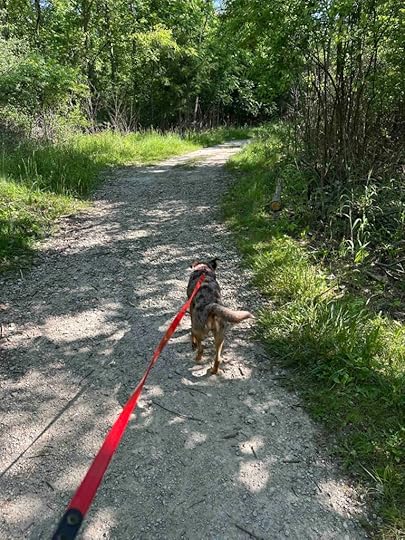
Bloodroot Trail
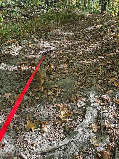
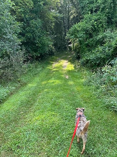
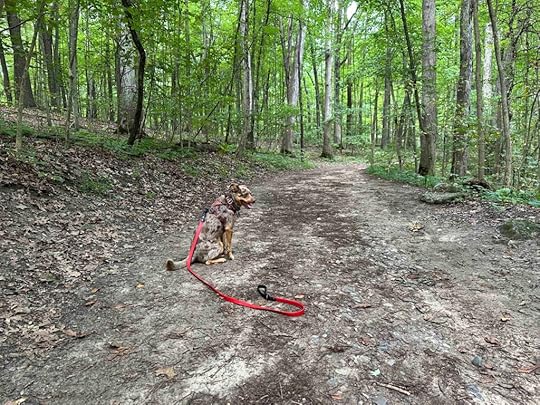
Despite a chilly morning Sunny and I decided to hit the trails. We wanted to explore a new place so we drove to Andrews, IN to check out the Bloodroot trail. What we found was a beautiful and peaceful hike with views of the Salamonie River.
History of the Bloodroot TrailLocals and the Civilian Conservation Corp developed the Bloodroot Trail in the 1930s as part of the Salamonie River State Forest. The thirteen mile trail connects the Lost Bridge West State Recreation Area with parts of the Salamonie River. The name of the trail comes from the abundance of the bloodroot plant along the river. Native Americans used this plant to create yellow dye and the native term for yellow paint, O-sah-mo-nee, gave the river its name – Salamonie.
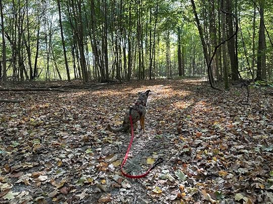
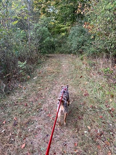
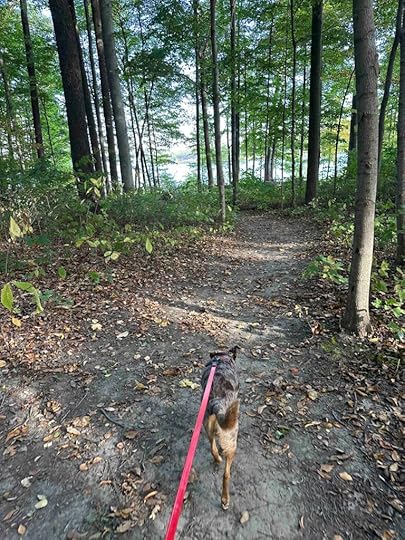
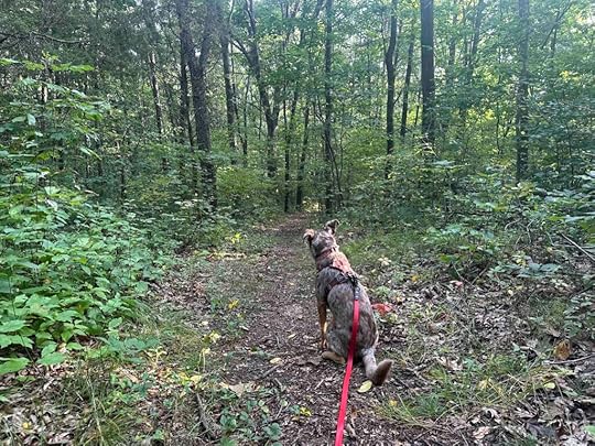
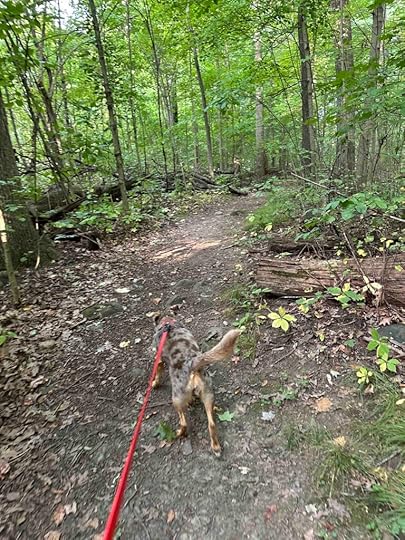
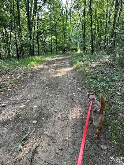
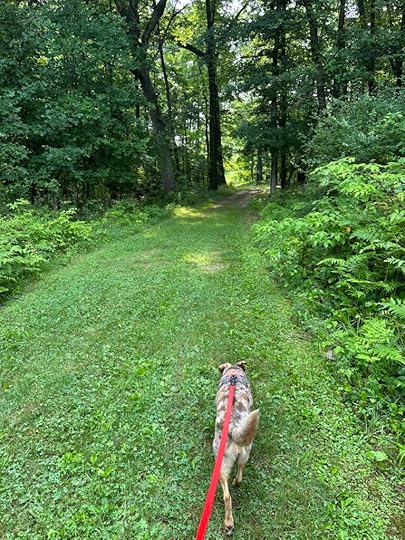
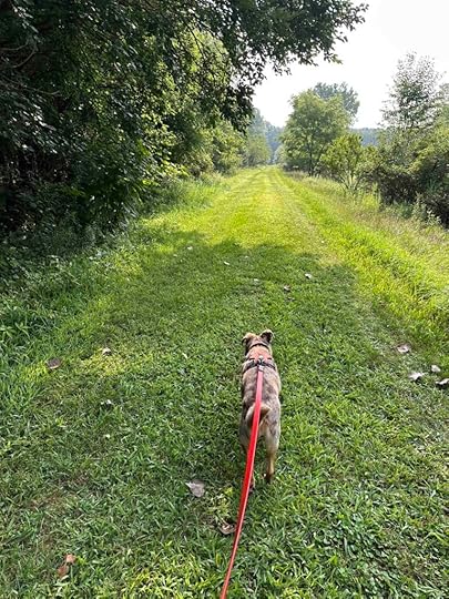
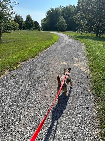
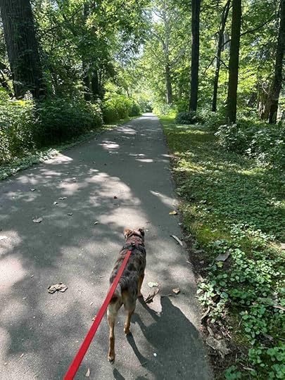
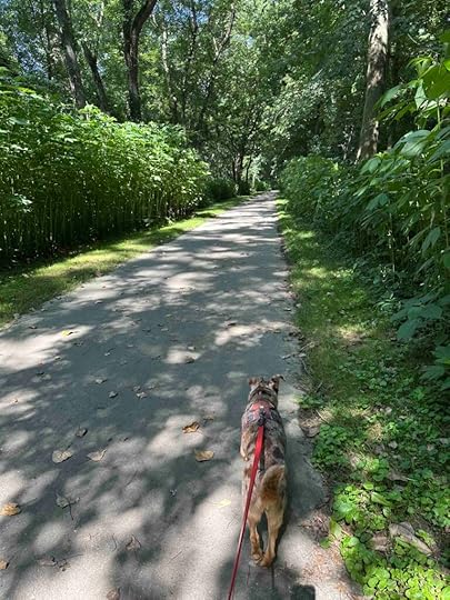
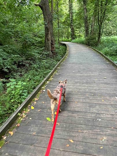
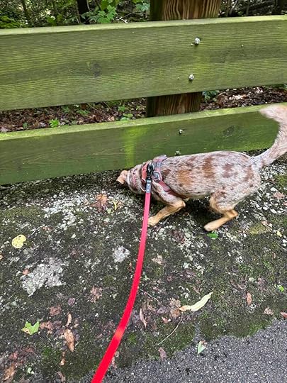
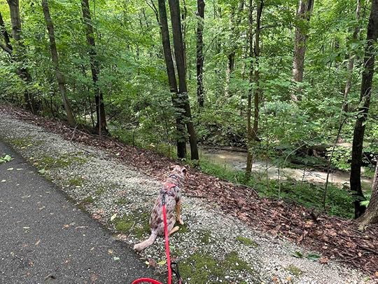
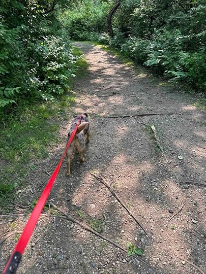
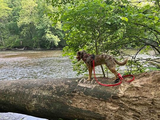
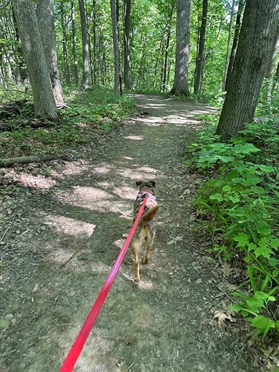
Our AdventureWe started our exploration of the Bloodroot Trail at the south entrance in Andrews, IN. At the sign for the trail we turned right and entered the woods. Barely after starting we climbed down an incline and then exited the woods onto a mowed grass trail. After a short distance we were able to get a glimpse of the Salamonie River. We continued on the grass trail and eventually re-entered the woods.
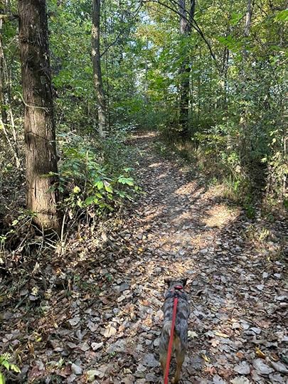
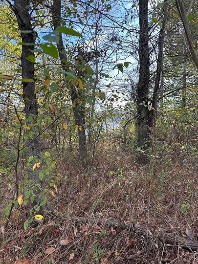
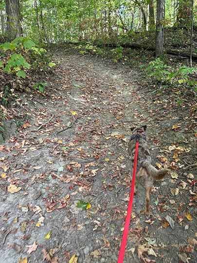
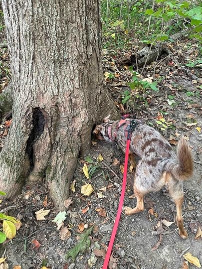
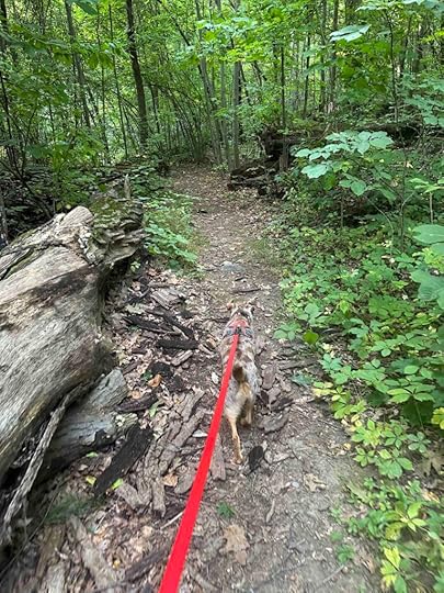
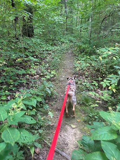
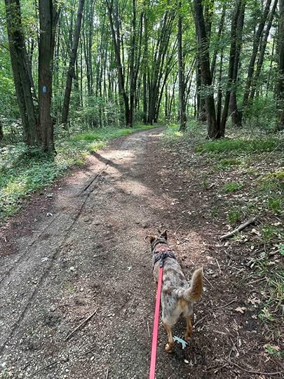
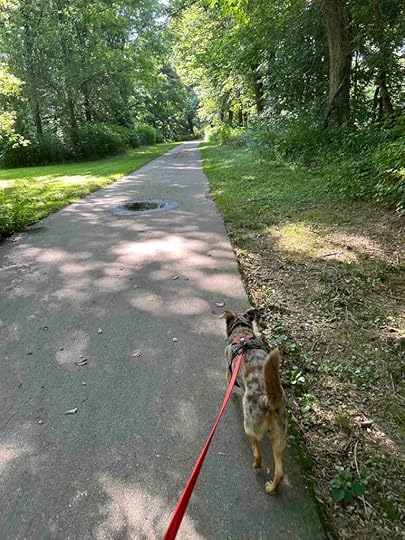
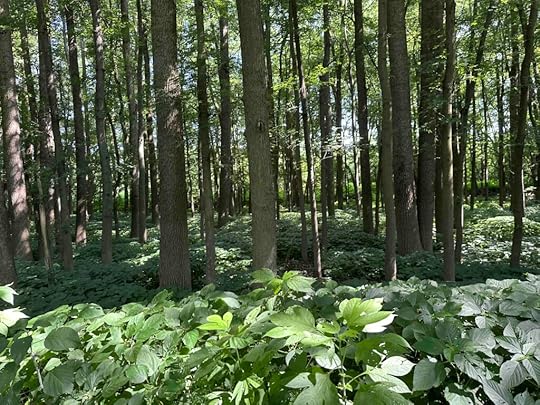
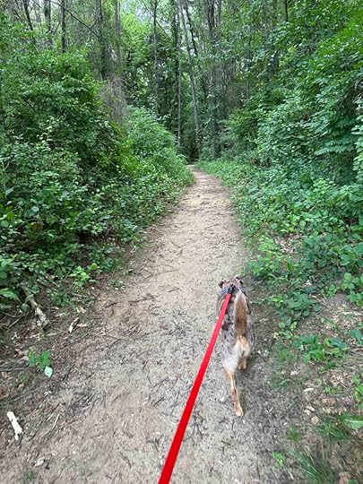
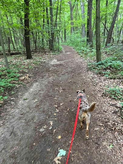
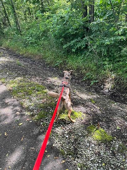
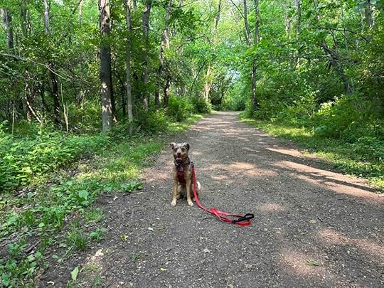
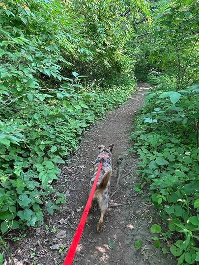
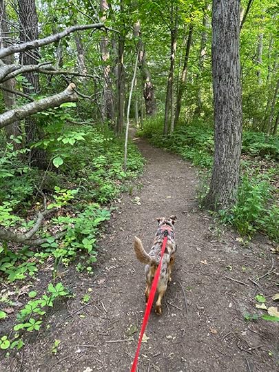
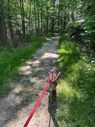
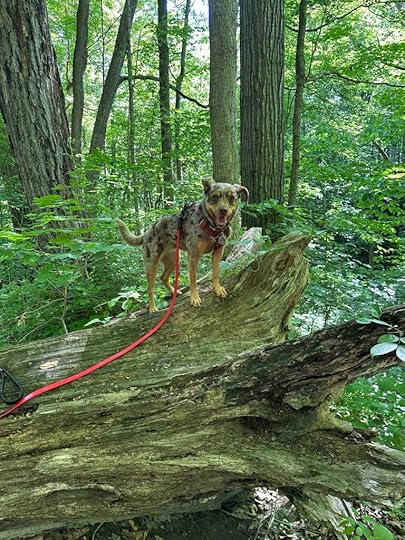
From this point forward the trail continued through the woods. We were surrounded by trees on a nice wide dirt trail. There were so many leaves on the trail and Sunny smelled, heard, and saw quite a few squirrels scurrying around.
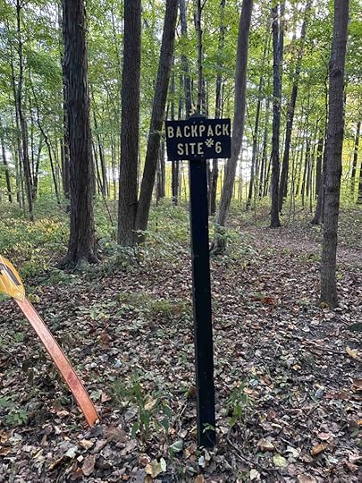
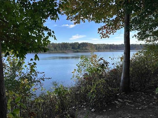
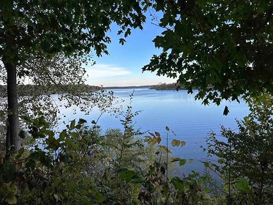
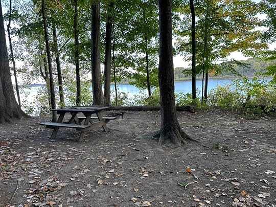
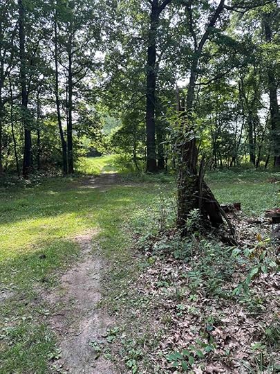
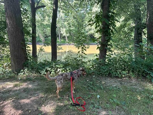
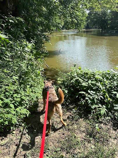
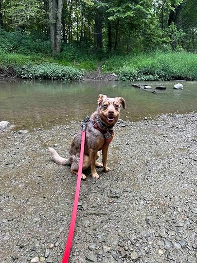
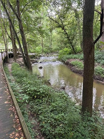
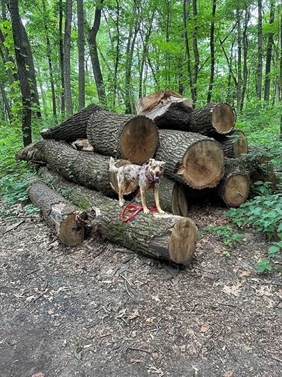
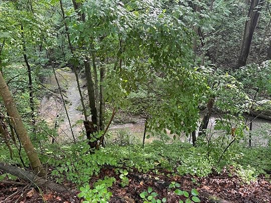
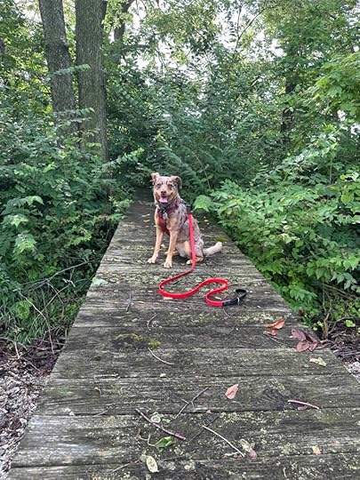
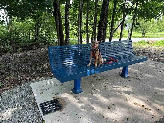
After quite awhile we came upon a sign for backpack site #6. This is one of 6 rustic camping sites along the trail. Sunny was curious so we walked down the trail toward the camping site. What we found were beautiful views of the Salamonie River and a campsite. The campsite consisted of a picnic table, fire pit, and space for a tent. We learned later that these campsites can be reserved online for less than $13/night.
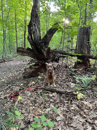
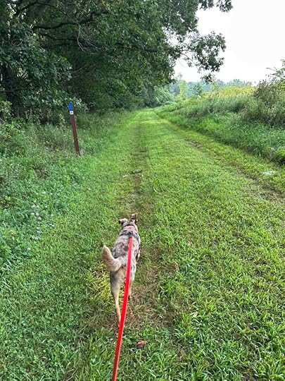
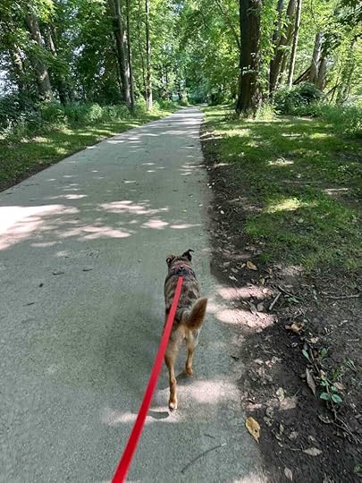
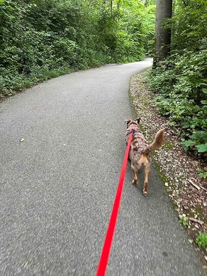
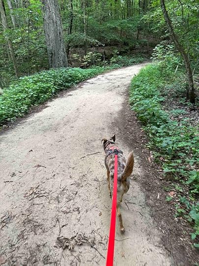
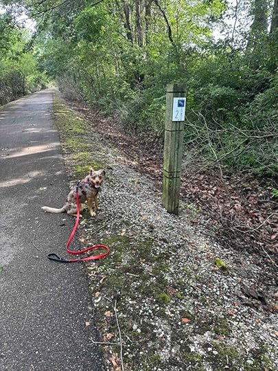
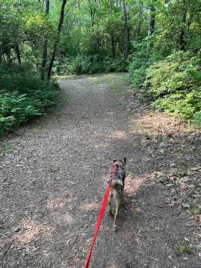
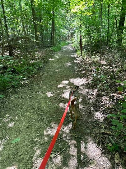
We retraced our steps back to the main trail and continued our hike. It felt like we were making our way further into the woods. The trail wound around and had some inclines and descents. We passed backpack site #5 and a little further, backpack site #4. A short distance past backpack site #4 we decided to turn around. At this point we had hiked nearly 2.5M and decided it was time to head back to the car. We retraced our steps and made it back to the car. We took a few selfies and then headed back home.
 Sunny’s Perspective
I loved this hike! The smells were amazing and I heard and saw a lot of squirrels. I wish we could have found a way to get down to the river, but it was still super fun. We hiked quite a distance and when we arrived home I was pooped out, but it was worth it.
Our RatingSunny and I give the Bloodroot Trail 3.5 out of 4 paws up. It’s a beautiful hike with views of the river. You can hike a long distance and even camp overnight. Parking is ample and it’s easy to follow the trail. The only downsides are no restroom and no access to the river, at least on the section that we hiked.
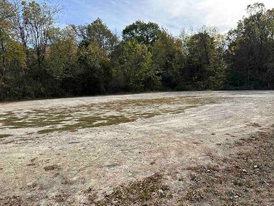
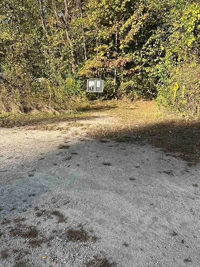
How Do I Get There?For the location we used Bloodroot Trail South Trailhead. From I-69 take exit #278 toward Huntington and merge onto I-5N. After 1.5M turn left onto IN-24W/W 600S and continue for 7.4M. Then turn right onto S 700W. AFter about .3M look for a sign for the Bloodroot Trail pointing to a road on the left. Follow this road to a gravel parking lot. The entrance to the trail is on the left. Look for a wood sign with trail information.
The post Bloodroot Trail appeared first on Live Like Karlie.


September 30, 2025
Apple Ice Treat Recipe
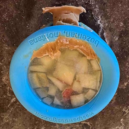
Sunny loves to spend time in our backyard monitoring the squirrels and neighbors so when it’s hot I like to give her an icy treat. This apple ice treat recipe is super simple to make and if you don’t have a Toppl from West Paw, you could use any puzzle mat or an ice cube tray.
Ingredientssmall amount of any nut butter your dogs likes1 – 2 T chopped apple sliceswaterInstructionsFill the hole in the Toppl with nut butter and put in the freezer. Make sure to fill the hole from the outside and inside so it seals the hole. Although you can purchase a stopper for the Toppl I prefer to use nut butter since it gives your dog a nice treat. Just remember to check the ingredients for xylitol which is toxic for dogs.Once the nut butter is frozen solid, place the chopped apple pieces into the Toppl. Don’t worry if the nut butter pushed out of the hole as shown below. It will still hold the water. You don’t want too much apple, just enough for a little treat. I usually use 1 – 2 slices that have been chopped into smaller pieces as shown below.Fill the Toppl to the top with water and return to the freezer.Once it is frozen solid, give to your dog for a tasty treat.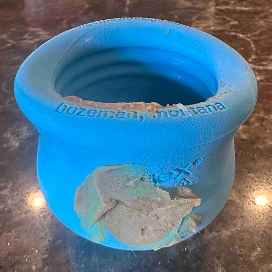

The post Apple Ice Treat Recipe appeared first on Live Like Karlie.
September 7, 2025
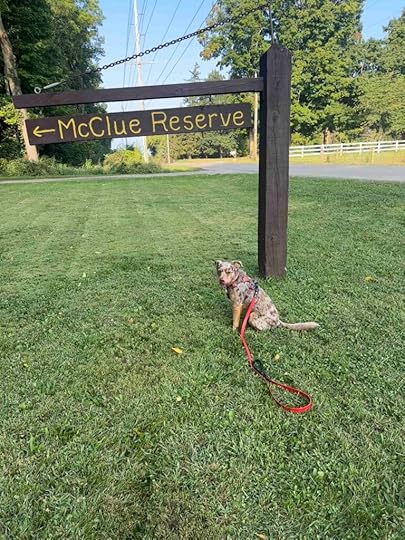
Charles McClue Nature Reserve
We got back out in the woods yesterday and explored a new to us location – The Charles McClue Nature Reserve in Steuben County. Although this reserve is not part of the Acres Land Trust, it reminded us of those trails. The land was bequeathed to Steuben County in memory of Charles McClue by his son. It’s a beautiful place and we are grateful to the family for donating the land to preserve it.
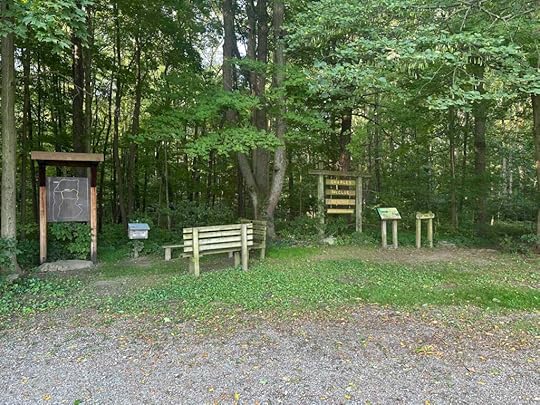
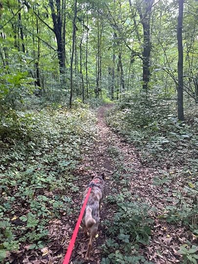
Our AdventureThere are three trails at the Charles McClue Nature Reserve – Tulip, Juniper Hills, and Long. We managed to investigate some of each trail. Once we parked we headed toward the informational sign and took one of the informational guides from the box. There is a nice map of the trails on the sign and guide. We found the entrance to the Tulip trail on to the right and started our hike.
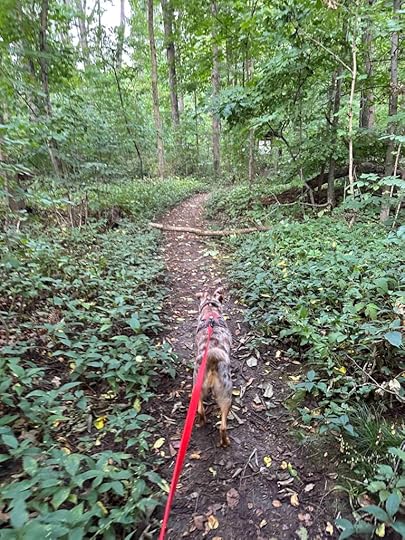
The trail is fairly narrow, but well maintained at the start. We were the only people on the trail so we enjoyed a peaceful hike. The trail winds around the “old woods” with views of huge oaks and tulip trees. We found some interesting downed trees which made for a nice photo. After about .4M we came to an intersection where the Tulip trail continues to the left and the Juniper trail continues to the right. As is our normal custom, we headed to the right and explored some of the Juniper trail.
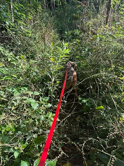
Shortly after turning onto the Juniper trail we came to another intersection with the Long trail leading to the right. We followed that trail through the young woods. At times this trail narrowed and became almost too overgrown to continue. This section would not be good for very small dogs as Sunny was nearly engulfed by the plants on the sides of the trail.
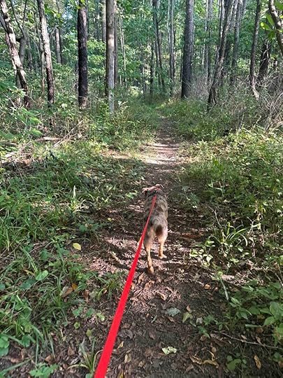
Finally the trail opened back up as we walked further into the young woods. As we neared the end we came upon some beautiful pine trees that were planted by school children from Steuben County in the mid sixties. Shortly after this we found ourselves back in the parking lot. Our total hike was just under 1.5M.
Sunny’s PerspectiveWhat a fun hike! The trail had amazing smells and in one area I’m sure a deer was close by. I never saw her, but I sure could smell her! I liked this place but wish there was some water and that the trails were a little longer. I did like that it was not a long car ride to get there.
Our RatingSunny and I give the Charles McClue Nature Reserve 3 out of 4 paws up. It’s a beautiful hike in the woods and at least on the day we were there it was very private. We liked that the trails wind through the woods with some inclines and descents, but wish there was some water features. We also didn’t love the overgrown section and would recommend wearing pants because of it. There is parking for several cars, but no restrooms. All in all it’s a lovely place for a peaceful hike in the woods.
How Do I Get There?From I-69 take exit #354 – IN-127 and turn right onto IN-127. After about .2M turn left onto W 400N. Continue for 1.2M until you see the McClue Reserve sign on your right. All three trails start near the informational sign.
For more information check out these websites:
Indiana Department of Natural Resources – McClue Reserve
Indiana Department of Natural Resources – Town of Orland
ECOIndiana – McClue Nature Reserve
The post Charles McClue Nature Reserve appeared first on Live Like Karlie.
August 4, 2025
Litchfield Nature Trail

Today we ventured to Michigan looking for a new place to hike. What we found was the Litchfield Nature Trail in Litchfield, Michigan which is part of the North Country Trail that spans several states.
Our AdventureAfter parking at Firemen’s Park we walked past the playground equipment toward the bench and turned left where the gravel path ended. This took us to a mowed grass trail behind some homes. We followed that to some concrete blocks and turned left as directed by the arrow. This led us (finally!) into the woods.
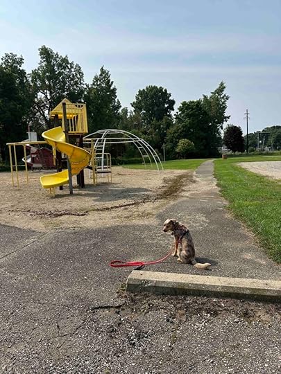
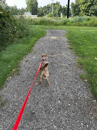
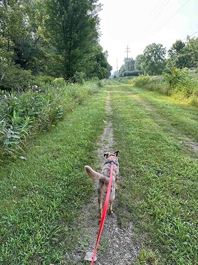
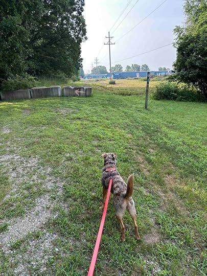
We were happy to enter the woods as this was much more scenic than walking behind homes with views and the noise of Tenneco Company. Finally we had views of trees. The trail changed from packed dirt back to the mowed grass and then we exited the woods to a field with trees and the river on one side and tall grass, trees, and other vegetation on the other side.
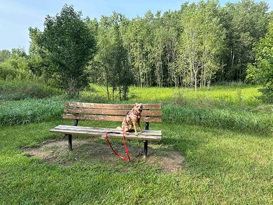
As we continued walking we found a bench that was a great spot for a water break and to look at the beauty around us.
After a quick break we started back on the trail and re-entered the woods. Again we enjoyed the beauty of the trees and being in the woods, but it didn’t last long before we were back out in the open. We continued past the broken tree stump and back into the woods. After a short distance we decided it was time to turn around and head back to the parking lot.
Our total hike was just over 3M, but we could have continued a little further as the total length of the Litchfield Nature Trail is 3.4M.
Sunny’s PerspectiveI thought the start of this hike was a little boring since we were just walking behind some homes. It got much better when we finally entered the woods. There were a lot of great smells and we even saw some deer that ran away into the woods. I really wanted to run with them, but had to stay on the trail. The best parts were when we were in the woods since the grass made my feet really wet!
Our RatingSunny and I rate the Litchfield Nature Trail 2.5 out of 4 paws up. It’s not a bad trail, we just prefer hiking in the woods to open prairie. It’s also a fairly long drive (over an hour) when we have other trails that we prefer closer to us. If you live in the area, this would be a great place to get back to nature especially since we nearly had the trail to ourselves the whole time we were on it.
How Do I Get There?Take I-69N to Michigan and exit at Jonesboro Road. Follow Jonesboro Road for about 10 miles then turn left onto M-49 North. Continue for 4 miles and the park is on the left. Once you park, walk on the gravel path past the playground equipment and turn left on the grass trail that goes behind the homes.
The post Litchfield Nature Trail appeared first on Live Like Karlie.
July 22, 2025
River Greenway
With a break in the heat it was time to hit the trails today. But with nearly two inches of rain in less than two days we knew it would likely be muddy so I decided to find a paved trail. The challenge was finding a new one since we’ve been on several in the area – Fishing Line, Nickel Plate, Pufferbelly, Pumpkinvine, and Reike trails. After a little searching I found the River Greenway Trail in Fort Wayne, IN.
The River Greenway is a network of nearly 50 miles of trails in Fort Wayne and New Haven, IN. It connects attractions, neighborhoods, parks, and waterways throughout the area. Because of the vast area that the trails encompass, there are many different ways to access the trails. We selected the River Greenway boat dock parking near Kreager Park.
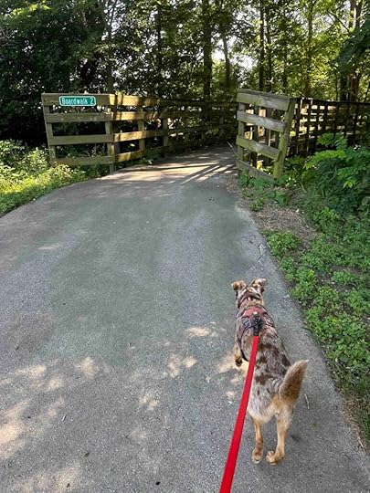
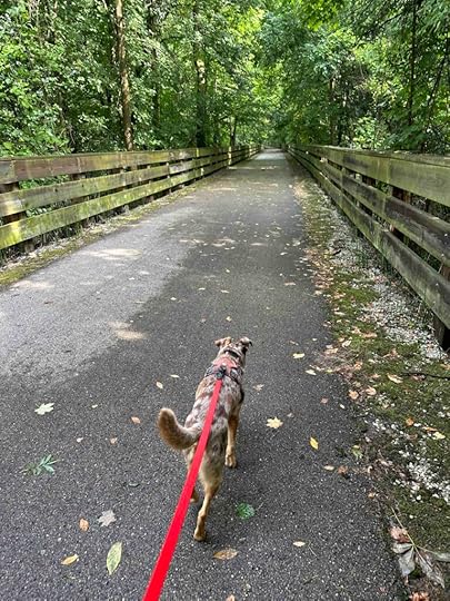
Our AdventureWe arrived at the parking area and checked out the boat ramp which gave a nice view of the Maumee River. Then we started our hike by turning right onto the trail. At the beginning the trail is through an open area of grass, but soon comes to a boardwalk over the river. This section parallels North River Road and passes the entrance to Kreager Park. Near Kreager Park the trail veers to the right, continuing to follow the river.
It is at this point that the trail enters a wooded area with trees on both sides. This makes it much more shaded and serene. As you walk you also get some views of the river.
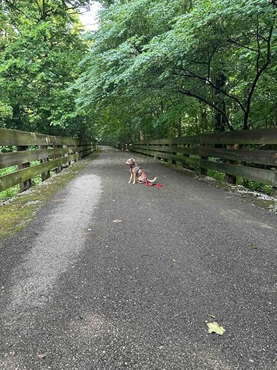
We continued along the trail and passed some “rest areas” and benches. At one point we found a trail down to the river so we decided to check it out. Sunny loved getting close to the water.
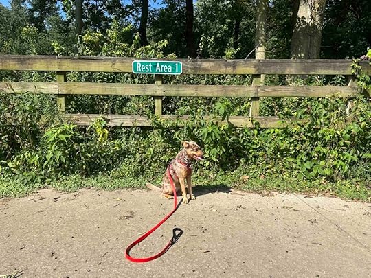
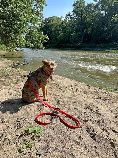
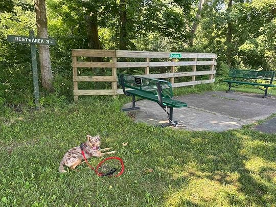
We continued on the trail and came to an area with trees and other vegetation that blocked the view of the river. And then a short distance later we found another spot to get a closer look at the river. We continued down the trail and came to a second boardwalk and rest area 3. At this point we had hiked over 2M and decided it was time to turn around.
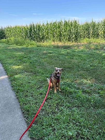
Most of the trail felt like a walk in the woods with a view of the river, but there was a cornfield that came into view in several areas reminding us that we were near homes and farms. I joked with Sunny that only in Indiana could you go for hike and see cornfields, beautiful trees, and a river while being near the city.
 Sunny’s Perspective
The start of this hike was pretty unremarkable, but once we walked over the boardwalk and into the wooded area it was really nice. I liked getting down to the water and catching views of it along the way. There weren’t any squirrels or other critters that ran across the trail, but there were some great smells. We had to share the trail with a few people on bikes, but everyone was nice and let us know they were coming up on us. All in all this was a nice hike and didn’t take long to get to.
Our RatingSunny and I give River Greenway 3 out of 4 paws up. It’s a nice rail trail type of trail with wooded areas and views of the river. Parking is easy and plentiful. The main downside for us, is the trail is popular with cyclists so you have to be a little more alert with riders approaching from behind. All in all it’s a great option when you want a paved trail in the Fort Wayne area.
For additional information about the River Greenway check out these websites.
How Do I Get There?From I-69 take exit #315 – I-469E/US-30E and continue for about 2M. Take exit #29B and merge onto Maplecrest Road. Continue for nearly 5M, then turn left on Lake Ave which turns into North River Road. The parking lot is less than half a mile on the right.
The post River Greenway appeared first on Live Like Karlie.
Karlie Celebration Day – Year Three
This week marked another birthday without Karlie. Every year we would celebrate our birthdays together since they are just 5 days apart. Despite her being gone for over 3 years I still get melancholy in July as our birthdays approach. It’s just another reminder that things have changed and she is not here. Despite my love and enjoyment of Sunny, I miss Karlie every day, but especially in the middle of July.

This year I celebrated both my birthday and hers by spending time with Sunny hiking. On my birthday we ventured back to Bicentennial Woods which is one of our favorite local places to hike. Although Karlie never visited Bicentennial Woods she would have loved it. Sunny and I visit often as it’s close to home and a wonderful spot to hike.

Since Karlie’s birthday was a rainy, cool day we waited a few days until it was nicer for our celebratory hike. Sunny and I ventured to a new spot – River Greenway in Fort Wayne. This is an asphalt trail used by a lot of runners and bikers. Although Karlie preferred dirt trails I chose this one because of all the rain we had the past few days. I still think Karlie would have enjoyed this trail as it follows the Maumee River with at least one spot where you can get down to the river. Karlie would have loved getting her toes wet.

Sunny and I had a great time exploring a new spot and being out in the woods. I thought a lot about Karlie and all our adventures as we hiked while Sunny sniffed all the smells. After returning home we lounged in our backyard, which is something that Anna, Karlie, and I did a lot when we lived in Texas and California. And then I gave Sunny a special treat. It was a good day and a happy day. We celebrated Karlie, remembered all the good times, and created new memories.

As time goes on I don’t miss Karlie less. I just have learned to live with her in a different way. I live with all the wonderful memories we made while making new memories with Sunny. Karlie’s spirit is with us on every adventure because without her there would not be any adventures. I am so lucky to have spent 14+ years as her best friend and to carry on our traditions and adventures with Sunny the past 3+ years.
Happy birthday, sweet little Bug. I love you and I miss you. I hope you and Anna are chasing tennis balls and dipping your toes in the water.
The post Karlie Celebration Day – Year Three appeared first on Live Like Karlie.
July 18, 2025
Wildwood Preserve
After some hot weather that kept us from hiking things cooled down enough for us to get into the woods. Since we’ve explored so many areas in Northern Indiana we decided to venture to Toledo, OH to check out Wildwood Preserve Metropark. What we found is a fabulous park with trails in the woods and along the Ottawa River as well as a manor and visitor center. Despite the nearly 2 hour drive we plan to return in the fall when the leaves start to turn.
Wildwood Preserve is one of the Toledo Metroparks which is a system of 19 parks in Lucas County, OH. The parks have natural spaces and offer a variety of recreational activities such as biking, hiking, and kayaking. The Wildwood Preserve Metropark is a 493 acre park on the former estate of the Stranahan family, whose patriarch founded Champion Spark Plug Company. It includes the Manor house, Metz Stables & Visitor Center, and miles of trails.
Our AdventureWe arrived at the park early in the morning and the parking lot was already full of cars. We saw people walking on a variety of trails so we parked near the stables and found our way onto the Blue/Floodplain trail. We followed it through the woods, across a boardwalk, and back into the woods. We had views of the buckeye, cottonwood, and sycamore trees as well as the Ottawa River. The trail was asphalt, wood boardwalk, and dirt.

Eventually we took a turn that led us further into the woods and onto the Purple/Prairie trail. We continued until we came to a sign indicating the Red/Upland Woods Trail. We turned left and followed the Upland Woods Trail back to the visitor center. After checking the trail map we got back on the Upland Woods Trail and found another way to get on the Blue/Floodplains Trail. We retraced our original path through the woods and across the boardwalk and eventually exited the woods near the parking lot.
We decided to explore some of the grounds and checked out the exterior of the Manor and the stables. By this time we had hiked 3.5M and were both tired and ready to head home.
 Sunny’s Perspective
It was a long drive, but once we got out of the car I could not get into the woods fast enough. The smells at this place were amazing. We walked in the woods, across a board walk, and down by the water. There were quite a few people on the trails and even a few dogs. I liked everything about this place except for the long drive. We hiked all over and I spent a lot of time sniffing all the smells. What a great adventure!
Our RatingSunny and I give Wildwood Preserve Metropark 4 paws up. It really has everything we love – miles of trails in the woods, water that you can get down to, plentiful parking, and well-marked trails. Trails are accessible by bike, stroller, and on foot. We did run into some bugs and mosquitoes in the woods and would recommend bug spray if you plan to spend any time in the woods.
How Do I Get There?From I-475 take exit #13 for US-20E/Central Avenue. Continue for 1M and then it turns into OH-120E/Central Avenue. Continue for about half an hour mile and then turn left at the Wildwood Preserve sign. Follow the road past a parking area on the right and continue to the large lot by the stables and manor. You can access any of the trails from this area. We recommend printing the trail map which can be found at Wildwood Preserve trail map. For additional information about the park and the trails check out the Toledo Metroparks website.
The post Wildwood Preserve appeared first on Live Like Karlie.
June 21, 2025
Nickel Plate Trail
It has been a really rainy spring so we have not been hiking as much as we would like. When we finally had a break in the rain at the end of last week we hit the trails. We ventured to Peru, IN and found a real gem, the Nickel Plate Trail.
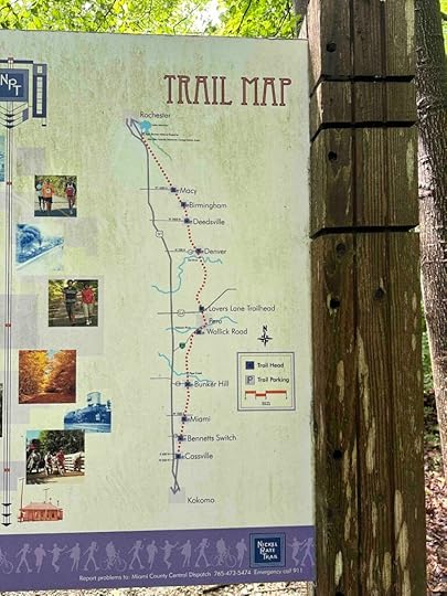
History of Nickel Plate TrailThe Nickel Plate Trail was built in 1881 to compete with the Lake Shore and Michigan Southern Railway. The intention was for it to be a high-quality competitor and was nicknamed Nickel Plate after being described as nickel-plated. It grew into a significant railway that reached St. Louis, Chicago, and Peoria. Unfortunately over time rail service declined and parts of the line were abandoned. In 2000 a local non-profit began converting it into the wonderful trail that exists today and goes from Kokomo to Rochester, IN.
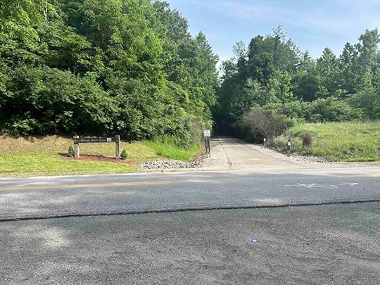
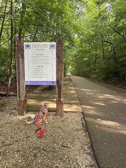
Our AdventureWe started our adventure at the Peru, IN parking area which is near North Street and Lover’s Lane. There is a gravel parking area on the left with the trail starting across the street. After a quick exploration of the grass and trees in the parking area we crossed the street and started our adventure.
The trail almost immediately becomes wooded on both sides making it feel like you are walking in a forest and not on a rail trail. After a short distance there is a sign with the trail rules on one side and the trail map on the other. As you continue on the trail you can hear the birds chirping and water flowing. You cannot really get down to the water, but have views of it for most of this section of the trail.
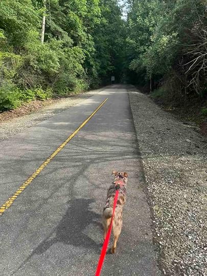
In several areas there are wooden barriers to prevent you from getting into the brush and down to the water. Sunny was quite interested in investigating what was on the other side of these barriers, but I convinced her to stay on the path.
As we continued Sunny noticed some critters in the woods. Although I thought they were squirrels it turned out they were bunnies. This was quite exciting for Sunny who wanted to get up close to investigate, but we continued on the trail instead. At nearly the two mile marker we found a little platform that looked like it entered the woods. It didn’t go very far, but it made a nice spot for a photo.
Not much further down the trail we came to a stop sign as the trail continued across a road. Since we had hiked for over 2M we decided this was a good spot to turn around. There was a bench dedicated to Nick and Lolie Farinas where we stopped for a quick snack of water and apple slices. Then we headed back toward the car. Along the way we enjoyed more views of the water and the peaceful tranquility of the trail.
 Sunny’s Perspective
Although I really do prefer dirt trails this was a fantastic trail. The smells were amazing and there were BUNNIES! I was not allowed to chase the bunnies, but I sniffed and smelled all the areas where they were and I made several of them hip hop back into the woods. It was great fun to keep those bunnies in check.
Our RatingSunny and I rate the Nickel Plate Trail 3.5 out of 4 paws up. The only real downside for us is the section we hiked did not have a restroom. We loved how peaceful it was, that we felt like we were in the woods, and that we had views of the river. Parking was easy to find and directly across from the start of the trail. All in all this was a great spot and I imagine it’s amazing in the fall. This is one we will definitely visit again despite the long (for us) travel time.
How Do I Get There?Use Nickel Plate Trail North Peru Parking for the location in your GPS. From IN-24W turn right onto IN-19N and then take your first left onto Lovers Lane Road. After about .6M it turns into North Street. The parking area is on the left just after this and the trail is across the street from the parking area.
For more information about the Nickel Plate Trail check out these websites.
The post Nickel Plate Trail appeared first on Live Like Karlie.
June 4, 2025
Oxbow County Park
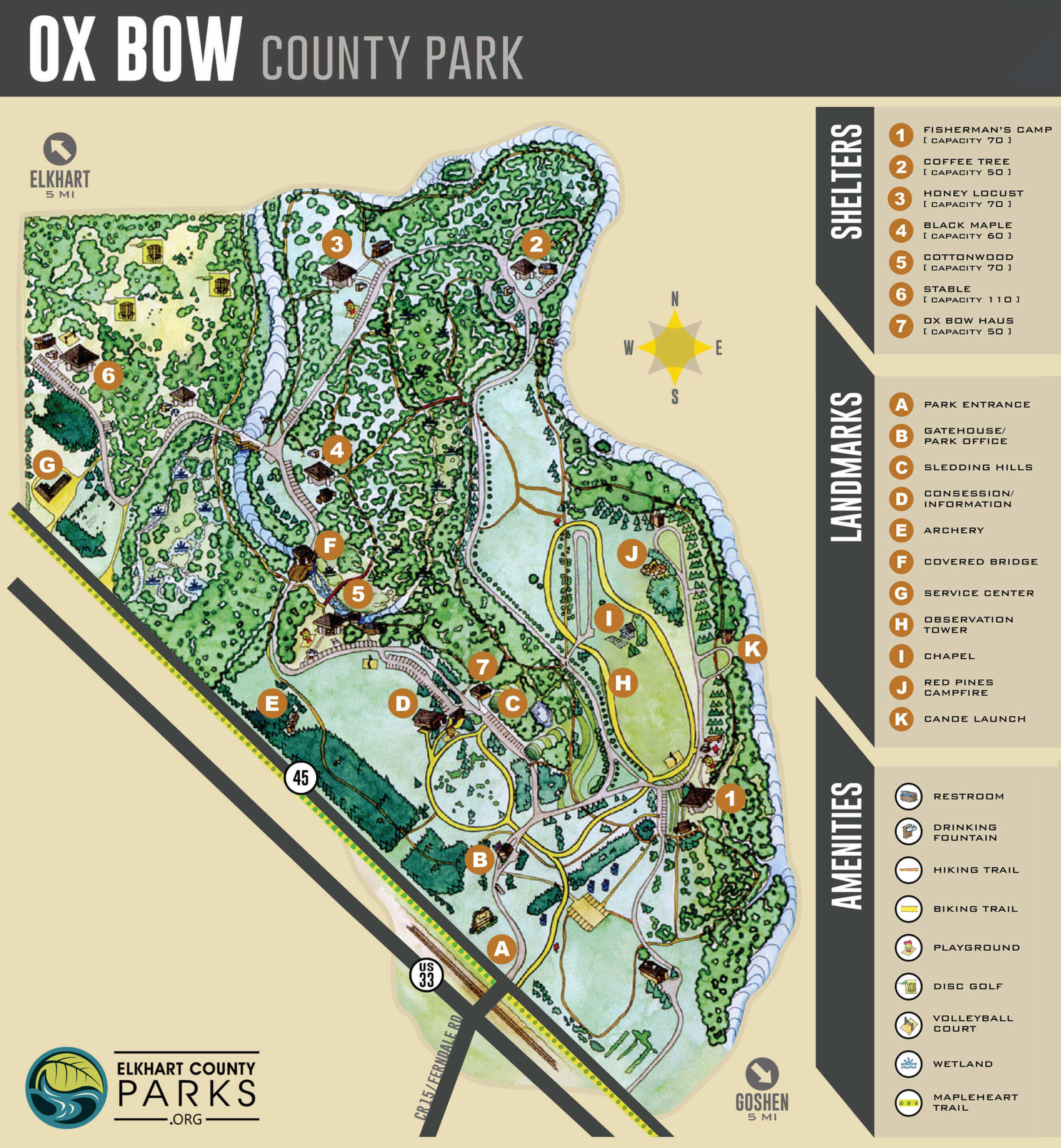
I have visited Oxbow County Park several times to participate in Dogapalooza, a fun event for you and your dog held in early May. Today I finally decided to bring Sunny so we could explore all the park has to offer. I am so glad that I did because it’s truly wonderful.
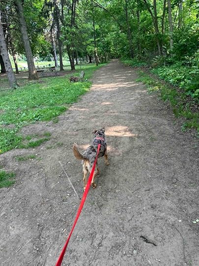
Our AdventureLooking at the map of the park I wasn’t sure where to get on the hiking trails so I asked the attendant at the entrance. She suggested parking at the Fisherman’s Camp so that’s what we did. A nice thing about starting at this point is the restroom next to the parking lot.
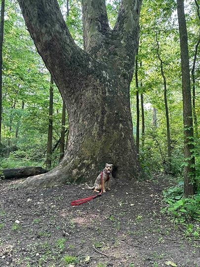
The entrance to the trail is to the right of the shelter and as soon as you enter you feel like you are in the woods. It’s a nice wide trail surrounded by trees. It is so quiet and peaceful. As usual we took the trail to the right whenever there was a choice. As we walked we found a big tree that was perfect for a photo op.
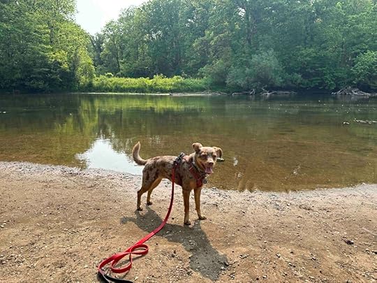
As we continued we could see the Elkhart River on the right. Eventually we made our way around to a beach area. Sunny loved getting her toes in the water. Then she found a trail that followed the river. It wasn’t the best trail as it was narrow and required me to duck in several spots, but it was fun to explore. Unfortunately the trail ended so we retraced our steps and found another trail that traveled in the same direction.
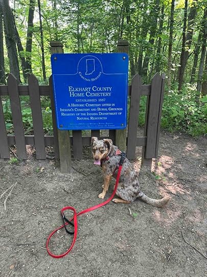
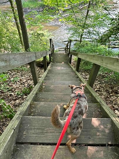
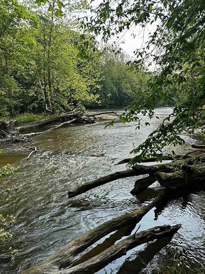
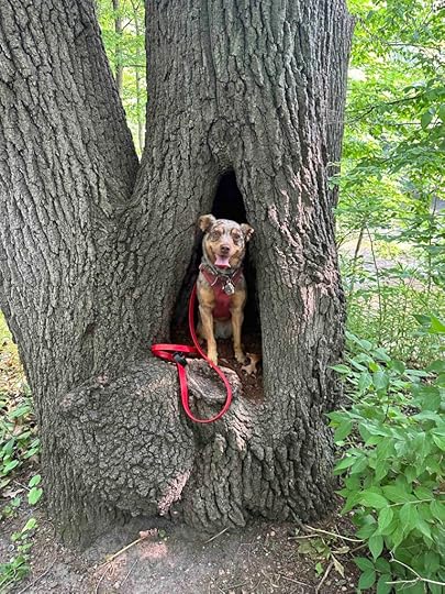
This trail went past some picnic benches and a road on the left before becoming more wooded. As we continued we saw a brown fence and wondered what that was all about. We learned it was a cemetery and entered. There we found some steep stairs that led down to the river. Of course Sunny insisted we check that out and I’m glad that she did. We had some nice views of the river and found a downed tree limb over the river.
After we finished exploring the river we climbed back up the steep steps and found a cool tree. It had a little opening that was just perfect for Sunny to sit in. Of course I had to place her in it and take her picture. After that we continued our hike following the river. Once we came out of the woods we found the Oxbow Haus shelter and made our way back to our car. Our total hike was almost 3M, but we could have hiked further if we continued following the river.
 Sunny’s Perspective
This was another long drive, but was totally worth it. Most of the hike it felt like we were in the woods and there were so many fantastic smells. A lot of dogs, squirrels, and other critters have been on these trails. I even found two turtles, but we didn’t get too close to them. The best part was going down the steps to the river. I loved walking along the river. I hope we return to this place it was so much fun!
Our RatingSunny and I give Oxbow County Park 4 out of 4 paws up. This place truly has something for everyone – picnic benches and shelters, ample parking, restrooms, hiking trails, biking trails, playground equipment, access to the river and so much more. The only down side for us is the long drive, but that won’t keep us from a return visit.
How Do I Get There?From Goshen, IN take W. Pike Street and veer right onto Elkhart Road which turns into Lincoln Highway. After almost 6M turn right onto Ferndale Road E and cross the railroad tracks. Follow this into the park and the entrance booth. There is a $3 vehicle fee for the park. After paying head to the right to Fisherman’s Shelter.
For more information about Oxbow County Park check out these websites.
Elkhart County Parks – Oxbow County Park
The post Oxbow County Park appeared first on Live Like Karlie.
Salamonie River State Forest
After a soggy, chilly spring we finally have some good weather so Sunny and I decided it was time for an adventure. We’ve been so many places in Northern Indiana that it was a challenge to find a new place to explore. I finally decided on the Salamonie River State Forest in Lagro, IN. We’ve been to several other spots in the area so we expected the State Forest to be a nice spot. And we were not disappointed. What we found was a heavily wooded area with trails and some views of the Salamonie River.
Our AdventureAlthough the trail map shows quite a few different trails we started with the Three Falls Trail because we wanted to see the waterfalls. I also knew that although it is a short trail it intersects with many other trails so we could have a nice hike. After entering the forest we followed County Road 100 S until we saw a sign for the Three Falls Trail. There was a small parking lot on the right so we parked and started our adventure.
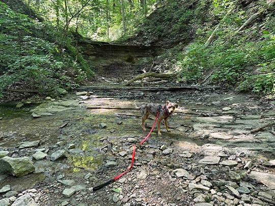
The start of the trail is gravel and dirt with trees and vegetation on both sides. It continues for a short distance before you feel like you have truly entered the woods. Not too far after that is the area where there are two waterfalls. Unfortunately on our visit the creek that feeds the waterfall was quite dry so there were no waterfalls. We were disappointed, but enjoying our hike in the woods so we continued hiking.
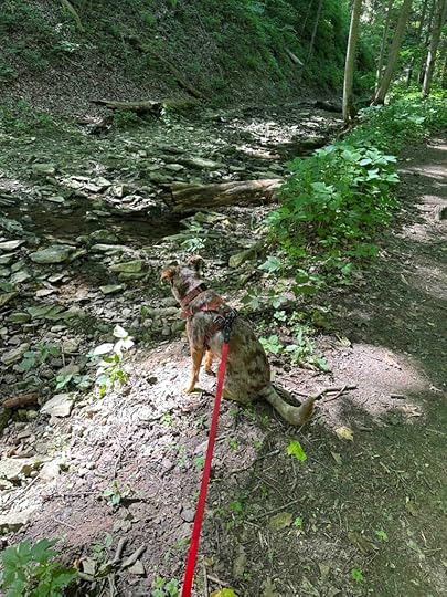
We found ourselves on the Blue Trail which meanders around the entire forest. Despite that I am sure I could not replicate our hike. We walked on the cliffs and then in one area we hiked down to the ravine. Once we were in this area we heard some running water and thought it might be a waterfall. We crossed the creek bed which was nearly dry and eventually found a trickle of a waterfall. Although it wasn’t the waterfall we were hoping for, it was fun to see.
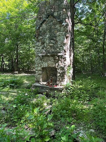
We retraced our steps and ended back up on the cliffs. We could see peaks of the river as we hiked. At one point we found an old chimney and fireplace. That was an interesting find. We continued on and eventually found ourselves out of the forest and on the road. We headed to the left and just as we walked out of the forest we saw our car about a quarter of a mile away. Our total hike was just under 3M and we could have hiked for many more miles.
 Sunny’s Perspective
It was a long ride to get to this adventure and once we arrive I was sprayed with Cedarcide. Andie said something about protecting me from ticks, but I was not amused. Thankfully things got much better after that. The smells were amazing and I saw quite a few squirrels. As usual I was not allowed to chase them, but I enjoyed trying. I especially liked when we climbed into the ravine and along the mostly dry creek bed. The waterfall was kinda lame, but it was fun to put my toes in the water. All in all this was great fun.
Our RatingSunny and I give Salamonie River State Forest 3.5 out of 4 paws up. We loved the solitude of the forest and the somewhat challenging trails when we climbed down into the ravines. We would have loved to see the waterfalls, but Mother Nature had a different idea. Although we did not find a restroom there is a visitor center on Salamonie Dam Road which likely has one. Parking and trail signage was good, although I would recommend downloading a copy of the trails.
How Do I Get There?From I69 take exit #296B – Lafayette Center Road W and continue for 2M when it turns into E 900 N. Follow that for another 1.8M and turn left onto US-24 W. Follow that for nearly 12M and then continue straight onto IN-9 S. Continue for 4.7M and turn right onto W 100 S. After 1.1 M turn right onto S 600 W and then take the next left onto W 100 S. Follow that for 4M and then it turns into Salamonie Dam Road. Cross the dam and then take a sharp right onto Pefley Dr./S. Salamonie Dam Road. Continue toward Horseman’s Camp. Once past the camp look for the Three Falls Trail sign on the left and the parking area on the right.
For more information about Salamonie River State Forest check out this website.
Salamonie River State Forest Horse and Hiking Trails
The post Salamonie River State Forest appeared first on Live Like Karlie.


