
C. Gene Wilkes's Blog
September 16, 2024
Taggart and Bradley Lake Trails Hike
Two friends and I drove to the Taggart Lake trailhead in the Grand Teton National Park about noon in mid September. The skies were clear after a rainy and winter mix the day before. Aspen trees were in their early stages of changing their colors for the fall. The lot was more crowded than expected on a Friday almost two weeks after Labor Day. One friend lived in Jackson Hole and knew the area well, and he gave us several options once on the trail.
We decided to take the Taggart Lake Trail counter clockwise. The trail followed a stream, which provided a pleasant soundtrack to our leisurely pace. The skies were clear with Cumulus clouds, some that would never reveal the top of The Grand Teton peak.
We took the fork to Bradley Lake trail at the fork and could see Taggart Lake as we made our way up the trail. The elevation gain was minimal with occasional rises and drops. The trail is well worn with few exposed rocks and roots.
 Stream along Taggart Lake Trail
At the lake we took time to hydrate and take in some fuel. The lake is pristine and clear even with the heavy traffic. We were surprised when a couple of riders led their horses into the lake. I guess you can lead a horse to water and into water. Both rider and horses seemed comfortable in the mountain lake.
 Bradley Lake
 Horse and riders IN Bradley Lake
 Grand Teton from Bradley Lake trail
 Taggart Lake via return trail
The data on the leisurely hike from my All Trails app was 6.24 miles, 778 ft elevation gain, 2:54.34 moving time.
I highly recommend this short and easy hike. The views of the Teton range and Snake River valley are superb.
The best part was making the trek with two good friends and sharing whatever is on our minds and hearts. The best way to know someone is along a trail over a long period of time in God's creation. Iron sharpens iron on the trails. I'm grateful to have friends with whom I can be my true self and share those things I enjoy most.
I continue to embrace the truth that my preferred time with God is in God's Creation. My body, soul and spirit are filled up by the beauty and life in the wilds. I appreciate the times when I am away from the concrete, man-made suburbs I live and travel in.


July 3, 2024
Grand Canyon Rim-to-Rim Hike
Our goal was to hike rim to rim in the Grand Canyon in one day. We trained for several months to endure basically one mile elevation drop on the descent from the north rim to the floor of the canyon and the one mile elevation gain on the ascent to the south rim. We planned to follow the North Kaibab Trial to the Bright Angel Trail. Everything and everyone was on plan to reach our goal.
Only one issue: the heat on the floor of the canyon.
We began our adventure on Tuesday, May 28, 2024 from the north rim. This was the earliest all of our schedules would allow for the climb. However, our friend and guide said this was the latest she had ever done the hike. (She usually hikes/runs rim to rim to rim in March or October.) The reason for the other dates we discovered was that the heat on the canyon floor rose to around 100 degrees F during the midday hours. But, I’m getting ahead of myself.
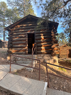 Grand Canyon Lodge cabinTuesday afternoon, we took the Trans-Canyon Shuttle from the south rim to the north rim where we stayed at the Grand Canyon Lodge cabins. I was surprised at the length of the 4.5 hour ride around the rim of the canyon with only one bio break stop. That’s one big canyon. We chowed on pizza at the local deli and got to bed to get some sleep for at 0430 alpine start.
The weather was ideal, and the trails were in good condition. I love the picture below because it shows the trails we covered as we descended to the canyon floor. The north rim has more trees and foliage than the south rim. The colorful vistas lit by the rising sun made me pause to take in the beauty and majesty of the scene along the way. I was sure we were on our way to a one-day hike across the canyon as planned.
 Descending from North Rim

 By the time we reached ‘The Box,’ I was overheating and needing an extended break. Let me pause to say our guide and veteran rim-to-rim-to-rim friend and guide, Carol, did not suffer like I did. She slowed to our pace and was patient with us all—me especially. As we approached Phantom Ranch, Ed and she backtracked to greet me with a bag of ice and brought relief again by carrying my pack to the ranch. When Amy and Gina first arrived at Phantom Ranch, the ranger looked at them and asked, “Are you just getting here?” “Yes,” they answered. “You need to get in the river and cool off.” (She saw what we all were feeling as we walked slowly into the ranch area two hours behind schedule to finish according to our one-day goal.) And, she added, “we have rooms.”
 Amy and Gina went on to cool down in the river while Carol and Ed came to rescue me with the bag of ice Ed bought at the Phantom Ranch cantina. While we were sitting in the river wondering how we were going to finish, Gina told of her conversation with the park ranger when they arrived. When she said the ranger said, “We have rooms,” Ed sat up from lying down in the rushing waters and said, “What are we sitting here for? Where’s my wallet?” In that moment, our one-day hike turned into two. We gave up our hotel reservations on the south rim by default, but we did not care. We now had an air conditioned room, indoor toilet and showers, and a dinner of stew, cornbread, salad, and a double-chocolate brownie for desert. I have never been more relieved by a turn of events than when I realized we did not need to push on into the night to finish our hike. I think we would have spent the night on the trail or crawled to the top of the south rim about 0200 the next morning if we had not been offered a place to spend the night. We had no tents or gear from camping. It was supposed to be a day hike.
I often tell folks that God’s grace comes in many forms. I truly believe the availability of a room at Phantom Ranch that day was God’s gracious gift to us. Getting a room at the ranch involves months of planning and a lottery choice. There should not have been any rooms available that day, but there was. “Now I ain’t too good at prayin, but thanks for everything,” was my prayer as sung by Larry Fleet.


After breakfast, our guide, Carol, headed back to the North Rim where she met us and left us to complete the hike on our own. She planned to run back to her car after we completed our one-day hike, but since we had rested and were confident we could finish, she headed home Colorado. (She made the climb out of the canyon in half the time it took us to hike into the canyon.)
Our morning hike was mostly flat and led us to the Colorado River that flows through the canyon. The air was cool and dry, and we made good time as we followed the trail to the (formerly Indian Garden), where we cooled off in the stream, rested, fueled, and filled up our water bottles and pack bladders for the next leg of the hike.


The day became increasingly hot as we hiked, but we were acclimated and rested and the pressure to make a deadline was gone. We enjoyed the beauty of the canyon and took our time to rest, fuel, and hydrate as needed.
We began our ascent after lunch. The trail became steeper the farther we climbed, and the number of people on the trail increased. They were mostly day hikers coming from the Village to see what they could see. A mother carried her baby in the heat, and teens wore cutoffs and street shoes. Few had even a water bottle. The forest service does 300 ground rescues and 150 helicopter rescues a year in the canyon. I wanted to tell them how easy it is to get in trouble.
The photos show the trail as I looked back on where we had climbed. The views were spectacular and the heat relented as we ascended to the South Rim. We made the Village about 1500 hours and headed to our vehicle and the RV for a shower and dinner. While we did not reach our initial goal, we shared a memorable adventure I’d do again.
 I recommend this hike. Two to four days would be the best plan to complete the 26 plus mile hike, but if you plan well and get in shape you can do it in a day. Hey, if I can drag my 70-year-old body through the canyon, you can too.
Don’t go alone. Share the adventure with friends. Ed, Gina, Amy, and Carol were the ideal partners. We laughed, suffered, encouraged, and pushed each other on this epic trail together. There is no better way to see and share the wonders of Creation than with friends.

February 24, 2024
Tres Cruces Costa Rica
I try to find a hike or something out of the ordinary when I travel. In 2023, I was invited to speak at a conference, MICN Re-Fresh, in San Jose, Costa Rica. The conference was held at the International Baptist Church, Paul Dreessen, pastor. Paul knew I liked hiking and adventure so he lined up a hike on the Tres Cruces Trail just north of his home in San Antonio de Escazu.
 Paul’s house sits at about 4100 feet above sea level, and the highest point on the trail is about 6600 feet. The trail is only about 1.5 miles one way, so it is a pretty steep climb. Getting to the trailhead was challenging enough. When I commented about the steepness of the trail, he asked, “I thought you were in shape to hike something like this?” I replied, “I’m in shape, but not for this!” I had not done much leg work getting ready to speak at the conference.
Once we found the trailhead, which is hard to find without someone who has been there before—that is why you always hike with a local, experienced hiker—we were joined by a couple who were also looking for the trailhead.
The trail is rugged with smooth sections and views along the way. We were fortunate that the trail was dry. The clay base would be slick if it was wet. Vines and rocks made some of the hike hard to make our way through, but it is very doable.


The first of three crosses was massive, but the view of the capital city was spectacular.
 Pastor Paul and me
 The group from IBC who hiked the trail
 The Second Cross
Only a pedestal remained of the second cross. The platform provided a place to rest, hydrate and take in some carbs. Another group of hikers took advantage of the setting for the same things. They were locals on a Saturday morning hike. We flat landers from Dallas are jealous of those who have trails like this in their backyards.
The approach to the third cross opened up after another section of steep jungle trails exposing the cross in front of us and a panoramic view of the city behind us. When we arrived, a woman and her companion came running up the hill behind us. We found out she had run Mont Blanc four times, and used the trail to train for that ultra mountain run. It took her about a third of the time we took to get up to the third cross. I have learned to admire rather than compare myself with those who are not only talented but who steward their talents well. She ran off before we finished our rest.


We took time to rest and enjoy the view. Instead of returning the way we came up, we traveled down the other side of the mountain. That trail was very steep and carried us through the valley and back into the town through a park. Descending is usually more difficult for me than ascending. I misstepped crossing a stream on the way down and carried several bruises and cuts the rest of the week as badges of my hike.


 The trail headed back to town
I recommend you hike this trail if you are ever nearby. Costa Rica has many trails with multiple levels of difficulty. This one will give you the flavor of the country’s offerings. I did write in my journal “very difficult hike-not again-but glad I did it.” But like when you finish a marathon, and you say you’ll never do that agin, you sign up for the next one within a month of your last confession. I’d do it again.
July 29, 2023
We Are One
By C. Gene Wilkes (c) 2022
July 27, 2023
I Celebrated my 70th Birthday on the CT (Segment 14)and Mt. Shavano
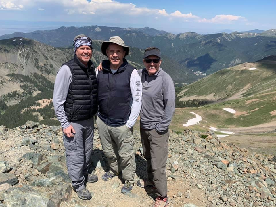
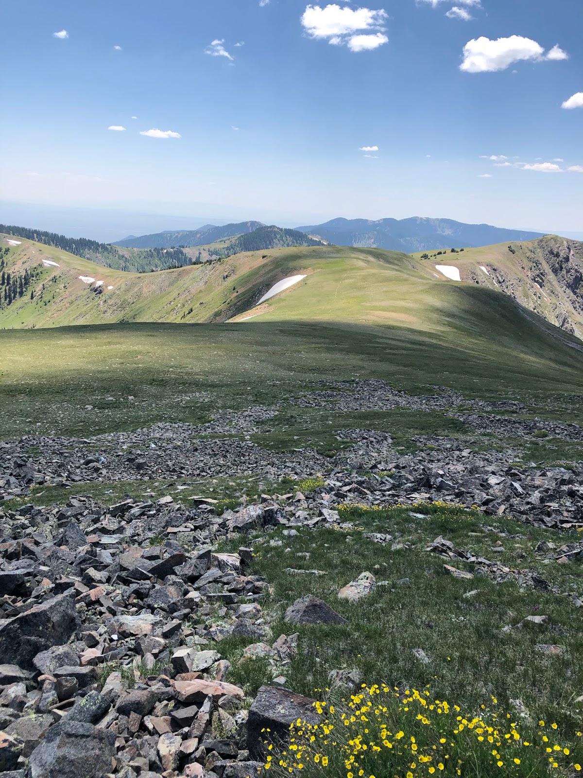
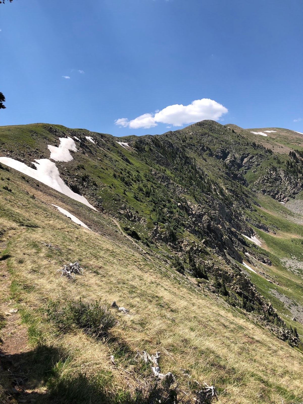
You can tell by my other posts, I like backpacking and hiking. So, to celebrate my upcoming 70th birthday (August), two friends who have shared other adventures with me partnered to complete Segment 14 of the Colorado Trail and climb Mt. Shavano. Mark and Amy have shared epic climbs and cycling events, and I was happy they agreed to join me in my celebration of life. Mark’s wife, Linda, prepared meals and snacks for us she gathered from a blog post suggesting a backpacking meal plan. We could not have completed the trip without her help. It takes a team.
We hiked the segment from the Highway 50 trailhead north to the Chalk Creek Trailhead. Most through hikers and day hikers traveled north to south, but we only had three full days to complete the segment, and we decided to do the shorter length of the trail prior to our climb before the ascent of Mt. Shavano.
We started from the Highway 50 trailhead at 17:00 and hiked about a (steep) mile to our first campsite. We left that camp the next morning about 0600 and hiked about 7 miles to make camp near the Mt. Shavano trailhead.
The next morning we left at 0430 for the 9-mile round trip, 4,600-ft-elevation gain, climb up Mt. Shavano. Mark made the summit while Amy and I made it to just over 14,000 ft. Mark surprised me with a t-shirt he kept from my last day at Legacy to celebrate my birthday. We laughed, but I was moved someone make that kind of effort to say “Happy Birthday.” The quote of the trip for me was Mark saying to Amy and me, “I’m uncomfortable with how uncomfortable you are with these boulders. I suggest you go no farther. We still have to get down, you know.” The last several hundred feet was over boulders with no clear trail. We had become very slow in our careful maneuvering through the rocks. Mark’s observation was all it took for us to start down while he made the summit. The length of the climb and heat of the day caused us to deplete our water supply. We drank from the mountain stream at about mile two on our descent and were refreshed (and not sick) from the cold mountain waters. We returned to camp exhausted about 18:00. A tough but beautiful climb.
Day 3 we broke camp and started the final 12.2 mile leg of the 20.4-mile segment at 0430 and got to Chalk Creek about 15:00. Steep climbs and descents sandwiched open, near-level trails that made going relatively easier than the rest of the trail. The weather was unusually hot for Colorado this time of year. The exposed sections of the trail were dusty and hot. But, you get what you get when you make your plans. The mountain and weather have the last word on your conditions.
I am grateful to the Lord for seven decades of life this side of heaven. Being in God’s Creation has always drawn me closer to Him. My “sacred pathway” is definitely nature, but I will never forget to worship and be grateful to the Creator for the gift of creation and those I share it with.
I am grateful for my wife, Kim, who supports me in these crazy adventures and shares friendships with people like Amy and Mark. She quilts. I hike. We share everything else together.
 Never hike alone. Friends make everything better.
 Part of the section between the climb and end of the segment
 Happy Birthday t-shirt surprise
  Cooling off at the end of the hike
 Over my shoulder is the trail
 Headed to the summit
 Mark, Amy, and I on a break to the top
 Behind me is the ridge to the summit
 Pumping water from a stream was a daily chore
 Nothing like a campsite on the trail
 At the beginning of the hike
July 20, 2022
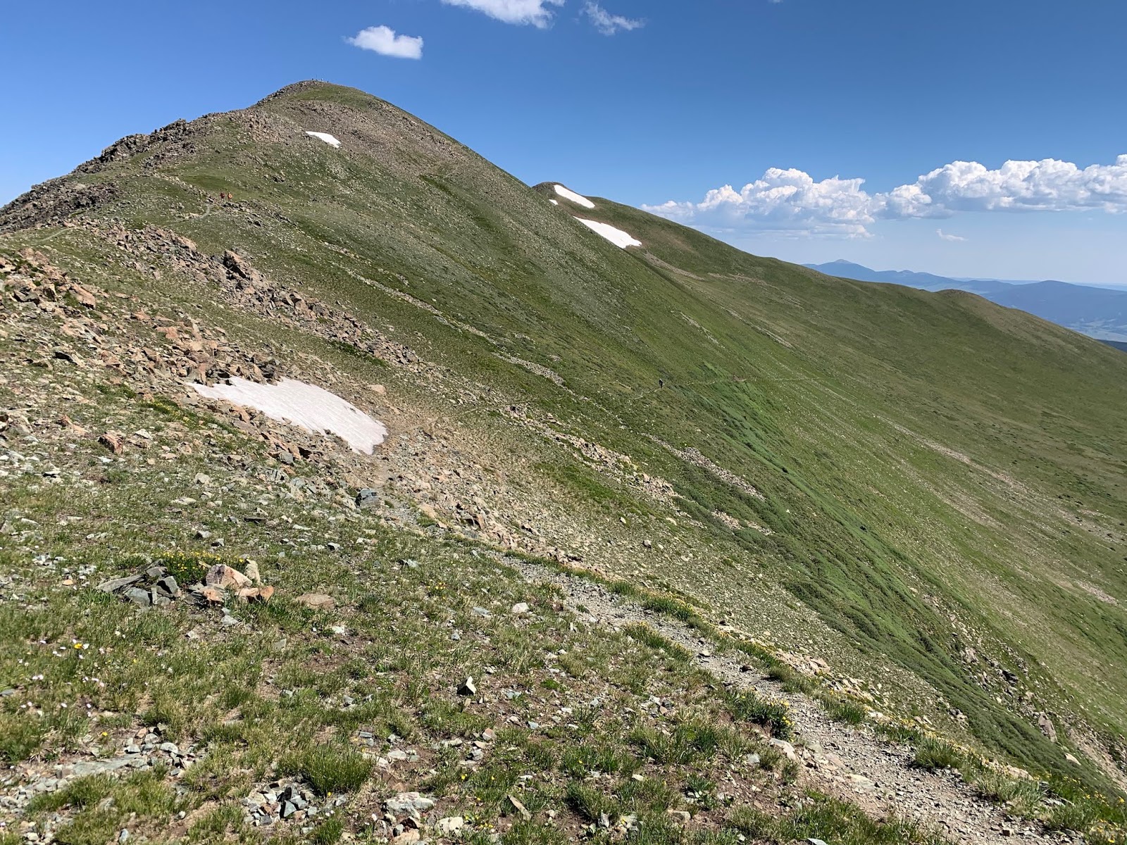
Wheeler Peak via Williams Lake Trail #67
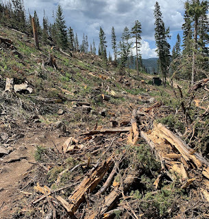
I have traveled most of the trails from Red River, New Mexico to Wheeler Peak. I had never climbed to the peak via the Williams Lake Trail out of Taos Ski Valley. Trail #67 comes out of the valley, past Williams Lake, and on to Wheeler Peak. The lower parts of the trail were damaged by the wind storm that tore through Taos and Red River in December of 2021. The destruction looked similar to the destruction caused by a Texas tornado, but they don't have those in NM in the mountains; do they?


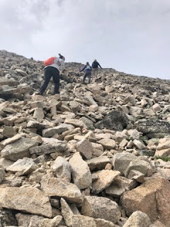
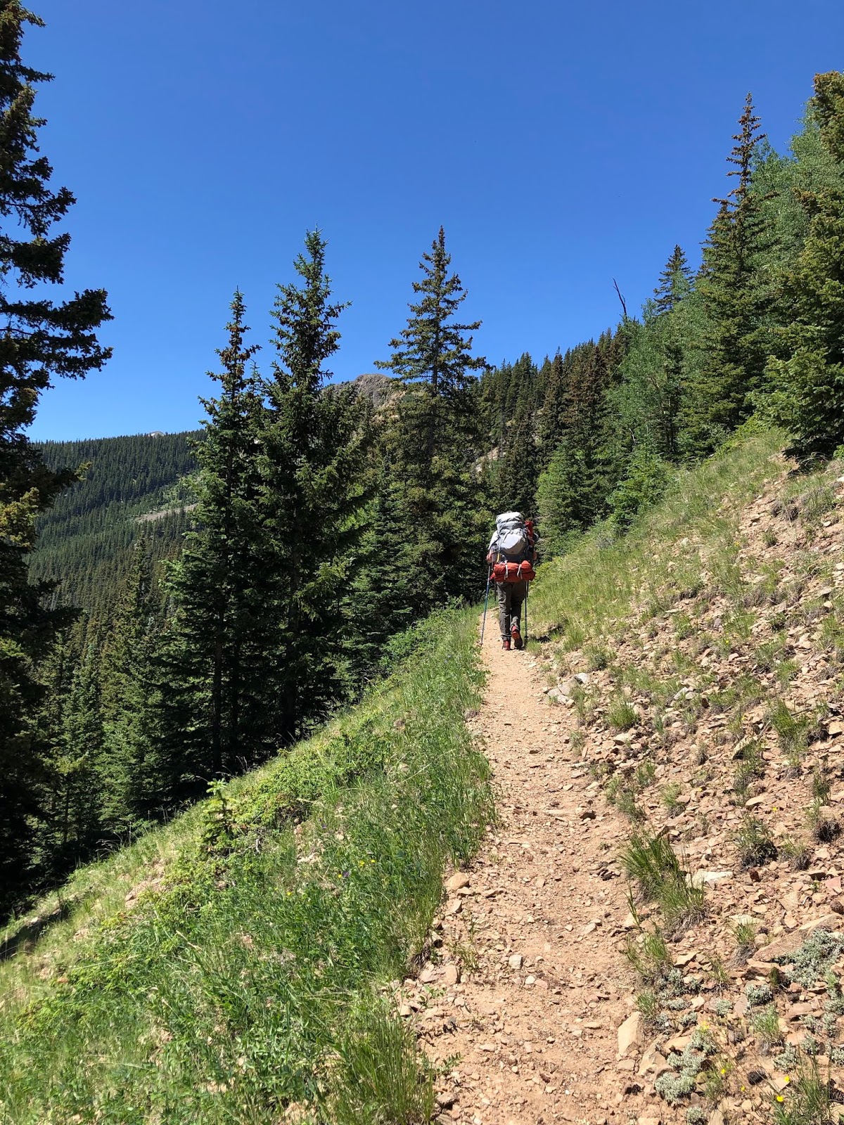
The trail rises steeply out of the valley and divides to go down to Williams Lake or continue up to the Peak. The trail above the tree line has several sections of scree, which makes traversing the face of the mountain difficult.

The trail intersects with the Middlefork Trail on the ridge between Mt. Walter and Wheeler and leads to the peak. Neal and I made it in about four hours with stops to catch our breath, fuel and hydrate.

I prefer the Lost Lake Trail to get to Wheeler Peak, but Trail #67 from Taos provides its own challenges and views and worth the effort. The forests will never return to what they were, but they always have a way of continuing to recover and recreate no matter what happens to them.
July 30, 2020
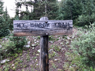
Mt. Huron, CO 14er

Finding the trailhead was iffy and required a 4W Drive Jeep. (Thanks, Jeff) Some other climbers helped us to the starting point, and we were off.

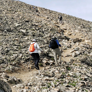
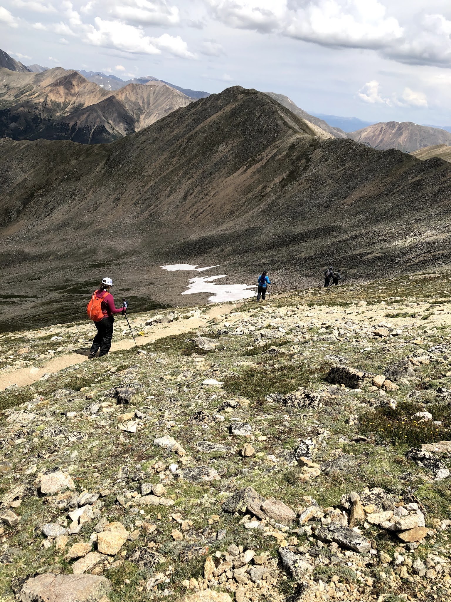
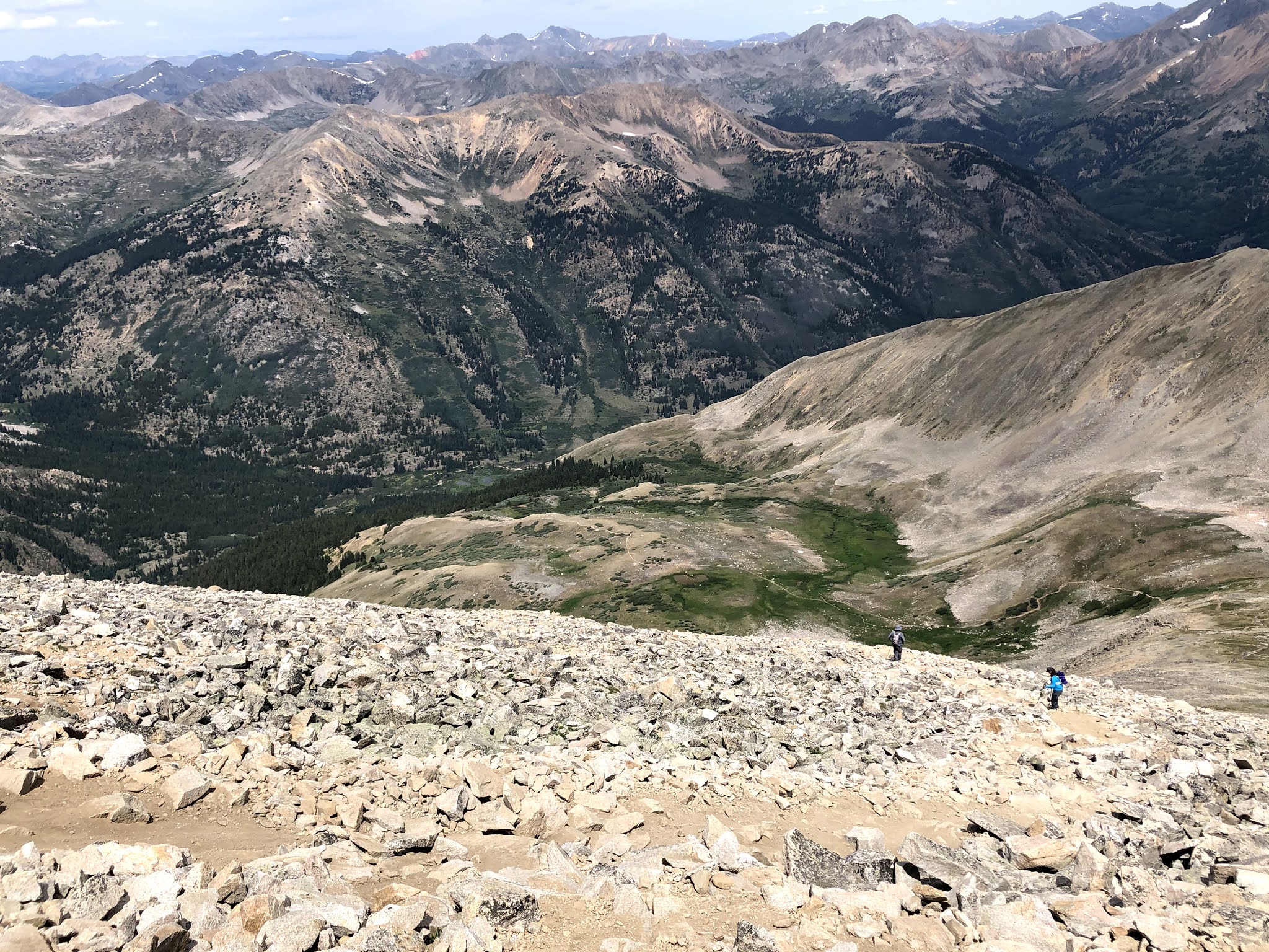
The initial switchbacks and first 3/4 of the trail was an easy walk up through beautiful forest and open slopes. The last quarter mile is another story. We had been told Mt. Huron was an easy climb, "no problem," they said. However, the trails near the top were loose rock and sand, which caused you to slide both going up and climbing down. This section is the Class 2 Moderate part of the mountain trail. I prefer the ascent because of better footing, and this trail only confirmed my preference.
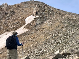
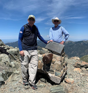
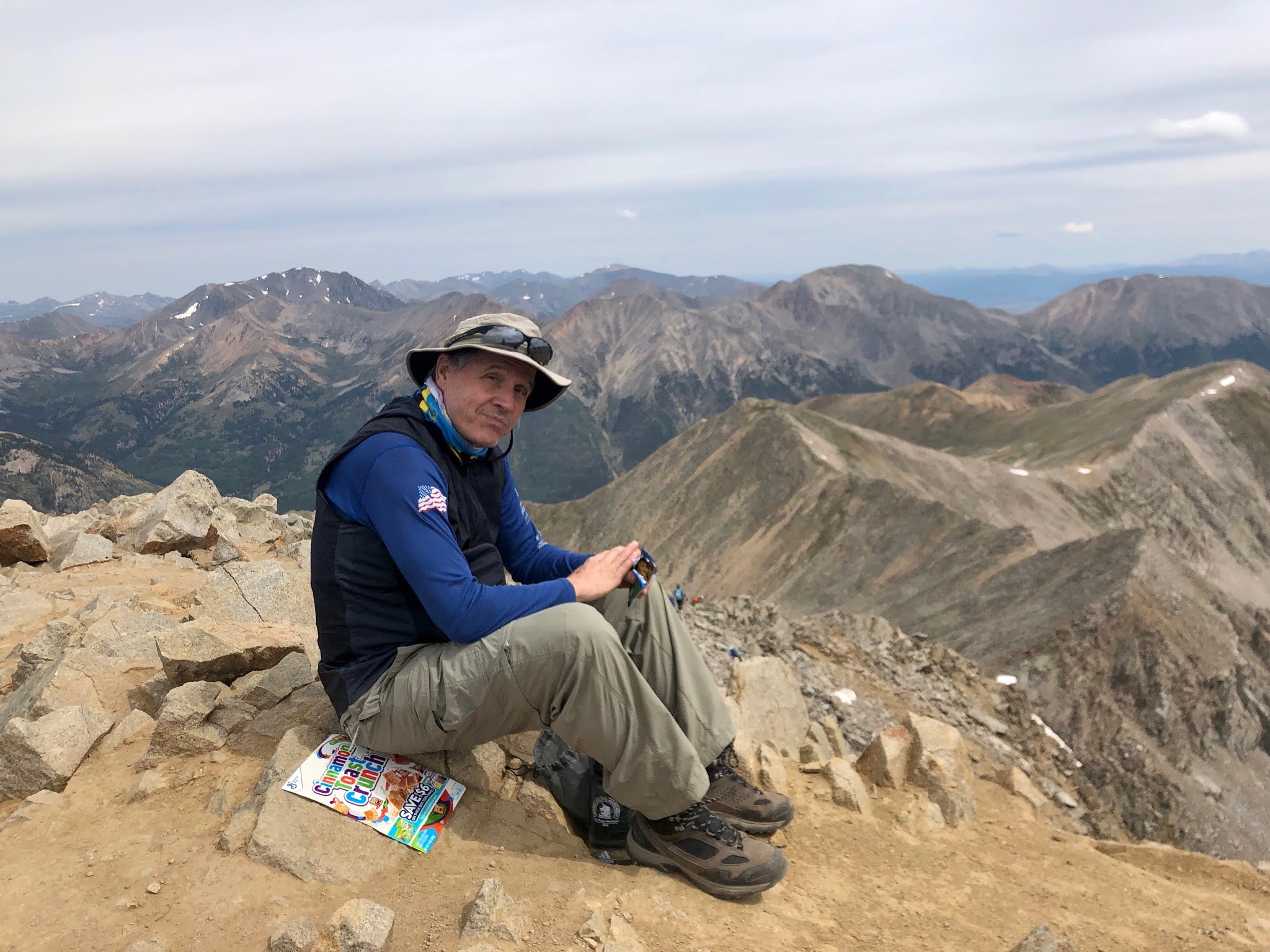
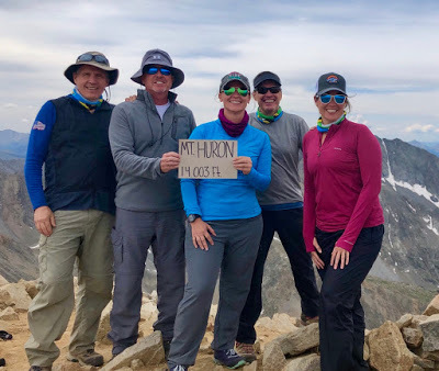
The summit was terrific and the view spectacular. Everyone in our group made it up safely, and we took some time to rest and enjoy the panoramic view from the top. No, I did not eat a box of Cinnamon Toast Crunch at the summit. That's the reverse of the sign in our group pic.

Going down the first quarter mile was everything we feared it would be. Slippery trails and loose rock. Yet, after carefully finding our footing through the rock field and returning to flatter trails, we made our way back to the trailhead.

Rain settled in toward the end of the hike, and we returned wet, tired, and ready for a hot meal. We broke camp down the road on 390 where we had camped the night before, and headed back to Crested Butte for pizza at Secret Stash Pizza.
I recommend this trail and 14er. It is very doable, but if you are nervous about loose rock and slippery trails, this is not for you.

July 30, 2019
Wheeler Peak, NM with Friends
 1994 Wheeler Peak Group
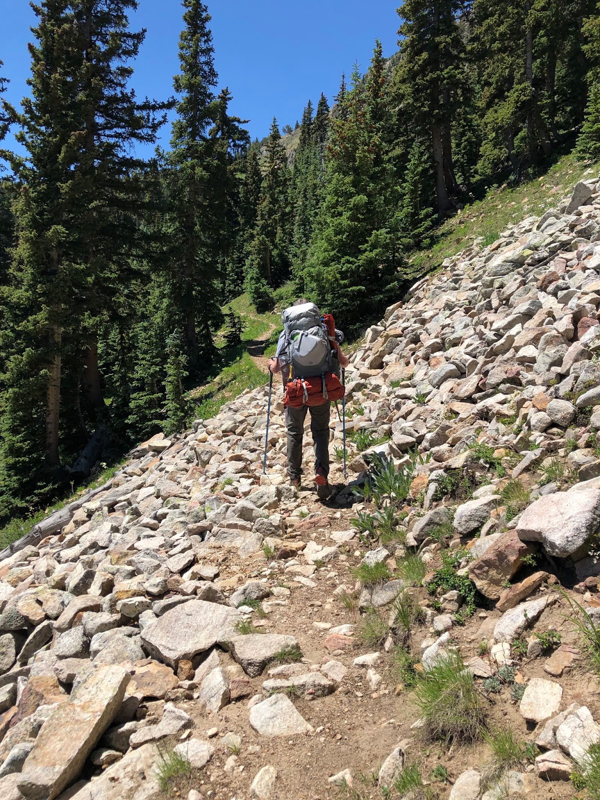
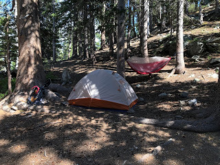 Campsite at Lost Lake
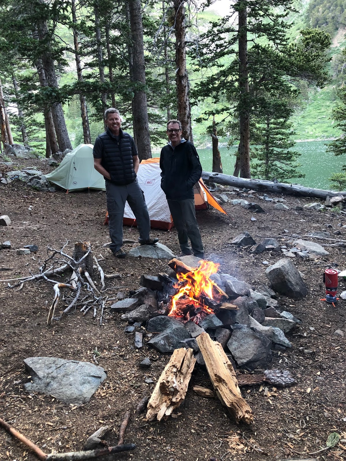 Jon and Jeff at Lost Lake
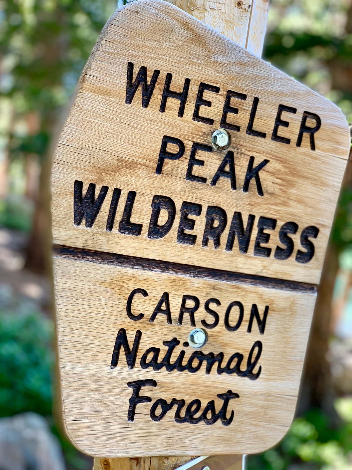
The three of us left Riverside Lodge in Red River about 0700 Friday morning. After stopping by Major Bean for coffee and sausage/cheese biscuit, we got to the Middle Fork Trailhead about 0800. The weather was ideal, and my legs were okay after Gold Hill the day before.
We got to the "half-way meadow" by 0900 and texted Kim, who had left for home the day before. I found out we needed a new AC unit at the house back home. Ended up calling Kim, texting a friend to get a friend’s number for a framer to lay boards in the attic, and buying a new unit to be installed Monday. All at 10,000 ft. of elevation! (Not really a break you want from life in the city while on the trail.)
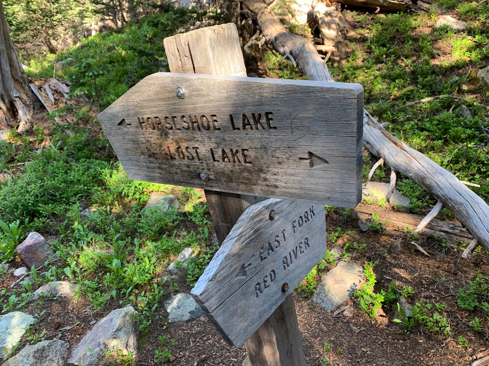
The trail from the meadow to Lost Lake is one of my favorite. Walking through the valley on the single track trail and rock falls make for a pleasurable and relatively easy ascent. There are places to stop in the shadows of pines that make for ideal rest stops. The panoramic view rivals some in CO.
Got to Lost Lake, picked a camp site, set up my tent, and took a nap in my hammock. My site was above Jon and Jeff’s and was isolated both nights. Wind was very high off the lake and kept us up in the night.
 Lost Lake
Started a fire, walked halfway around the lake with Jeff, and came back to freeze dried dinners. Fellowship was good. Really like these guys, and we never had an awkward or contentious moment. They have all the gear you would need and were always happy to share.
Went to bed about 20:00, but the howling wind and no sleeping pad made for a long night. The full moon was like a car headlight shinning in my tent. After a short night, we hit the trail by 0800.
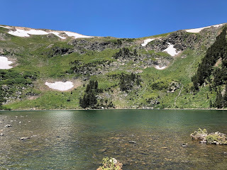
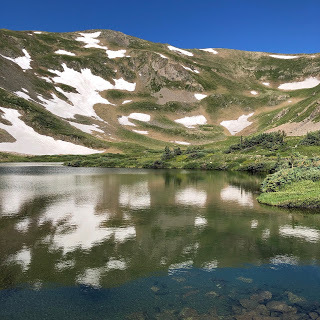 Horseshoe LakeThe trail from Lost Lake to Horseshoe Lake is as scenic and comfortable as from meadow to Lost Lake. Deeper forest with rock falls and a waterfall add to the beauty. The wind calmed down and Horseshoe Lake was still. Patches of snow dotted the slopes falling into the lake. Campers weathered the wind and exposure the night before and waved as we trudged by them. Stopped at the overflow bridge and pumped filtered water.
 The trail out of Horseshoe Lake is the most difficult to the summit. It is steep with loose walk. The view of HL from the top of the trail shows why the lake is named like it is.

The “freeway” from the top of HL to the ridge to Wheeler Peak is a respirate from the HL climb before the climb from the ridge to the summit. Smooth with a gradual incline spotted with marmots and marmot holes.
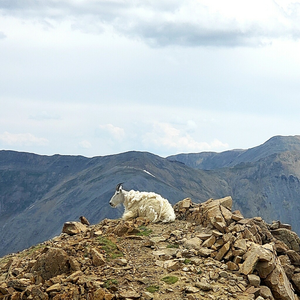
 We made the summit and joined the ten or so Saturday hikers. Dogs and sky runners were unique additions to the trip up. Signed the notebook, took pictures, rested and FaceTimed Kim. Little to no wind. That surprised us after the wind the night before and that morning.
 Met a couple from NM, who knew all the peaks around WP, and a guy from Ohio, who was hitting the highest peak in every state. Always a different group of folks on the peaks
Headed down as clouds began to gather in the west. Just the other side HL the storm hit, and we got pummeled with rain and pellet-sized hail. It stopped by the time we got back to Lost Lake, and it had not rained that hard there. Hit the tent for a nap as showers filtered over the lake.
By the time I woke up, the rain had stopped, and we gathered below to visit. Started a fire at 16:30 with a goal to keep it burning until 21:00 so it will be dark when we went to our tents. Goal attained. Also, instant mashed potatoes!! A must from now on.
Great fire and conversation before bed. I slept so well with only one bio break about 01:30. Woke up, took down the tent, packed my pack and went down to join J&J for a breakfast of a shot of G7 coffee and instant oatmeal. We used their Jet Boils and filtering systems (Sawyer and Katadyn). Not sure where my Katadyn went. Loaned it to someone, I guess.
Broke camp by 0740 and headed down to the car. Weather was ideal. Stopped on the valley trail down to worship the Creator of this beauty and power. Valley below and sunshine thru the clouds above. Cool breeze, green foliage, sweet smells of the forest, feet in the earth, eyes to the sky, heart connected to God. Truly an awe-inspired moment.
Got to the car by 10:00. Met Billie and Betty Ann at Major Bean for coffee and a muffin. Spit bath and change of clothes at the Convention Center and on the road by 11:00. Had to throw away the bandana I used for the spit bath. It was radio-active.
A fabulous trip that satisfied my wanderlust and desire for adventure. With the Gold Hill climb on Thursday I had enough to satisfy me. And with these guys made it even better.
Headed home to a full inbox of emails and Kim’s Sewing Kamp at our house all week.
Thank you, Lord, for the blessings of this trip. The beauty of Creation still moves my soul and refreshes my spirit like few other things you have provided.
I’m ready for the run to Christmas.
July 29, 2019
Gold Hill Hike, New Mexico July 2019
 I left RR ski lift area at about 0700 and headed up
Pioneer Trail
(forest road). Hiked to private property gate and found Trail 171 near gate that loops around the property. The run off from the snow made the road a creek bed the higher I climbed. Several long creek crossings. The trail throws you back onto the Jeep trail but soon brings you to the continuation of the trail. That takes you to the
Gold Hill Trail
juncture. Steep but heavily forested. I think I was the first and only one on the trail. Saw no one coming up.
I left RR ski lift area at about 0700 and headed up
Pioneer Trail
(forest road). Hiked to private property gate and found Trail 171 near gate that loops around the property. The run off from the snow made the road a creek bed the higher I climbed. Several long creek crossings. The trail throws you back onto the Jeep trail but soon brings you to the continuation of the trail. That takes you to the
Gold Hill Trail
juncture. Steep but heavily forested. I think I was the first and only one on the trail. Saw no one coming up. 
 Took Gold Hill trail to the summit. Steeper and more rugged than I had thought. Switchbacks near the summit were heavily washed out.
 The view was spectacular, and the wind was blowing hard. Still some snow on the morning side of the mountains. No animals in sight.
Saw only chipmunks and black squirrels coming up.


Decided to go down Goose Creek Trail instead of back tracking and fighting the ATV traffic on Pioneer.
A mistake when it came to connecting with Jon and Jeff and Billie, who had made great time coming up from Dallas for the climb on Friday. Took Goose Creek Trail 65 at the crossroads to get over the ridge and down to Goose Lake. Very steep with much loose rock. Tough going.

Got to Goose Lake and saw the sign 8 miles to RR!! I was screwed to meet up with the guys any time soon. I could not find the trail head so I started down through the parking lot. Saw a couple of guys, two kids and a dog snaking on the back of their SUV. We exchanged greetings, and when he asked how I was doing I told him, “I bit off more than I can chew, and I’ll buy you a drink if I could get a ride down into town.” He said, “Sure, I’ll give you a ride but it’ll be in awhile.” I said it would be no problem and I’d meet him on the road.
Sure enough in about 20 mins he came bouncing down the road, stopped, and I got in the back seat with his daughter, son, and Jasper the dog, and his friend from CO. His name was Dean from outside Albuquerque. They were pop-up tent camping in Taos Ski basin and came up as they always had since he was a boy to Red River. Said that may be his last drive to Goose Lake due to the ruggedness of the road.
 The ride down was wicked. Washed out roads made for slow going. Dean would let Matthew get out of the car sometimes and video him driving over a rough spot. Delightful conversation.
Stopped to video a cave, see a Jeep that drove off the road and rolled down the hill, and crossing the swollen river at the base.
Jeff and Jon were there waiting. Thanked Dean. Found out where they were eating dinner and said we’d see them there. We dropped by Riverside, I showered while they unloaded their stuff. Got the the Red River Brewing Co about the time Dean and his gang did. Bought them drinks and an appetizer as I said I would.
Best $30 I spent all week.
June 10, 2018
Weeds in the flowerbed
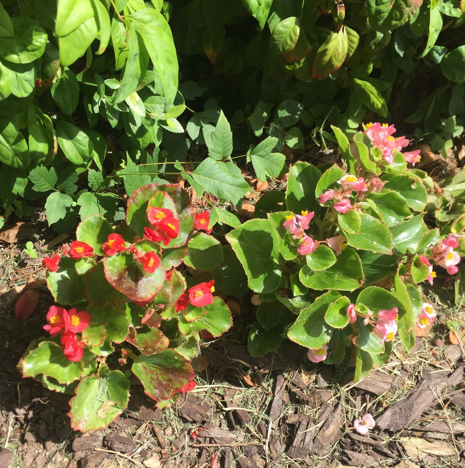
Do you see it?
It's right there.
Behind the flowers.
It's Poison Ivy.
I hate the weed because I'm allergic to it, but it fades so nicely behind the scene.
The beauty of the flowers in front hide the weed in the back.
I have two options here: 1) leave the weed and keep it in the background, hoping no one will come in contact with it; or, 2) I can intentionally get a broad-leaf herbicide and kill it.
My bad habits springing from my heart are like that poison ivy growing in my flowerbed. I think they go unnoticed because the flowers of my public behavior built on good habits masks them, but they are there. They betray my heart's deepest motives even when I think they don't. My "unseen" habits, however, do affect those who come near me whether I tell them they are there or not. People are made ill, or, at least, irritated by my selfish behaviors.
Like poison ivy in the flowerbed, I have two options with my habits: 1) I can leave them alone and try keeping the poisonous ones in the background, hoping no one will be hurt by them; or, 2) I can intentionally work to know my heart, tutored by the Holy Spirit, and then destroy and replace them with habits that add to the beauty of my life.
I know it's easier to kill weeds in the flowerbed than change habits in my life. Seeing the motives in my heart behind the habit is harder still. But I will never know the full beauty of a life lived for God and others until I work to know my heart and change the habits that mold my behavior.
Dallas Willard wrote astutely, "A carefully cultivated heart will, assisted by the grace of God, foresee, forestall, or transform most of the painful situations before which others stand like helpless children saying, 'Why?.'" (Renovation of the Heart, 14 Kindle Edition)
Beauty in a flowerbed begins and ends in carefully cultivated soil.
Beauty in life begins and ends in a 'carefully cultivated heart.'
C. Gene Wilkes's Blog
- C. Gene Wilkes's profile
- 7 followers

