
Second Heartkeeper Prep - The Map
Cartography is not easy; I can say that with absolute conviction. Every part of it - from conception to execution - is tedious and time-consuming. That said, it is an invaluable process in that it forces me to think about my characters' journeys, and it cements the world in reality.
With the first book, I worked off of a very rough regional map. It was always a small story with only a few real locations, so that was all I needed. But this story is so much bigger, and it's intended to open up the world. The map had to reflect that.
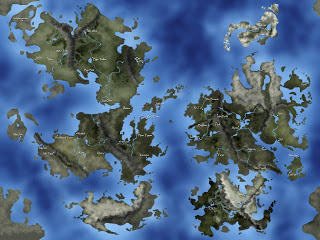
So, this is my first real fantasy map:
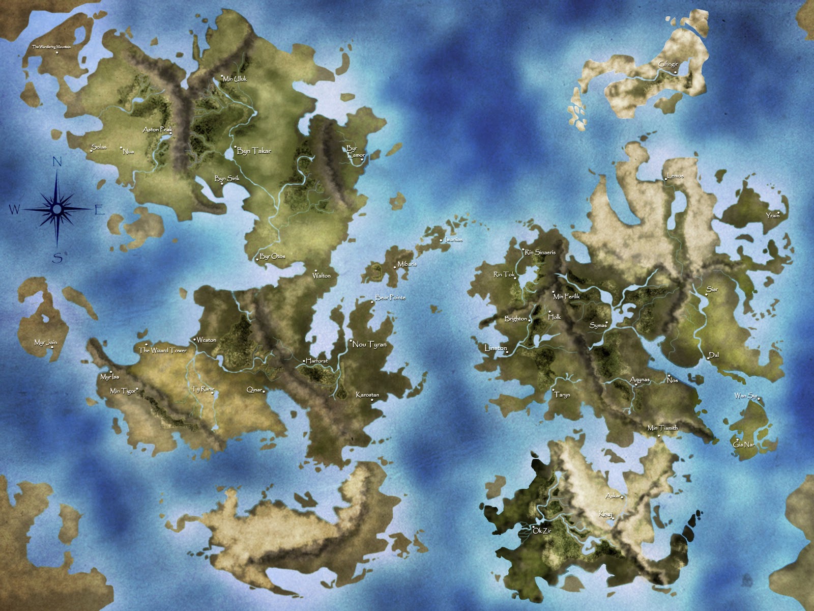
This is the map after a texture pass and the addition of the compass rose:

Part of me wanted to go with a traditional fantasy map with icons, names for everything, and borders, but with a full-world map like this, that's not really an option. So I chose to make it a little more realistic - kind of like a satellite view of the world, with only the cities named.
I started with a sketch (basically just the continents and major landmarks) on nine 14x17 pages (creating a 3x3, 9 tile grid). Then, I took pictures (the pages were too big to scan), and loaded those pictures into Photoshop CS5. From there, I refined the shapes of the continents, did the coloring, applied the textures, and then, finally, labeled it. All in all, it took about 12-15 hours of work, but I think it was well worth it. The result is a useful bit of art that I can use as a reference and promotional material. That, and I think it's just pretty cool. Hopefully you all do too.
In the next update, I'll probably have another couple of maps ready. I still need to do a political map, and I'll probably use a variation of this one to establish the names of natural formations (mountains, rivers, oceans), scale, and major landmarks. I also have plans to create maps of Nou Tyran, Byn Takar, and Linston sometime in the near future.
So keep checking back, and I'll keep posting.
With the first book, I worked off of a very rough regional map. It was always a small story with only a few real locations, so that was all I needed. But this story is so much bigger, and it's intended to open up the world. The map had to reflect that.
So, this is my first real fantasy map:

This is the map after a texture pass and the addition of the compass rose:
Part of me wanted to go with a traditional fantasy map with icons, names for everything, and borders, but with a full-world map like this, that's not really an option. So I chose to make it a little more realistic - kind of like a satellite view of the world, with only the cities named.
I started with a sketch (basically just the continents and major landmarks) on nine 14x17 pages (creating a 3x3, 9 tile grid). Then, I took pictures (the pages were too big to scan), and loaded those pictures into Photoshop CS5. From there, I refined the shapes of the continents, did the coloring, applied the textures, and then, finally, labeled it. All in all, it took about 12-15 hours of work, but I think it was well worth it. The result is a useful bit of art that I can use as a reference and promotional material. That, and I think it's just pretty cool. Hopefully you all do too.
In the next update, I'll probably have another couple of maps ready. I still need to do a political map, and I'll probably use a variation of this one to establish the names of natural formations (mountains, rivers, oceans), scale, and major landmarks. I also have plans to create maps of Nou Tyran, Byn Takar, and Linston sometime in the near future.
So keep checking back, and I'll keep posting.


No comments have been added yet.


