Max Carmichael's Blog
November 23, 2025
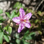
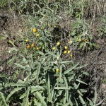
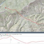
Wind Chill
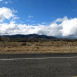
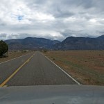
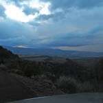
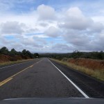
If this is La Niña, I have no complaints: one Pacific storm after another, swinging south over us. High mackerel scale clouds, then the storm itself, then the cold wind. Just like when I lived in San Francisco, decades ago.
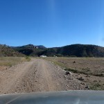
Throughout the night I woke repeatedly to a soft sound of rain on the porch roof outside my bedroom. The mountains north of town had been capped with snow since Monday, but after last Sunday’s dark, wet, and cold hike I wanted something lower elevation, something less challenging. I really wanted to drive to Arizona, but the saddest time in my life is approaching and I needed to stay close to home. Part of me didn’t think I should be hiking, or doing anything for myself, at all.
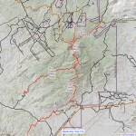
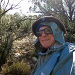
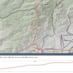
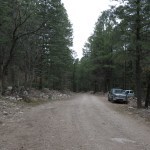
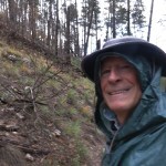
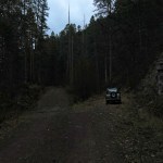
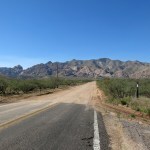
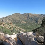
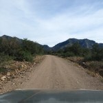
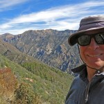
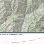
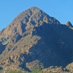
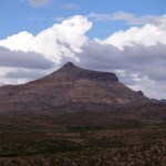
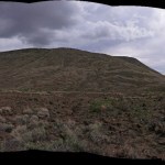
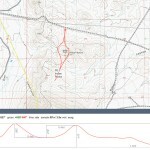
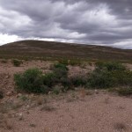
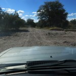
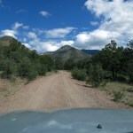
But hiking keeps me sane, enables me to cope, so I decided to hike the CDT south of town up a series of ridges to an 8,000 foot peak with communications towers. I figured there would be snow on top. The forecast high in town was nearly 50. I debated taking my fleece jacket, but the jacket is for temps in the 30s, and as before, I forgot I would end up 2,000 feet higher than town. Even worse, I ignored the forecast for wind. This is what happens when you’re distracted by tragedy.
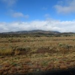
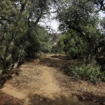
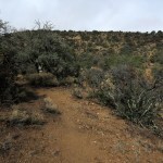
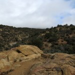
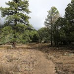
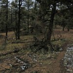
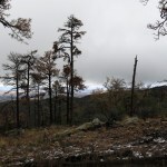
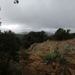
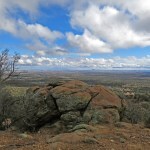
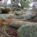
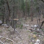
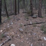
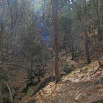
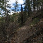
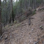
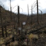
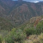
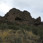
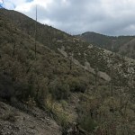
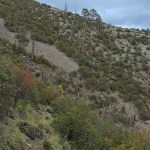
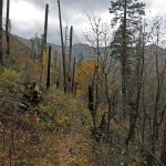
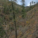
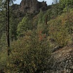
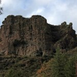
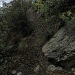
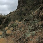
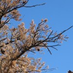
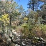
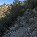
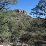
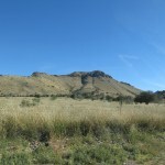
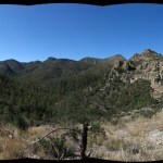
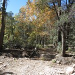
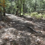
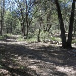
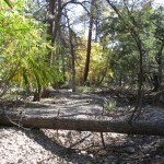
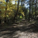
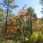
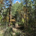
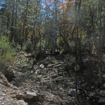
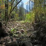
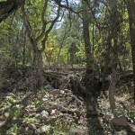
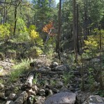
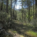
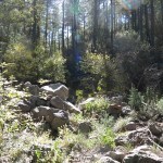
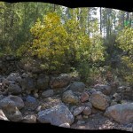
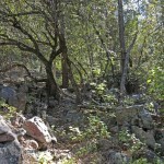
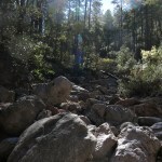
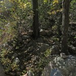
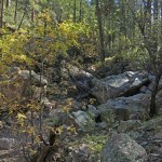
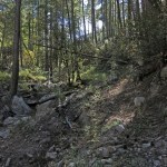
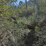
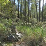
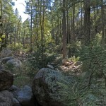
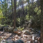
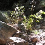
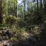
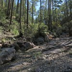
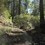
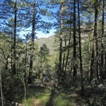
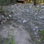
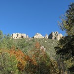
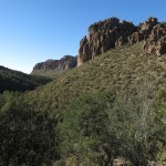
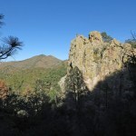
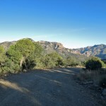
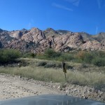
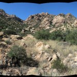
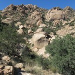
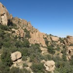
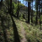
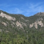
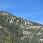
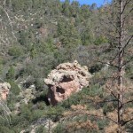
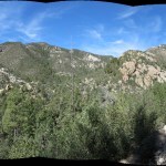
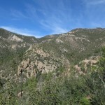
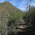
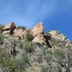
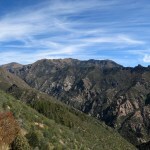
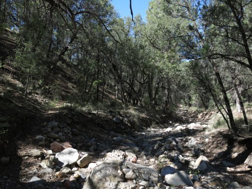
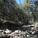
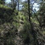
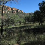
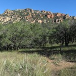
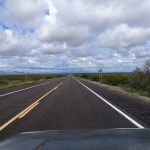
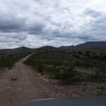
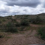
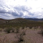
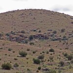
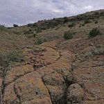
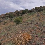
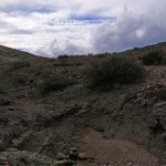
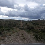
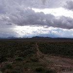
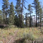
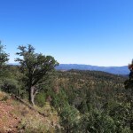
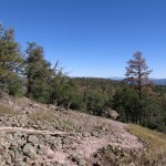
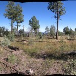
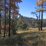
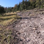
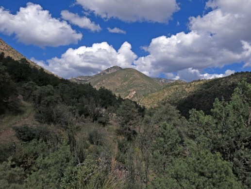
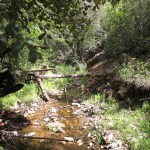
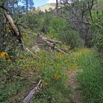
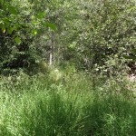
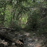
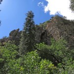
I had some sun starting up the trail, but the dark clouds soon closed over and brought drizzle. The trail starts in a sandy basin then winds its way through granite boulders up a seemingly endless series of mazelike ridges, finally reaching the crest of this low range, where ponderosa pines rise sporadically above oaks and junipers. When I’m in shape, this hike is too short and monotonous for me, but I’ve done it several times, twice in snow up to a foot deep.
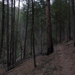
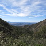
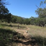
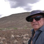
The exposed nature of the trail through the foothills is what attracted me today, but it soon exposed me to wind, and even after the rain stopped, despite my long-sleeved shirt, sweater, and storm shell, my arms got chilled. I’d only gone a mile or so and hated to give up, so I pulled out my rain poncho for another layer of wind resistance. It whipped around in the wind and wasn’t very efficient, but it just barely kept my arms from getting colder.
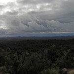
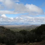
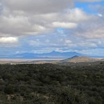
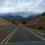
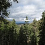
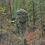
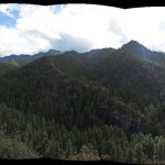
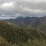
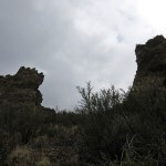
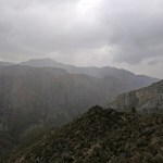
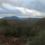
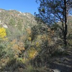
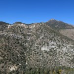
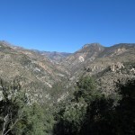
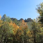
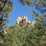
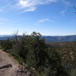
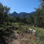
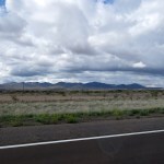
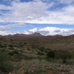
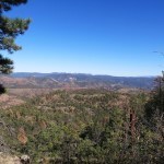
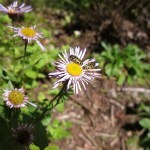
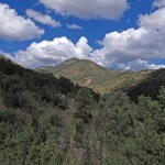
The views, normally nice, were extra special under those dark, shifting, ornate clouds.
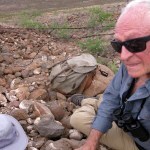
During the final climb to the crest I was loudly clearing my throat, preparing to spit out some congestion, when I suddenly saw another hiker right next to me on a boulder, waiting for me to pass on the narrow trail. He had a cowboy accent and wasn’t very friendly, but it transpired that he was a through hiker finishing the Canada-to-Mexico trail. He said there were three more not far behind, and shortly I came upon another guy, very friendly this time. I asked him if he’d camped on top last night, and if he’d been snowed on. “Wintry mix”, he replied. He said his partner was right behind, and after another hundred yards I saw a tall, 30-something woman striding down the trail, ignoring me and jabbering into her smart phone. That is so annoying.
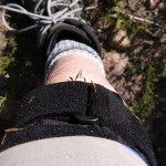
Not much later I passed the final through hiker, who seemed to be in a hurry. I was wearing the strap the new doc had recommended, but my knee started hurting and was tender to the touch, for the first time in a couple of weeks.
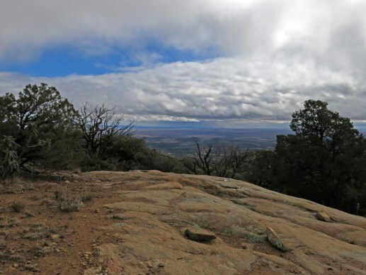
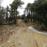
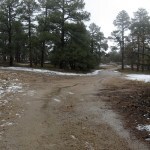
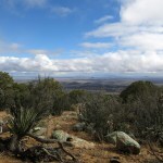
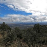
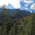
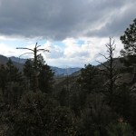
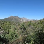
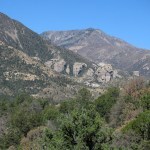
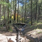
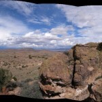
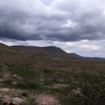
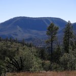
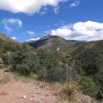
On the crest I entered a patch of sunlight, then passed under even darker clouds. My arms were still on the edge of uncomfortably cold and I assumed the effort of climbing was the only thing that kept me from shivering. But before long I reached the forest road that services the towers on the peak. It’s only a short distance from there.
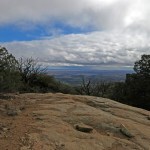
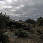
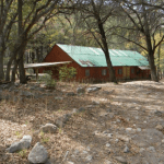
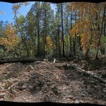
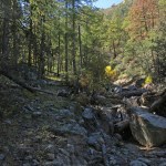
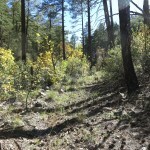
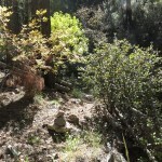
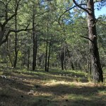
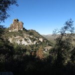
I found much less snow than I expected. I didn’t want to continue up the road to the towers, the peak, and the spectacular view, because it’s totally exposed up there and I’d just get more chilled. A plateau less than a hundred feet below the peak contains the foundations of an old scout camp in parklike ponderosa forest – a nice picnic spot in good weather.
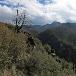
The return hike seems really endless, with lots of ups, downs, and arounds before you begin descending from the crest. On the way, I got more rain, but finally the sky cleared and I was able to take off the poncho.
Nearing the trailhead I heard people talking, and two mountain bikers, a couple in their late 20s or early 30s, appeared. This is no mountain bike trail, and I couldn’t imagine them riding more than another quarter mile, after starting the steep, winding climb through boulders on loose rock and over rock ledges. In the parking lot, their Prius had an NM plate. I figured they were from one of the cities – Cruces, Albuquerque, Santa Fe.
I hit more rain nearing town – meaning more snow in the high mountains to the north. May this continue for months…


November 17, 2025
The Dark, the Wet, and the Cold

Since the new knee doc said I could continue to hike without damaging my knee – and since for the past month I’d been limiting myself to 6 miles and 1,500 feet of elevation gain – I felt ready to tackle a little more mileage and elevation. But in my now-vast library of regional hikes, most options over 6 miles result in more elevation gain than my body is ready for.
I ended up with only two alternatives in less than a two-hour drive from home. But one of those was the partial hike of a trail I’d done many times, and ended at a very undramatic spot. The remaining option was a trail I’d never hiked before, a trail the official websites said had suffered catastrophic washouts and had been impassable since the 2012 wildfire.
The reason I was willing to try it was that in the previous week, I’d found a recent online trip report that said the trail had been at least partially cleared. But – on the eve of departure I could no longer find that trip report.
On top of everything, I’d had a very challenging couple of weeks and kept telling myself I needed a pleasant, fun hike – not a grueling bushwhacking, routefinding challenge. But in the end, the allure of hiking an unfamiliar trail and penetrating new habitat proved to be irresistable.
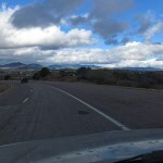
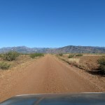
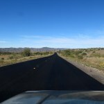
As usual, before leaving, I checked the weather forecast – but crucially, I only checked the forecast for town, which was for clear skies and a high just over 60. My first surprise occurred when the highway turned north and clouds appeared ahead, and my biggest surprise occurred when the high mountains appeared, partly obscured under a dark storm. That was my destination.
Since our weather finally turned cool, I was prepared for fall conditions – sweater, storm shell, thermal cap and glove liners – but not for winter weather, which in the past would’ve been essential in November. Winter wear includes thermal bottoms, fleece jacket, and insulated Goretex gloves.
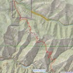
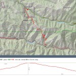
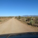
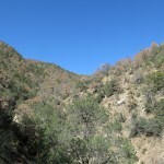
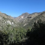
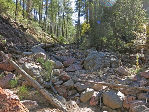
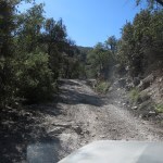
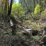
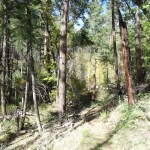
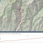
Today’s trail starts on the rocky backcountry road – usually closed by now – that traverses the northern boundary of our big wilderness area. This road climbs a narrow, dark canyon with steep sides. The trail itself climbs over a ridge and descends into the biggest canyon on the west side of our high mountains, continuing up the other side to a junction near a 10,200 foot peak. When I was at peak fitness this trail had never appealed to me, even as a routefinding bushwhack, because it spends most of its time below 8,000 feet. But if I could reach the bottom of the big canyon today that would net me 7.5 miles and 2,400 vertical feet.
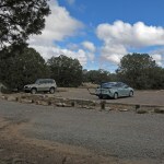
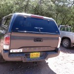
Two big pickup trucks from Texas had parked in such a way as to block the entire parking area for the trailhead. I’d passed dozens of hunting rigs on the way here, so I assumed the pickup drivers would be hunting somewhere along the trail ahead of me – not a pleasant thought. But I’d driven most of two hours to get here, so I continued to another parking spot about 500 feet up the road.
My previous hikes from this road had started more than a thousand feet higher, in the burn scar in former spruce-aspen forest. Here the forest was intact, but the trail started dauntingly steep. In fact, I couldn’t imagine anyone hunting deer in such steep terrain with such dense forest. Deer hunters seem to prefer level ground and open woodland where you can keep a steady eye on moving game and easily follow it on foot.
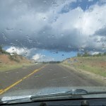
But my concerns were more immediate – making steady progress on steep grades, up and down deeply eroded gullies, and staying dry – it began to drizzle, then rain hard enough for my poncho, in the first quarter mile. Not what I’d planned for at all! I realized I should’ve checked the forecast farther north.
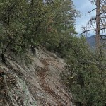
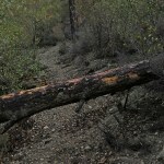
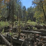
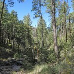
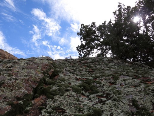
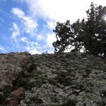
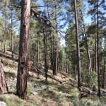
Despite the official warnings, it was a good trail, with narrow but level tread, and most deadfall had been logged. The habitat – high-elevation pines, fir, and eventually spruce, with occasional lichen-covered boulders – was beautiful in the rain. Still, it was so steep that I had to stop often to catch my breath. When I finally felt the saddle approaching, I checked the time, stepped under a pine to get out of the rain, and dug out my map. It’d taken me an hour to go only a mile and a half. Hopefully I’d make much better time on the descent into the canyon – but then I’d have an even longer ascent on my return.
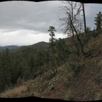
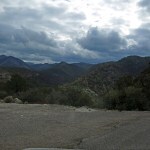
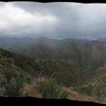
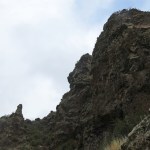
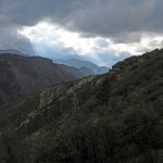
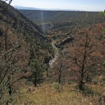
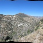
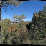
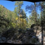
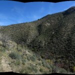
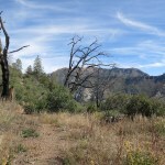
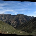
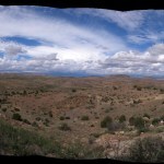
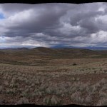
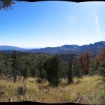
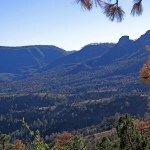
In the saddle, I stepped into a howling barrage of drizzle. As usual, my view of the big canyon was blocked by treetops, but when I climbed a rock formation to shoot a panorama, rain spotted the lens.
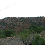
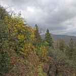
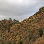
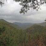
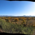
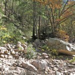
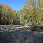
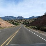
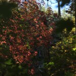
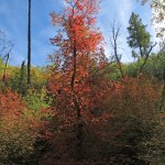
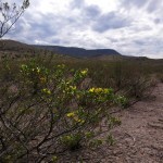
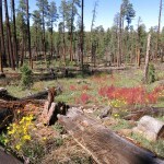
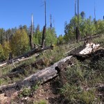
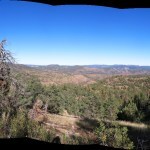
From here the trail traversed across the ridge, and when the rain stopped I was able to get a panoramic view across the big canyon. The burned slopes on the opposite side were colored vivid red and gold by oaks, maples, and locusts, but the entire landscape under the storm was so dark, the colors were almost impossible to capture with the camera.
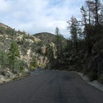
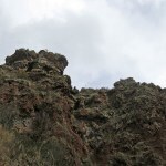
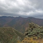
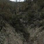
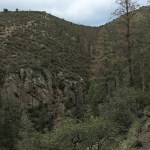
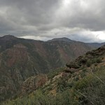
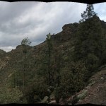
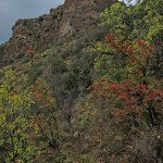
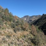
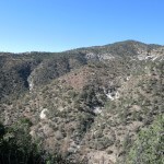
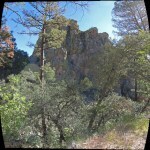
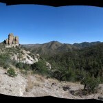
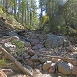
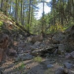
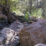
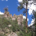
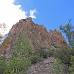
The traverse continued around a rocky shoulder, below dramatic outcrops made forbidding by the storm. Rain had abated and I took off the poncho and replaced it with my storm shell. This was the prettiest stretch of trail, until it descended into a washed out gully where the footing changed dramatically.
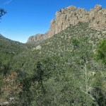
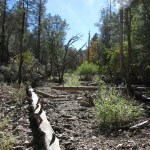
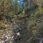
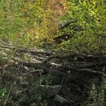
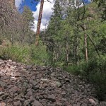
Rounding another shoulder, the trail began descending, in long switchbacks, a brushy slope that consisted of pale crumbling rock. Brush, and older logs, had been cut in years past, leaving an open corridor across the crumbly rock but no level tread, so you were continuously side-hilling instead of walking, and mounds of beargrass or bunchgrass every two or three yards had to be climbed over hundreds of times on your way. Plus at the ends of the switchbacks there were deep gullies with precarious crossings where tread completely disappeared and I had to use boot edges and reach for handholds.
Meanwhile the storm clouds temporarily parted, revealed patches of blue sky, then closed to dump more rain. I knew I was running out of time, but rejoiced when I reached the end of the crumbly switchbacks, rounded another shoulder, and emerged into sunlight with the treetops of the canyon bottom only a couple hundred feet below me.
It’d taken me two hours and forty-five minutes to go 3-1/2 miles, even with most of that downhill. I could probably ascribe the slow pace to the weather – requiring frequent stops for changing outerwear – plus my cardio recovery. I figured my stops had so far amounted to close to 30 minutes.
It was a little frustrating to be so close to the bottom – I could hear the big creek roaring down there – but that descent had been brutal on my lower body and I knew I’d be sore later. And I would already end up making at least part of the drive home in the dark, something I really hate to do with the potential for wildlife on the roads.
The sunlight was soon replaced by more darkness, and at the foot of the crumbly switchbacks I was suddenly hit by a downpour that had me scrambling to dig out and pull on the already wet poncho. I’d dreaded the climb – over 1,100 vertical feet, most of it sidehilling on wet gravel – but it’s all part of hiking in wilderness, so I just switch off my feelings and take it in stages, trying to enjoy the Gothic drama of this steep, rocky landscape under a storm.
More than an hour later I reached the saddle, where the wind suddenly grabbed my poncho, and for a moment I felt like the Wicked Witch from the Wizard of Oz was carrying me off to perdition. It was so bad, I briefly lost the trail on the other side, racing to get down out of the wind.
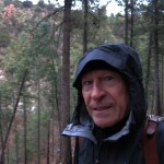
Once out of the wind, I stopped to roll up the poncho and replace it with my storm shell. I added the thermal cap, but my hands were wet and Raynaud’s syndrome was turning them white, so I had to rub them frantically to dry and warm them before donning the lightweight gloves. I definitely need to start packing for winter conditions.
My new Goretex boots were soaked, my canvas pants were soaked to the thighs, and it was only forward motion that kept me from shivering. Both knees were sore and I was getting some kind of cramp that made stepping down rock ledges painful, but the rain had finally abated, and the descent wasn’t as bad as I’d expected.
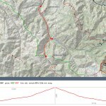
The big trucks were gone from the trailhead – they hadn’t used this trail, so I couldn’t imagine what else they’d been doing here. With stops, it had taken me five hours and forty minutes to go seven miles and 2,105 vertical feet.
Driving down out of the mountains on the narrow, partly one-lane winding road with its sheer drop-off, I faced some beautiful sunset skies in the west. The storm clearly covered our region, and fifteen miles out of town I hit another downpour which followed me home. Definitely not in the forecast!
At home the next day, I re-checked the official websites, and discovered their trail description had been changed in the past few days, showing the trail had been re-routed around washouts and cleared to the big creek.
November 10, 2025
Hikers That Pass in the Day
The new knee doc, three hours away in Tucson, says my local doc was mistaken/misguided, and the brace that made my life hell for the past five months has actually delayed my recovery.
I’m scheduled to get PT – starting in Tucson – but meanwhile I can hike, wearing something hilariously simple called a Cho-Pat strap. I can make this myself using a cheap athletic tape called “pre-wrap”, only available at Walmart. What a wonderful world, what a wonderful healthcare system that makes simple solutions so incredibly hard to find.
So on Sunday I returned to my old favorite trail on the west side of our high mountains, for the first time in almost two years. This is the trail that descends 400 vertical feet into a canyon, climbs a thousand vertical feet to the southwest end of a rolling plateau, crosses the plateau northeastward, descends 1,200 vertical feet into a second canyon, and from there branches either upstream or over another ridge into a third canyon. The hike into and out of the second canyon is brutal but rewarding, and for some reason this trail has featured more crazy weather than any other – blizzards, hailstorms up to 3/4 inch.
Today I only hoped to make it to the edge of the plateau, where I would face a dauntingly steep climb on loose rock up 350 vertical feet. Unseasonable warm weather was finally over. Here in the second week of November, this was our first true fall day, with a forecast high of 61 in town.
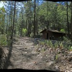
On my last visit I’d found a new restroom at the trailhead, constructed on public land by a private club of recreational aviators to service a nearby dirt airstrip. Their thing is to fly in and out, adding this landing to their competitive life list – just like birders, peakbaggers, and through hikers. Today, at the end of the 15-mile, mostly unmaintained dirt ranch road that accesses the typically lonely trailhead, I found three vehicles, a tent, a big pickup with a huge fifth-wheel trailer, and a newly graveled camping and picnic site with permanent concrete picnic tables – all installed by the private club on public land.
A young woman was sitting outside the trailer, reading, surrounded by expensive gear. First time I’d seen anyone under 60 with a setup like that, so I spent the next hour or so struggling to imagine what she was doing there alone with that huge, expensive rig. As I shouldered my pack, she gave me a half-hearted wave and turned back to her book.
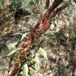
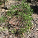
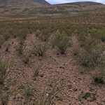
Traversing down into the first canyon, the first thing I noticed was that virtually all the pinyon pines had died in the past year. I’ve been seeing and remarking on tree mortality recently, but this was beyond anything I’d seen yet. I estimated it was over 90 percent, and I’m sure it will get worse.
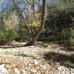
The next thing I noticed was the gnats, swarming my face. Why now, on our first cool day, weeks after the last rain? I could see the creek flowing over bedrock in the bend below the trailhead, where it leaves the mountains, but at the crossing in the canyon bottom, which usually requires waterproof boots, it was barely a trickle.
Climbing the opposite wall, on a series of long switchbacks, was a great workout to recover my cardio capacity. I had to stop repeatedly to catch my breath, but I still did better than expected.
At the top of the switchbacks the trail cuts back into a shallow valley, past looming rock formations, finally climbing to a saddle below the low peak at the southwest edge of the plateau. But today was my mother’s 99th birthday and I’d planned to visit her after the hike. The gnats became so bad that I finally had to stop and pull on my head net. By the time I reached the saddle I was out of time, so I immediately turned back.

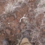
The knee strap is designed to reduce tension on the inflamed tendon, and on the steep descent it seemed to be doing its job. More than halfway down I was approached from behind by a young man wearing a medium-sized pack and carrying what looked like a tripod. When I asked him if he was scouting for deer, he replied, “Hunting!”
“Get anything?”
“A buck! My partner’s behind me with the meat.” The young man was taller than me and as I stood aside to let him pass I saw the head and a modest rack of antlers sticking out of his pack.
“Whitetail?”
“Yep. No mule deer left around here.”
“Plenty in town,” I replied.
At the creek crossing, I met him again, sitting at the foot of the little cliff on the west side. He asked me if I was a hunter and we fell into a conversation. I asked him where he was from – he named a tiny village two hours north – and that led to him asking me if I’d hiked up around Willow Creek, on the other side of the mountains.
I said yes, two or three times. Then I remembered that more than four years ago, hiking the next canyon north of here, I’d met a tall young man who’d hiked 40 miles over the mountains from Willow Creek. Here’s the passage from Dispatches describing that encounter:
About midway up the canyon I surprised a young man with a dog. He was in his early-to-mid 20s and was carrying a pack smaller than mine, but he said he’d backpacked over from the opposite side of the mountains – a journey of close to 40 miles. I wanted to ask him how he’d made it so far, carrying supplies for himself and the dog in such a small pack. But he was anxious to discourage me from going farther – he’d had to climb over the deadfall I’ve encountered in the past up on the crest. I think he assumed I was backpacking and I didn’t get a chance to correct him. We wished each other well and parted ways.
I described that encounter to the hunter, and he admitted it was likely him. What are the chances?
I continued up the steep trail, and at the trailhead, as I was unloading my pack, the young hunter appeared and walked to the lone pickup truck that wasn’t surrounded by camping gear. That answered part of my curiosity – he wasn’t the partner of the girl in the fifth wheel trailer, who was now nowhere to be seen.
November 4, 2025
Rewilding
My itinerary, returning home from Tucson with stops along the way to explore new hiking areas, was resulting in mid-day hikes and missed mid-day meals, which I can ill afford with ongoing muscle atrophy and weight loss. After the Indian Trail hike on Saturday, I’d spent the night in Willcox and was hoping to hike the wild, less-visited west side of the range of canyons on Sunday. And sure enough, I was destined to miss another mid-day meal while doing some hard exercise. A great weight-loss plan if that’s what I needed. Yeah, I always carry snacks, but not enough on this unplanned trip. I didn’t even have enough clean clothes, and would unsuccessfully try to wash and dry a set overnight…
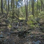
The west side of the range consists of four major west-trending ridges, all designated wilderness, with three primitive forest roads leading up between them to remote, primitive campgrounds and trailheads. Until the massive 2011 wildfire, an intricate network of 4wd roads and backpacking trails penetrated the entire area from exterior basin to crest, but after the fire, flash floods, washouts, and debris flows resulted in all those trails and most of the roads being abandoned.
This is just the kind of hiking scenario I crave! But before now, this area had been just too far from home to explore. The far northern ridge lies within the national monument where I’d done a couple of hikes, and the northernmost forest road leads over the crest of the range to the popular eastern basin – I’d driven that once from west to east.
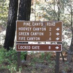
My map showed a secondary forest road turning south off that crest road, well below the crest, toward a pass and a remote canyon marked with something called “Pine Canyon Camp”. A little more research revealed an elaborate Methodist Church Camp tucked away in this remote canyon, which had been damaged by catastrophic floods after the 2011 fire, and “completely removed” by the Forest Service as recently as 2018. Apparently they even broke up and buried the foundations…
My topo map showed that branch road into Pine Canyon climbing over a pass and ending at the canyon bottom, where trails led up and down canyon. With all that flood damage, I had no idea whether the road over the pass would be usable – let alone the trails in the canyon. If not, I would just continue to the crest, do a hike there, then make the three-hour drive home, stopping at the cafe in late afternoon for my only decent meal of the day.
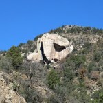
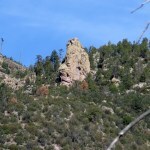
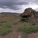
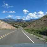
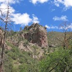
The main road to the crest is pretty scary, but the minute I turned off onto the side road to the pass I felt like a real pioneer. Not only was it rougher, it was far more spectacular! In tight, narrow turns, it cut between a cliff and a towering rock outcrop, then did a hairpin and climbed precipitously over the pass, between dramatic rock outcrops – one of the most spectacular backcountry roads I’ve driven!
And beyond the pass lay a big, very remote canyon with more spectacular rimrock, and a short, steep descent to the bottom. I’d studied this canyon on the map, and assumed the main access was via a maze of ranch roads in the western basin. But the sign at the bottom said this road dead ends at a locked gate – private ranchland. So this gnarly road over the pass is the only way into and out of this big, spectacular canyon.
I wanted to explore it all, but only had time for a hike. Beyond the sign, the old road north up the canyon was washed out and officially closed, so I parked, loaded up, and set out on foot.
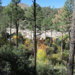
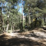
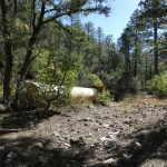
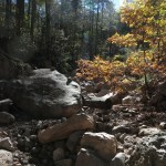
Across the shallow washout was a broad floodplain, where remnants of the old road alternated with debris fields from the floods. Despite our continuing unseasonable warm weather, fall color was spreading through the sycamores, oaks, walnuts, and willows.
Some types of off-road vehicles had recently disobeyed the road closure and rock-crawled over the debris fields, up to a point where a side road – unmarked on any maps – climbed up a small side canyon, and the way up the main canyon was decisively blocked by logs. That side road may just be former access to one of the removed camp buildings, since nothing shows there on satellite view. But I was only interested in the main canyon, where I spotted the tail end of a whitetail buck disappearing into the forest across the floodplain.
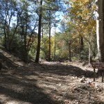
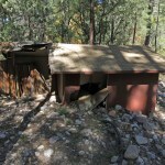
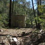
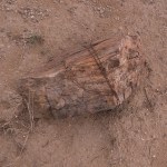
Walking up the broad debris field, over and around logs, was easy and pleasant enough, until I reached a small cabin, still standing but partly collapsed by flood debris. On a camp history web page this is called the “Forest Service Storage Building” – hopefully they’re planning to remove it before it washes downstream.
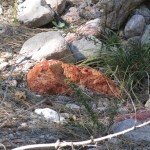
Past the storage building, the canyon narrowed and the debris got gnarlier. Eventually I reached the camp’s water tank and associated equipment, which the Forest Service apparently considered not worth the effort of removing. This is the ultimate legacy of Western Civilization – toxic ruins.

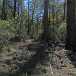
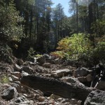
I could still follow traces of the old road up the canyon, but frequent washouts and debris had mostly obliterated it and created an unfolding obstacle course. Initially I embraced the challenge because my knee pain had confined me to easy trails for so long. Eventually I found a trickle of running water.
The map showed that after a mile and a half the canyon split into two upper branches, one coming down from the crest of the range, the other from a saddle in the next major east-west ridge. The latest Forest Service map, from 2016, shows an actual, driveable road not only going up the main canyon, but continuing up the left-hand branch all the way to the crest. So most of this flood damage must’ve occurred since 2016.
I was hiking in the creekbed and could easily tell when I reached the branch point, but there was no sign of a road there. So first, I took the left branch, and there was enough floodplain left that I was able to climb out of the gully and hike through forest for a hundred yards, until I came upon an apocalyptic pile of debris that I had no interest in climbing over.
I sat on a rock and ate a snack, then climbed over a logjam toward the “crotch” between branch canyons. Reaching a gentle slope with parklike forest, I looked back and noticed a shallow gully that was likely the old road to the crest. Amazing, in less than a decade here a road can revert to a natural feature!
A little farther, I came to a broad corridor in the forest, leading toward the next branch canyon, that could only be an old road – an even older road that had been “retired” and left off the 2016 map. I love the habitat in this range, but there was something about the experience of societal abandonment that enhanced my hike, made my spine tingle, and encouraged me to continue past the obstacles in this rewilding canyon.
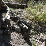
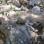
It helped that the old roadway left intermittent terraces where I could walk faster, making up for the occasional logs, washouts, and debris piles. I spotted another whitetail buck fleeing across the canyon. But I soon came to a sharp dogleg in the canyon that had cut deep banks and left taller piles of debris. That’s where I began encountering minimal cairns – often just a single rock sitting on a boulder – that helped me find a path through the chaos.
Beyond the dogleg, the canyon got narrower and more spectacular, and the debris got bigger and more challenging, but I still found traces of the old road and its terraces. I’d been hoping to reach the saddle, but the sun was going down and I was starting to think about getting home before dark – especially since the time had changed and night was falling an hour earlier.
My route passed back and forth across the creekbed, and eventually I crossed a stretch of slickrock. Not far upstream I reached another daunting debris pile, and decided to turn back. I figured I hadn’t been able to cover much more than two miles in over two hours of hiking, and probably had another mile to go to the saddle.
When I checked the GPS waypoint that night, I discovered that my turnaround point was just inside the federal wilderness boundary. It’s likely been years since anyone had the masochism to hike up there – again, just what I like. HikeArizona has a trip report from a guy who hiked the eastern canyon in October 2019, so that may be the most recent. The official trail guide says some group cleared this trail in 2022, but admits it hasn’t been verified, and the report was clearly mistaken. Maybe some of the cairns dated from that year…
Knowing the way, I was able to move a little faster on the way down – but not by much. Long before I reached the vehicle, I knew I would need to stay overnight at the lodge on the east side, to avoid driving home in the dark through deer-infested mountains.
A long, steep, rough drive – an hour and fifteen – to the crest road and over into the eastern basin, with the sun dropping behind the crest. To a big burrito, only real meal of the day, and a quiet room for the night, where shoulder pain – until now a lower priority than the knee – would keep waking me up.
I found only locals in the cafe when I arrived, but scientists and cyclists poured in shortly after. A scrawny but powerfully muscled cyclist in his 70s was wearing a “We the People” U.S. Constitution jersey, his whole body red white and blue. No way of telling whether he was a right- or left-wing patriot, although populists do lean right.
And after four nights away, the final drive home, to the ongoing trauma of helplessly trying to comfort my beloved, suffering, fading mother.
Indian Trail
Saturday morning. I was in Tucson, at the quiet, secluded courtyard hotel, in a residential neighborhood next to a huge park, where I’ve been staying on occasional visits for almost 20 years. Friday had been a miserable marathon of urban driving, traffic, looking for and failing to find solutions for my 18-month-long knee injury and my declining mom’s 14-month-long housing, care, and treatment crisis. The day had ended with four hours of tearful empathizing with caregivers and children of declining elders, leaving me an emotional wreck.
I’d left home Thursday afternoon hoping to make a mini-vacation out of this trip, but now that I really needed it, I was scheduled to check out of this peaceful retreat and make the three-hour drive home amid convoys of oblivious tractor-trailer rigs and Texans in giant pickup trucks seething with incipient road rage.
I couldn’t justify another expensive day and night in the city. My health was already suffering from the stress of driving, and my fitness had been set back, missing two workouts and a midweek hike at home. But the next day, Sunday, was the day of my longer weekly hike. What if I split the drive home into two short segments, stopping along the way to explore hiking areas I’d been researching for years? These are areas that are too far from home for a day hike, but nagging because I pass them regularly on longer trips.
My one feeble attempt at vacation life was breakfast at Hotel Congress downtown, a legendary hipster hangout which seems to have been colonized by retired tourists.
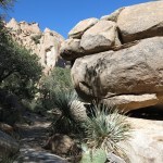
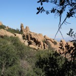
The first stop on my return trip was a relatively small mountain range that straddles the interstate highway. The interstate climbs to a pass in the small northern part of the range, where spectacular granite boulders remind me of my beloved Mojave Desert. But the larger southern part of the range has the hiking trails, branching out from what I’d always assumed was some sort of park or monument.
The long, lonely drive south from the interstate, past vacation homes and hobby ranches hidden in desert scrub, changed from paved to gravel when it turned toward the mountains. Spectacular granite cliffs rose straight ahead, so I pulled off the wide gravel road for a photo. Returning to the Sidekick, I noticed a vehicle approaching to pass me.
Driving at high speed on the wrong side of the road, it was a small Japanese sedan. I pulled out and followed it, trying to figure out what the driver was doing so far to the left. Sometimes on a dirt or gravel road where there’s no traffic, you drive on the wrong side to avoid potholes or washboard, but this road was both wide and smoothly graded. The car ahead continued to race away on the wrong side of the road, and when other vehicles approached, it would pull over briefly, then return to the other side.
When we reached a 90-degree bend at the foot of the mountains, the wrong-side driver suddenly pulled over to let me pass, and I saw that it was an old man with long hair and a stringy beard, looking distracted. I continued south into a narrow valley between granite cliffs on my right and low hills lined with oak and juniper to the east. Instead of a park or monument, I passed small rustic homes and ranches, crossing and recrossing a dry creekbed, until the road dead-ended in a small Forest Service campground in the shade of giant boulders and venerable oaks. There, I studied my map and learned that I’d already passed the parking area for a short trail up a boulder-lined slope, so I drove back, parked next to a small city SUV, and set off up the trail.
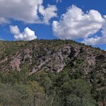
I had no expectations for today’s hike – I just wanted to get a feel for the area. I was exhausted and depressed after my failed city trip, but the climb, winding steeply through narrow gaps between boulders, reminded me so much of the Mojave, it felt like I’d been temporarily transported far away from my crushing problems.
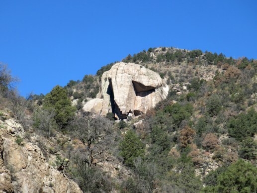
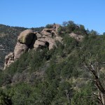
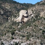
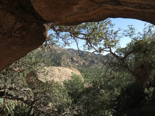
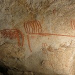
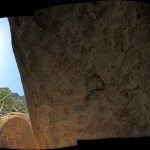
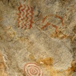
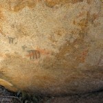
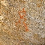
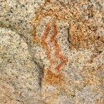
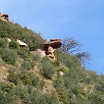
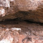
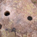
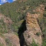
I could see a saddle on the crest about a thousand feet above, but my map showed the trail ending a couple hundred feet below it. Tracks showed this was a popular trail, and I knew there was a party ahead of me. But after the first quarter mile I spotted a boulder pile to the right of the trail with a promising-looking hollow underneath. And crawling inside, I found pictographs.
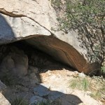
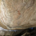
As I said, I’d studied this area in advance, and although I hadn’t seen anything about pictographs, I remembered reading something about an “Indian trail”. This must be it! When I rejoined the trail, I discovered steps cut into the rock leading upward – steps that looked suspiciously non-Colonial. It may now be worth mentioning that this “rugged natural fortress” was the headquarters and refuge for Apache chief Cochise.
I found the next alcove with pictographs hidden in a bigger boulder pile above the first one.
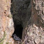
Fully sensitized, I scouted farther afield, and immediately found another rockshelter containing a big sheet of plastic, under which someone had left a sleeping bag and sleeping mat. Sand had washed down over it, showing it had been there for a while. Who had left it, and why? The cliffs and boulders should be attracting climbers, but I had a hard time imagining them driving to this remote spot, far from the nearest city, then leaving valuable gear in such an exposed spot right off the trail. It looked more like the stash of a homeless person than that of a yuppie.
I continued, checking every likely rockshelter, and soon found another stash – this time a single backpacking pad laid loosely under an overhang just off the trail. What’s going on here – road-trippers walking a few hundred yards up the trail, spending a night, then abandoning their gear?
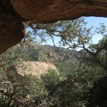
Right about then I heard the other party, a couple of guys, talking somewhere high above the trail. I never saw them, but I soon came upon a big ledge across the main drainage, where a thin stream of runoff had filled a small rock pool. The view was spectacular, and still tired, I decided to make this my endpoint and return to the vehicle.
Approaching the stone steps near the first pictograph site, I heard voices, and suddenly came upon a tall, attractive couple in their 20s, dressed and outfitted like they had just stepped out of an upscale suburban fitness center pumping loud techno. I smiled and greeted them, but they both frowned at me – trained not to smile at strangers, dismissive of older people, or just having a lover’s spat? I asked if they’d seen the pictographs, and I had to rephrase the question a couple of times before the bearded young man uttered a curt “Yes”, still frowning.
I wished them a good day, and returning to the parking area I found their immaculate, late-model 4-door Jeep Wrangler lifted on big AT tires. Clear evidence of progress – at their age I’d been dressed in thrift-shop castoffs, driving a 15-year-old, battered and oxidized VW Beetle.
October 27, 2025
Wilderness Homecoming
Despite its apparent failure, I was still following our local doc’s treatment plan for my knee: gradually increasing the difficulty of my hikes, in two-week increments. Since the injury/condition didn’t seem to be healing, I just wanted to restore as much cardio capacity and lower-body strength as possible.
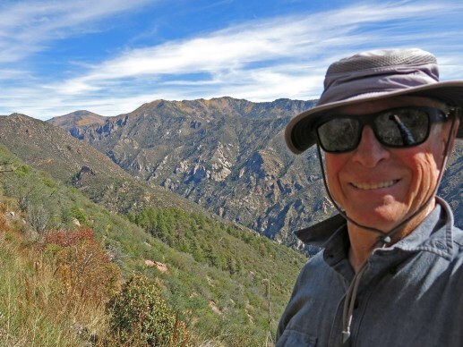
After almost two months of this I felt ready to try over a thousand feet of elevation gain, and the hike I’d been saving for this starts on the trail that first introduced me to our vast wilderness area. As such, that trail is more special to me than any other. It first enabled me to reach the crest of our high mountains and penetrate deep into the heart of the range.
The main trail starts at 6,400 feet, climbs through foothills, descends to the canyon bottom at 6,500 feet, follows the creek north for about three miles, then climbs steeply to the crest at 9,600 feet. Today’s hike would follow the creek for less than a mile, then take a branch trail that climbs over the right-hand wall of the canyon into the next canyon to the east, one of the biggest canyons in the range, which doesn’t have its own trail. Climbing to the saddle between canyons would give me a spectacular view and 1,500 feet of accumulated elevation gain in six miles out-and-back.
On the highway north, the first thing I noticed was the absence of southbound snowbird RVs and big pickups hauling UTVs – so thankfully, that phenomenon is seasonal. But our weather is still unseasonably warm, and the forecast today was for a high of 70, with thin clouds over the mountains.
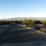
I found a late-model city SUV and a big, generic pickup at the trailhead – fairly typical, although I often find it empty.
It had been a year and a half since I’d hiked this trail – all the way to the crest, where I’d found snow and a young German had joined me most of the way. It really did feel like coming home to the wilderness, especially after crossing the boundary a half mile in. My knee had been pain-free for a few days so I started without the brace – my constant companion for almost five months.
Since I’ve hiked this trail more than any other, everything was immediately familiar: the emerging views, the late-season annuals on the trail, the steep and rocky stretches, the fall colors. Past the wilderness sign I encountered two friendly guys in their 20s in camouflage outfits, wearing packs and carrying tripods.
“Scouting?” I asked, stepping off the trail to let them pass.
“Yeah, looking for deer. We’ll start hunting in a couple weeks.”
“Seen any?”
“We found some south of here, but nothing today.” They asked me if I hike here often, and see deer myself. I said yes, often see deer, whitetails, but not so many bucks.
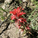
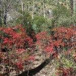
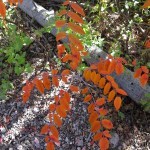
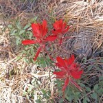
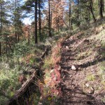
We wished each other a good day. Shortly afterwards, beginning the descent into the canyon, I spotted a bright red stand of sumac far below.
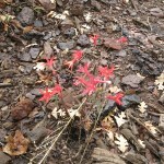
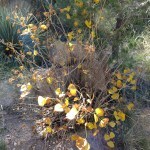
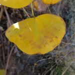
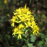
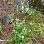
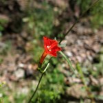
In the canyon bottom, the combination of late-season rain, warm days and the first cold nights had resulted in a magical mixture of flowers, berries and colorful foliage. The initial stretch is burn scar, but after entering intact riparian forest I was watching for the maples – and although there aren’t many, I wasn’t disappointed.
My knee was less comfortable by the time I reached the branch trail, so I strapped on the brace for the climb.
I’ve only hiked the branch to the next canyon a couple of times – it drops 1,500 feet on the other side, dead-ending at an old miner’s cabin. I reached the canyon bottom once but was blocked by a riparian jungle before reaching the cabin.
The climb to the saddle involves many switchbacks, with great views northwest to the rocky walls of the canyon hiding the main trail. It was perfect hiking weather for my long pants and long-sleeve shirt.
From the saddle, treetops block the view into the big eastern canyon, so as usual, I continued about a quarter mile to the high point of the trail on a mostly exposed slope. The trail to the saddle had been overgrown but with good tread; past here it was almost invisible.
I gratefully realized I hadn’t seen cowshit anywhere on this trail, which up till a few years ago had provided cattle a direct route to the heart of the wilderness. Since then, the Forest Service had hired shooters to kill feral cattle from helicopters. Ranchers had stopped that eventually, but maybe it had some effect.
Meanwhile, I enjoyed identifying spots across the canyon that I had reached on past hikes.
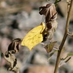
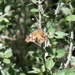
Since my return took place in mid-afternoon, those remaining flowers were hosting swarms of late-season butterflies – mostly too small and skittish to photograph. The brace masked any pain in my knee, and this turned out to be the most enjoyable hike I’d had since being immobilized at the end of May.
In the coming week I would see a sports medicine specialist in Tucson for a second opinion…
October 20, 2025
Boring Hike, Swell Brunch
I’d been in pain all night long, and was starting the day in pain. Meds hadn’t worked, which rarely but occasionally happens. I was determined to at least try to go hiking, but last Sunday’s hike had been both frustratingly short and difficult, and lunch had sucked. So today I wanted to do something longer and easier, with a more reliable midday meal. That left me only one choice – a trail so boring I’d avoided it while hiking every trail around it multiple times for the past seven years.
I mean, I would never complain about walking through beautiful, pristine Southwest habitat, with dramatic cliffs rising above the trees. But I do like variety and vistas, and this trail is a mostly level stroll through oak woodland that tends to block the views.
We’re still having unseasonably warm weather – apocalyptically so – and where I was going it was forecast to reach 80. Normal temps for this time of year would range from the 50s to the 60s.
Brunch – trout and eggs, with salad and sweet potato fries – was awesome as usual. If you wonder why I make a point of these weekly road trip meals, we lost our good restaurants during COVID – so since 2020, I only eat out while traveling.
I’ve actually done the first mile of this hike three or four times, on the way to the crest of the range. It starts in the canyon bottom and climbs past somebody’s luxury retreat and a series of gullies and ravines to an alluvial bench lined with the oak woodland.
Past the junction, the new trail hadn’t seen heavy use, but I was surprised to find a mountain bike track – the first I remember seeing anywhere in this canyon. It makes sense since this trail is the only one that’s easy enough for bikes.
The alluvial bench narrows as the trail trends westward, until you can glimpse the ravine through which the creek runs, and the gravel road on the other side that serves picnic areas and a campground. I’d been in denial of the fact that I would hear traffic, and kids yelling – more downsides of this hike.
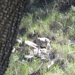
At one point I could see kids down below playing in the creek, and as I turned back to face the trail ahead, a hawk flew past me through the trees, only about eight feet above the ground and a dozen feet from me. A little later I came upon a whitetail doe – the first whitetail I’d seen in a long time.
Approaching the trail junction where I would turn back, the trail got gnarlier, descending into and climbing steeply out of one deep ravine after another – finally, some variety!
Despite being in pain, I’d started the day, and the hike, without meds – hoping the hike would loosen up the joints and get some endorphins flowing. But after three hours of hiking, I was still hurting pretty bad when I returned to the Sidekick, and immediately popped some pills.
Afternoons, with low angle sunlight, are great times to discover new aspects of the landscape. On the way out of the mountains I noticed an area across the highway that would make for promising hiking – if it’s not blocked by private land.
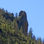
Then, getting ready to pass – for the umpteenth time – the granite spire I’d tried to climb earlier this year, I noticed for the first time a gully up the southwest side that might actually be climbable. Doing 65 on the empty highway, I grabbed my camera and took a sloppy zoom photo of the spire out my side window.
I’ve scoured the internet unsuccessfully for info on this peak, and despite the fact that peakbaggers are competitive and anal about keeping and sharing records of their accomplishments, it appears that nobody has ever claimed an ascent. Examining the photo back home, it does look like that gully might be a route to the top – for somebody with functional knees.
October 13, 2025
Rough Ground, Vague Traces
My entire region was under flash flood warnings, so I had an even harder time than usual deciding where to go for Sunday’s hike, which in turn delayed my departure.
Finally, I zoomed in on the topo map for a low desert area over in Arizona that I’ve only scratched the surface of and have been intending to explore more. It’s at the far north end of the very long, very narrow north-south mountain range – continuing into Mexico – that’s geologically diverse with a lot of cliffs, hoodoos, and rock outcrops. Suddenly I noticed the label “Indian Rocks” on a small outlying peak. What could that mean? Petroglyphs or pictographs? A cave with artifacts?
The peak itself didn’t offer me enough distance or elevation, but south of it was a cool-looking mesa – adding that to my hike should make it just right.
Due to my late start, it was lunchtime before I reached the turnoff, so I stopped for what turned out to be a mediocre burger in the Mormon village restaurant. I’ll stick to the enchiladas in future.
The map showed a couple different access roads, one with a solid line and one dashed. I tried the dashed one first, but it was clearly abandoned, deeply eroded, and way too slow. The next one turned out to be well-graded, obviously serving residences or working ranches.
The map showed this route crossing washes, and I knew a heavy rain could strand me temporarily. But eventually the flood would subside, and hopefully I wouldn’t have to wait too long. And hopefully I wouldn’t encounter any clay that would turn into deep, sticky mud.
It’s hunting season, and I passed a group parked on a side trail. I would hear their shots sporadically throughout the afternoon, about a mile and a half away in this open country.
To reach the “Indian Rocks” from this road I would need to take a powerline road over a pass, and those are notoriously rough. But with my lifted suspension and nearly new all-terrain tires I had no worries.
Beyond the pass, I could finally see the landscape between the powerline, Indian Rocks, and the mesa. A broad, low, creosote-lined ridge clearly led from the road to the base of Indian Rocks, and from there I could traverse around to the back to get to the mesa.
I now carry field glasses in the Sidekick, and although I couldn’t see any promising rock formations with the naked eye, the field glasses enabled me to see not only a rock formation, but a cave, just below the little peak, less than a mile away. Promising!
The habitat here is very similar to my California desert, and the creosote bushes were blooming all over – but not releasing their medicinal scent. I trust them more than the meteorologists, but my poncho and waterproof pants were in the pack, just in case.
The ground between the road and the peak was fine gravel, so I made good time. But bushwhacking is twice as hard as hiking on a trail, and my lung capacity is way down from 17 months of knee injury, so the 200 vertical feet to the rock outcrop went slowly.
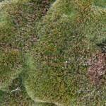
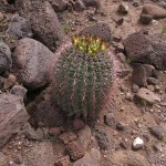
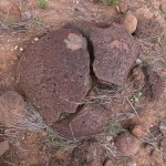
The rock outcrop – facing north – was covered with an amazing thick layer of moss, more than I’ve ever seen anywhere in this region. But the cave turned out to be too small for a human to enter, and after scouring the ground below I found no artifacts. The only evidence of natives that I could find was desert tobacco, blooming around the foot of the outcrop – the first I’ve seen in this region.
To be sure this wasn’t the only outcrop, I climbed to the top of the peak, where amazingly, I found a summit log in a jar. It recorded only two visits, in 1995 and 2003.
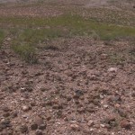
The climb from the outcrop to the peak had been arduous, over the dreaded volcanic cobbles, and now I could see that the entire south slope – my route to the mesa – was lined with those.
I could also see that the slopes surrounding the mesa were striped vertically, alternating between grass and volcanic rock. My best approach would be on the far right, which looked to be grass, at between 15 and 20 degrees.
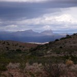
After slowly and carefully picking my way down that treacherous slope, I found that the valley below was mostly dirt and fine gravel. A low ridge rose across the valley – I would need to climb that and descend into some kind of gulch on the other side to reach the base of the mesa. From the valley, under those dark clouds, the mesa looked forbidding. I doubted I would end up climbing it.
As soon as I began climbing the low ridge, I encountered the cobbles again – so hard to walk over! But I made it to the top of the ridge. It’d taken me two hours and I knew I’d gone less than two miles. I wanted to get home before dark to avoid deer on the highway, so there would be no mesa today.
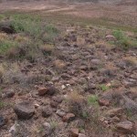
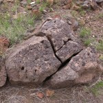
The top of the low ridge was dotted with volcanic boulders that had split into pieces, in place, like 3-dimensional puzzles. I assume this happened after they’d been ejected and landed, and while they were cooling. Interesting.
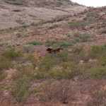
A recently-strung barbed-wire fence ran mostly west of my route, and halfway between the low ridge and the base of the Indian Rocks peak, a lone, yearling cow appeared, running frantically along this side of the fence. It had apparently ended up on this side by mistake and was separated from its range and its herd. It stopped to stare at me for a minute, then resumed running south toward the low ridge. A little later, it appeared running back north, and I watched it follow the fenceline out of sight. It would end up on the powerline road, and maybe get home that way.
As I approached the gully at the western foot of Indian Rocks, I found an old, narrow trail that was clearly man-made – possibly an Indian trail. I could see more promising rock outcrops below, so I detoured down there. There was a clearing that turned out to be a favored gathering spot for cattle on this side. There was a neat overhanging boulder, but I scanned in vain for petroglyphs.
Past the divide, on the north side of the little peak, walking was much easier. I hadn’t found clear evidence of the “Indian Rocks”, but I did find their tobacco, and I may have found their trail.
Beside a dry wash along the powerline road near where it meets the ranch road, somebody has set up a fairly elaborate camp, with a couple of trailers, several vehicles, and both the US and Arizona flags on a pole. The map shows this as public land, so it must be someone squatting on the grazing allotment with permission of the rancher.
I made it home without a drop of rain, and the streets looked dry. But we got some good rain yesterday – hopefully more will come tomorrow!
October 6, 2025
Another Sunday, Another Ridge
I started out planning to traverse the exposed slope of a spectacular rocky canyon not far from town. But I got a late start, and as I approached the turnoff, I realized doing that hike now would push my lunch back until mid-afternoon. So I decided to keep driving north and have lunch in the alpine village across the Arizona border, then do a hike from the volcanic plateau in the afternoon.
Once the highway entered the mountains, I began to pass big burly pickup trucks, hauling heavy-duty full-length trailers, each carrying a side-by-side 4-seater UTV. One after another after another, dozens of them heading south, to the point where I was laughing hysterically each time I met one on this road where I used to drive a half hour at a time without meeting another vehicle.
All the pickups were different makes and colors – it was no kind of organized convoy – what the hell are these guys doing moving all these UTVs south in the fall? It is hunting season – maybe they live in the south, and are returning from hunts in the north, all at once on Sunday.
But after my long drive north through those dark forested mountains, cresting one pass after another, the village grill turned out to be closed, with no explanation. I could turn back, to less interesting options a half hour down the road. Or I could drive 40 minutes farther up onto the plateau, to the lodge that claims to open at noon but rarely sticks to a schedule.
I decided on the latter – any excuse to visit that plateau. Reaching 9,000 feet, with some aspens flaming red, I began to pass road cyclists struggling through the thin air in their garish skin-tight nylon outfits. A sight I hadn’t seen here before.
More cyclists were waiting on the veranda and inside the lodge, where I was the first diner at 12:15. As usual, the laid-back staff was multi-tasking – taking orders, cooking, cleaning rooms, doing paperwork – but my burger, served a half hour later, met my needs. While waiting and eating, I watched and overheard the cyclists – half young and half my age or older. Some were from Minneapolis – rich doctors, as is common in this expensive pastime. The clacking sound of their cleated shoes on the wood floor preceded them, and when I looked up, the first thing I noticed was that they walked bent sharply forward at the waist like “dunking birds”, from riding bent over for hours on stiff old joints. Impressively, they were making a loop of almost 300 miles and god knows how many thousands of feet in elevation, beginning and ending in Safford, and crossing all those high mountain passes in between. Impressive if you call operating an expensive machine on paved highways an achievement.
The trails along this eastern rim of the plateau all head down into the “lost world” – the broad, wild canyon of a tiny river, a hard-to-reach area known to few outsiders. I’d hiked the upper half of a nearby trail last spring, and wanted to get another taste of this unique habitat.
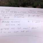
The trailhead, accessed by a long, meandering track through parklike ponderosa pine forest, was only occupied by a quad bike when I arrived. The trailhead log was such a bizarre jumble of dates that I couldn’t even tell what year they referred to. Air temperature was in the mid-60s in the forest, but I found that walking kept me plenty warm even in shorts. The first half mile emerged into and led gradually upwards through burn scar to the western rim of the big valley at 8,300 feet.
My topo map showed the trail dropping a few hundred feet onto a long east-trending ridge, similar to my previous hike here. I’d previewed it without zooming in, and the landmark where I planned to turn back appeared as a sharp bend south.
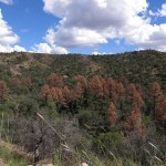
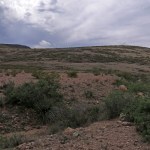
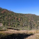
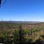
As before, the trail started in forest and became rockier and more exposed as it descended onto the ridge. On an open saddle, I had spectacular views up and down the big, wild valley, but I could also see the massive die-off in progress in the ponderosa pine forest, similar to what I’ve seen elsewhere in my corner of the Southwest, new in the past season.
From here the trail followed the ridge top, like a gentle roller-coaster over thin soil and a lot of bare rock. The trail and the “meadows” around were choked with cosmos, my old nemesis – an annual with tiny daisy-like flowers that produces burs that stick to and are carried widely by clothes and animal fur. On my way up one of these gentle rises I suddenly faced a tall, slender man in garish, skin-tight nylon running down the trail toward me.
He stopped and asked me if I’d “seen anything”. I smiled and said I’d only gone a mile so far, and he exclaimed, “Wildlife! Have you seen any wildlife?”
I laughed and said it was mid-afternoon, so the animals were all sleeping. He said he was not familiar with this habitat, he lives in Durango, Colorado. I asked him what kind of wildlife he was expecting, and he said “Oles!”, the way Cockneys pronounce “Holes” without the “H”. There followed a long, frustrating exchange, which ended in him spelling “W – O – L – F” twice before I realized he had the remnants of, perhaps, a German accent, and had trouble with our consonant “W”.
I explained that people here hike all their lives without seeing a wolf, and described the megafauna he did have a chance of spotting – if he ever decided to live here year-round. He said he’d just arrived from the nearest county seat – a tiny village – over in New Mexico, where he’d explored a certain obscure, almost totally unknown creek it had taken me almost 20 years to find on maps, and which I was still only dreaming about exploring. We had an enthusiastic conversation, but it was only later that I regretted not questioning about his travels.
After the first mile the little-used trail mostly disappeared, and I found my route mainly by means of sporadic sawn logs and vague corridors through rocks, cosmos, and brush. Then I came upon an obvious switchback, which had not appeared on the map, where the trail clearly began a steep descent onto a lower ridge marked with a big cairn. I didn’t think I’d gone far enough, and the paper map I had didn’t show enough detail. I descended a few hundred yards, captured my position on GPS, and decided to head back.
Returning, I had all that pine mortality in my face. I’d never seen anything like it. But with my knee brace, hiking uphill was easier, especially on the hated volcanic cobbles.
The sun was setting rapidly – it’s October – and the final descent from the rim to the trailhead seemed to take forever, as I pondered what this solo Germanic trail runner from Colorado was doing, accessing this trail on a “redneck” quad bike. Even less likely, how had he learned about this obscure trail all the way from Colorado, when it had taken me almost 20 years to learn about it from 2-1/2 hours away? And strangest of all, how had he learned about that creek, that only runs a few miles from an extremely remote dirt ranch road, through a box canyon that few have heard of and no one can access without prior arrangement at a remote, obscure Buddhist retreat? Box canyon and creek show up on no guidebooks and virtually no information is available online. Was he confused, talking about something completely different? The bigger the data, the less we know…
September 28, 2025
Return to the Jungle
Since I injured my knee in May 2024, I’ve been looking for hikes that don’t require me to climb very much. But one of the reasons I moved here is that we’re in the mountains.
Before the injury, elevation gain was my main goal, and the hikes I did most often went from canyon bottoms to the crest, with elevation gains ranging from 3,000 to 5,000 feet. So I’ve avoided all those familiar hikes for more than a year.
I’m currently trying to limit myself to roughly four miles out and back, and while reviewing options yesterday, I realized one of those hikes actually has minimal elevation change during the first three miles. Past the two-mile point it involves a lot of bushwhacking and rock-hopping, and the farthest I’ve ever been able to go is seven miles, with 4,200 feet of elevation gain.
The last time I’d done it was January 2024, when I was stopped by deep snow on a high saddle at the four-mile point. I was curious to learn how much rain that watershed had seen during this weak monsoon.
It turned out that the long gravel road to the trailhead had been washed out or buried under recent debris flows in dozens of places. It was barely passable in my 2wd pickup truck (the Sidekick needs a new engine).
Eventually the road climbs to the ridge. Considering the remoteness and the condition of the road, I was surprised to find another vehicle at the trailhead. I hoped to run into the other hiker(s) to find out how far they’d gone and what they’d seen in some of my favorite habitats.
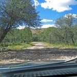
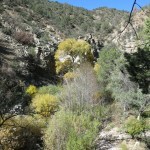
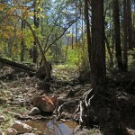
The weather was perfect – in the low to mid seventies, with drifting cloud shadows. The trail starts out following the remains of an old road servicing long-abandoned mines. It doesn’t enter the wilderness until about a mile in, and I’ve run into cattle on that lower stretch. As I got closer to the creek I could hear it rustling over the rocks.
Past the first crossing, I remembered the lower part of this trail had been destroyed by a flash flood a few years ago, and finally rebuilt in late 2023. In this steep, narrow canyon a trail is virtually unmaintainable, and much of the upper trail consists of picking your way through debris flows and over logs.
I used to call this canyon “the jungle”, and it didn’t disappoint. My first landmark would be the old cabin, but I missed it in the dense vegetation. I was looking for the point where the canyon makes a 60 degree turn east – that would be my two-mile point. But with the dense riparian forest and overhanging cliffs, I actually missed the turn and went beyond it, to the major side canyon. I couldn’t remember whether this was before or after the turn in the main canyon, and my national forest map wasn’t detailed enough, but it had taken me an hour and a half to get there, so I figured I’d gone far enough.
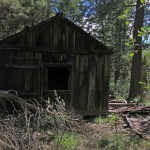
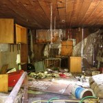
The knee brace masks any pain, and I felt like going farther, but knew I shouldn’t. Returning was easier, and finding the cabin, I was surprised to see how much it had deteriorated inside in only a few years. Nothing has been removed, it’s just messier.
Past the first creek crossing, the old road climbs, and I got some nice views. I was sorry not to see the other hiker(s), and wondered if they were backpacking. I sure miss getting back into that wilderness, one of the wildest in the world.
On the road out, I passed two youngish women in a side-by-side – probably from the small group I’d seen camping near the highway. Americans are far, far too affluent – the hot thing among blue collar families now is to own a huge pickup truck, a massive fifth-wheel “camping” trailer, and a side-by-side or rock bouncer – almost as expensive as your house, all bought on credit. You drive the whole setup just off the highway and live in it while exploring the back country in the little utility vehicle.
I also got a better view of the mature ponderosa pines in the lower canyon, which have all died recently. I’m guessing a series of debris flows have suffocated their roots – I’ve seen that happen elsewhere in the aftermath of big wildfires.