Lisa D. Holmes's Blog
November 2, 2025
Wilson River Trail Hike & Tillamook Forestry Center

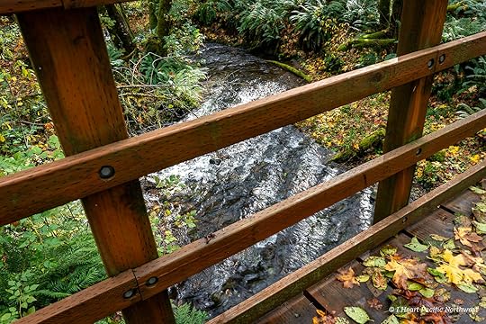
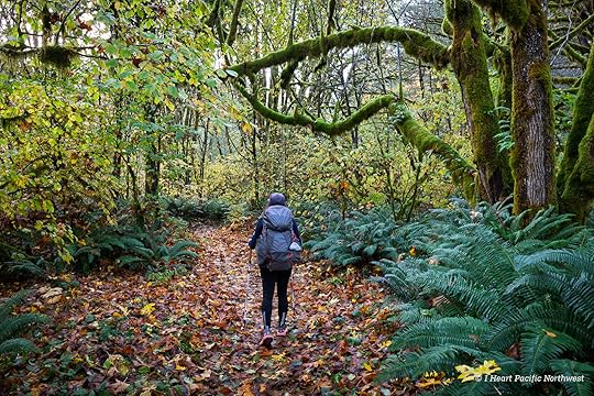
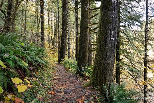
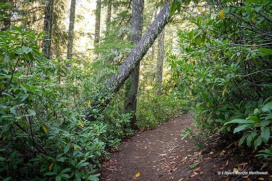
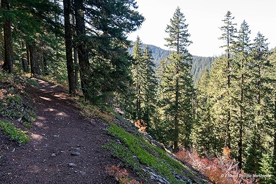
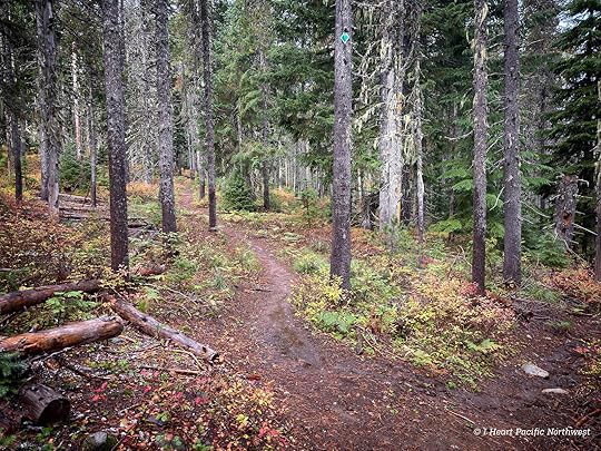
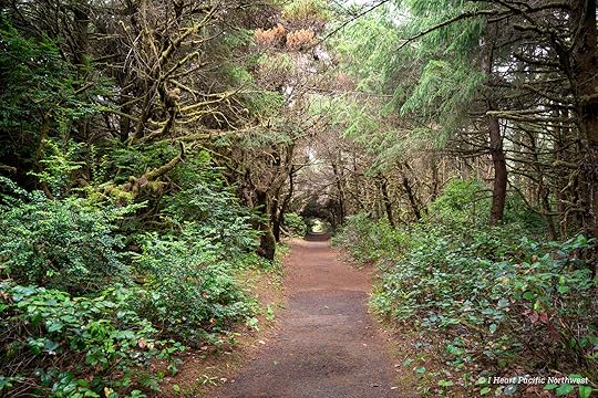
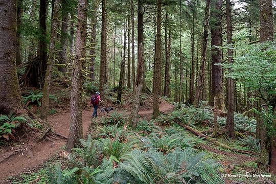
This was a quick hike on the Wilson River Trail, starting at the Jones Creek trailhead. From the parking lot, the trail follows the road past the campground before heading into the forest. This section was built after a bridge washed out near the day-use area, so the reroute now wraps around the campground and crosses several small streams. I love trail bridges, and the ones in the Tillamook Forest almost always share the same design — tall side railings built to accommodate both hikers and mountain bikes.
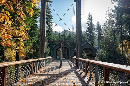
Whenever I’m here, I love stopping at the large suspension bridge over the Wilson River at the Tillamook Forestry Center. It was open when we arrived, so we went inside to see what had changed since my last visit about ten years ago.
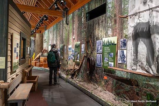
The Tillamook Forestry Center is an interpretive center with exhibits about the early days of logging in Oregon and the Tillamook Burn, a series of massive fires that swept through these forests from 1933 to 1951.
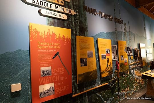
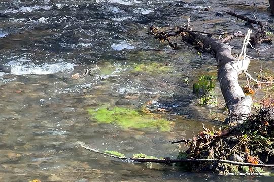
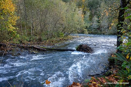
Checking out the gift shop is always fun, and this time a young ranger had a table set up to talk about salmon. She asked if we had seen any that day, then mentioned there were quite a few where the trail crosses Cedar Creek. I remembered the bridge—an oversized concrete span leftover from a former gravel road—so we planned to stop and see if we could spot them.
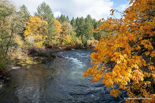
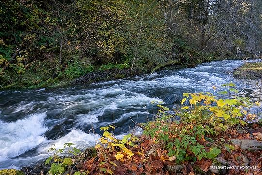
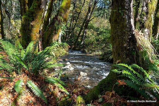
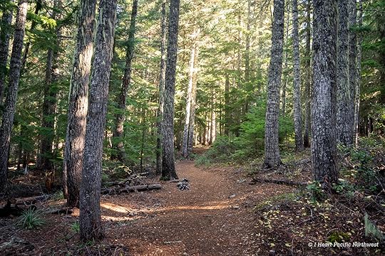
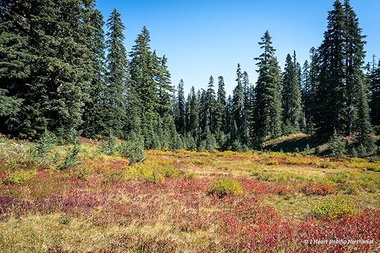
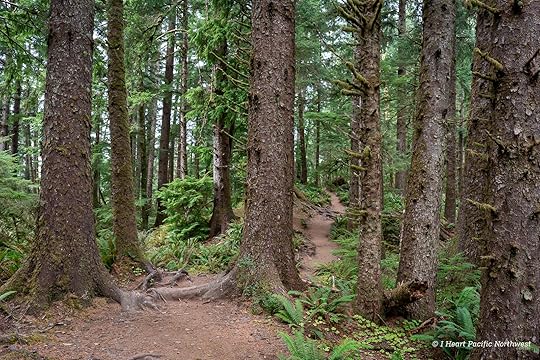
After spending a bit more time with the exhibits, we continued on the trail through mossy forest alongside the river.
When we reached Cedar Creek, a fisherman was standing on the bridge looking down into the water, and sure enough, several salmon were in the creek. We counted five or six, with several exhibiting spawning behavior—turning in the current and flicking gravel to prepare nests. They were also skimming the surface and splashing around quite a bit.
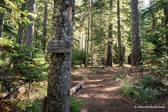
It was hard to pull ourselves away from watching them, but eventually we continued on since we were short on time and wanted to get in about five miles total for the day.
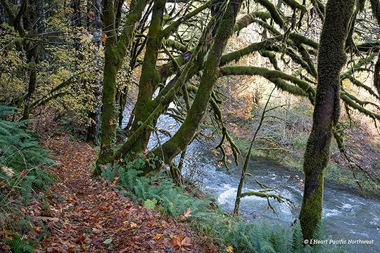
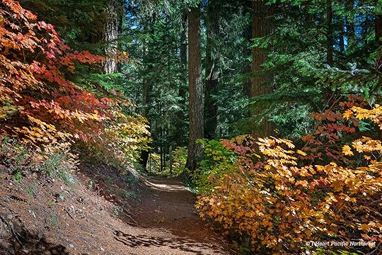
Just before the trail begins the ascent toward Wilson Falls, we turned around and headed back. We stopped at Cedar Creek again to watch the salmon a bit longer and eat our trail lunch before returning to the car.
The post Wilson River Trail Hike & Tillamook Forestry Center appeared first on I Heart Pacific Northwest.


October 24, 2025
Silver Star Mountain via Ed’s Trail Loop Hike
distance: 4.8 miles (loop)
elevation gain: 1,240 ft
difficulty: moderate to difficult (based on scramble sections)
best season: summer to fall
drive time from Portland: 1 hr 45 min
parking pass: none
hike description: OregonHikers: Silver Star via Ed’s Trail hike
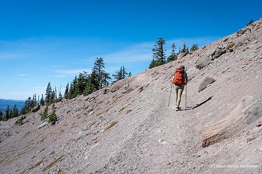
The road to the North Silver Star trailhead has long been known for being rough. I’d only driven it once before, back in 2014, and after scraping the bottom of my car several times, I swore I wouldn’t do it again. A few years ago, the volunteer group Friends of Road 4109 began working to improve access to this trailhead, which is considered the best starting point for hiking in this area. When I heard the road work had been completed, I wanted to check it out — and finally hike the infamous Ed’s Trail. My friend drove her Honda CR-V and didn’t have any issues. The road is so much better now — huge thanks to everyone who helped make that happen!
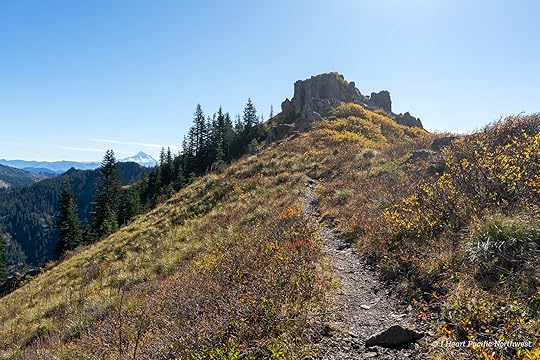
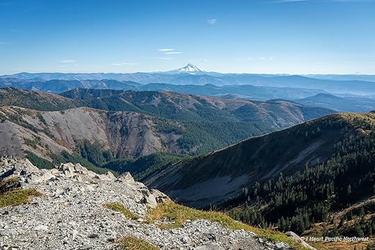
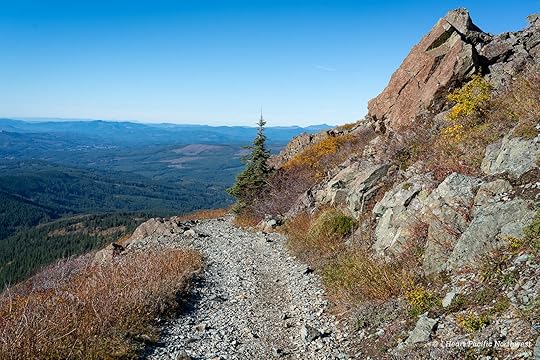
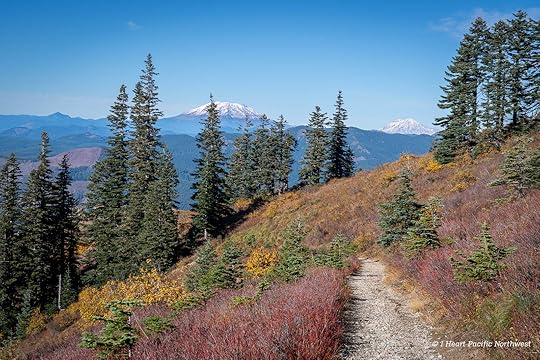
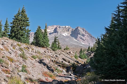
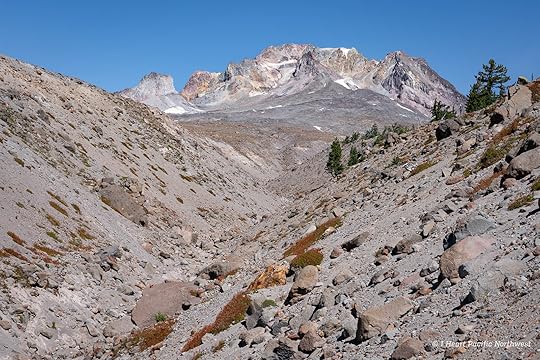
Even from the parking lot, the views extend to several Cascade peaks. We began on the main Silver Star Trail, then branched off onto Ed’s Trail — a more rugged and far more scenic alternate route that parallels the main trail.
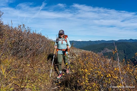
This was my first time hiking Ed’s Trail, and it was absolutely spectacular. The views are incredible — Mount St. Helens, Mount Rainier, Mount Adams, Mount Hood, and even Mount Jefferson fill the horizon. From higher points on the trail, we could also see fresh snow on Goat Rocks. And while I have hiked to Silver Star numerous times via the Grouse Vista trailhead during prime wildflower season, this was my first time here in the fall.
While the hike is just under five miles, it’s definitely a bit challenging due to the rugged terrain and two sections that require scrambling. I’m not a big fan of scrambling, especially with exposure, so I was curious how I’d handle it.
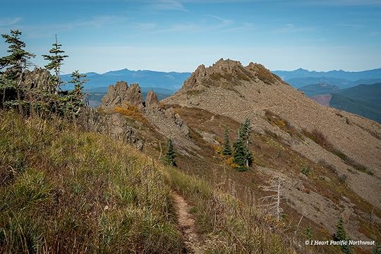
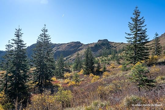
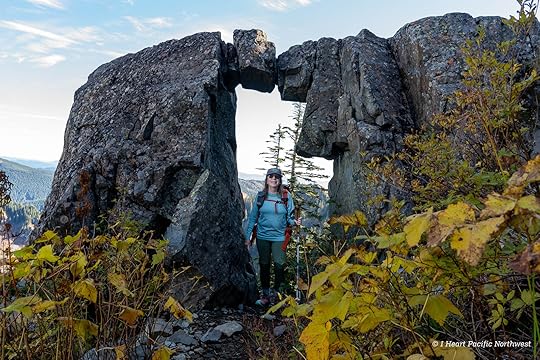
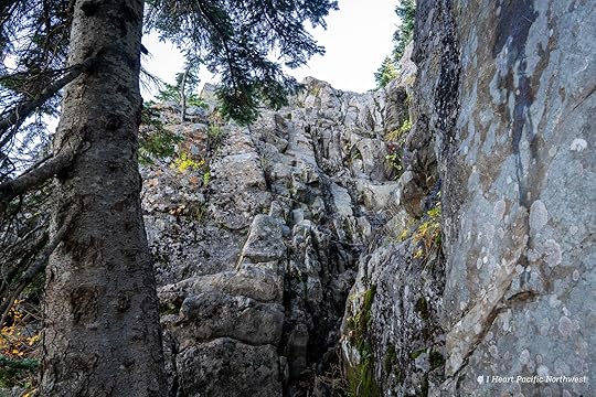
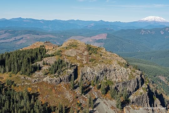
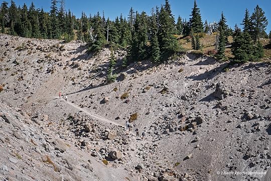
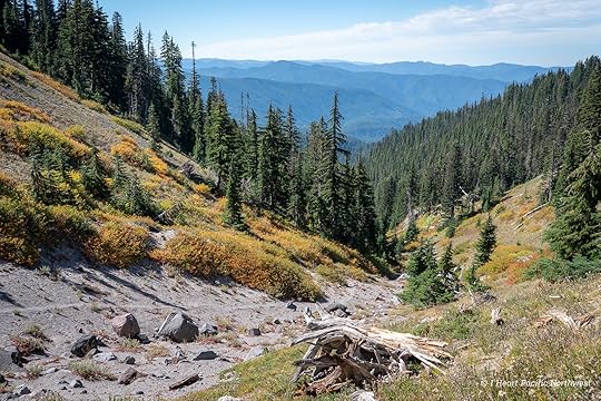
After traversing an incredibly scenic ridge, we reached the famous rock arch. I’d seen countless photos of it, and it was great to finally see it in person.
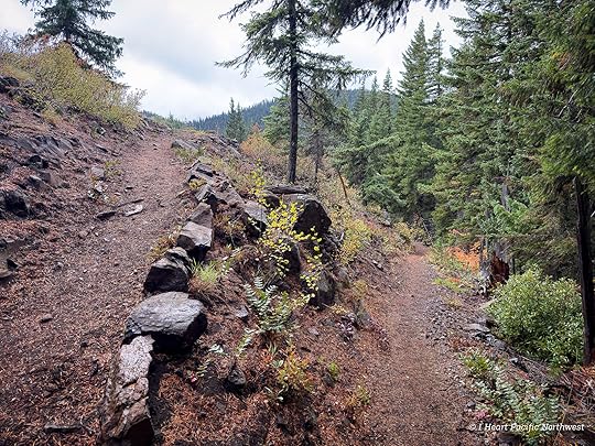
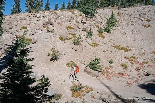
Beyond the arch, the trail continues along the base of several cliffs before reaching the first scramble. Staying to the left makes it easier to find the route — use your hands to pull yourself up to the continuation of the trail. Unfortunately, I didn’t take any photos of the first scramble.
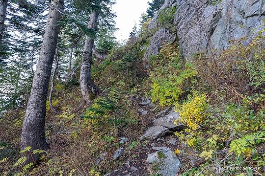
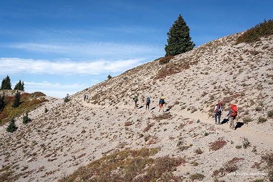
The trail remains rough and narrow for a bit, leading to a second scramble that climbs a 15-foot rock wall. Fortunately, there are plenty of good hand and footholds, though some are a long reach for short legs (I’m 5’1″).
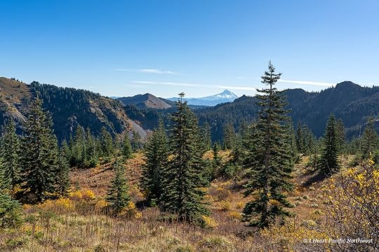
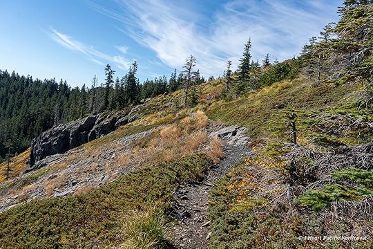
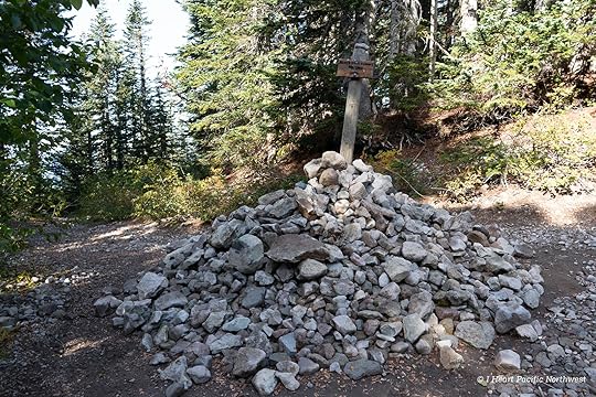
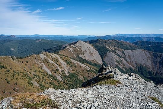
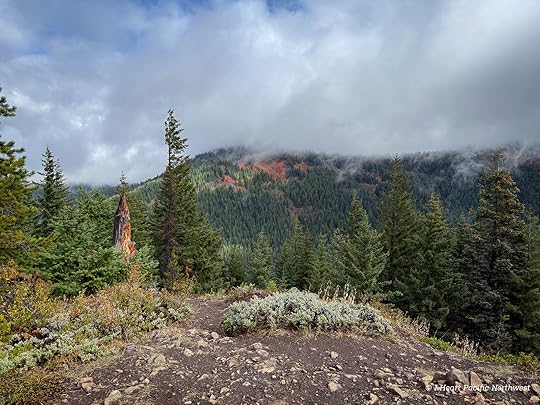
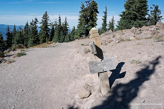
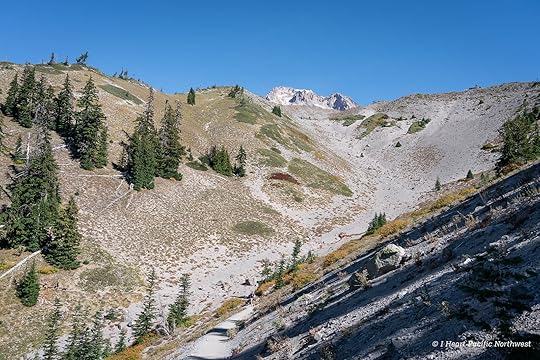
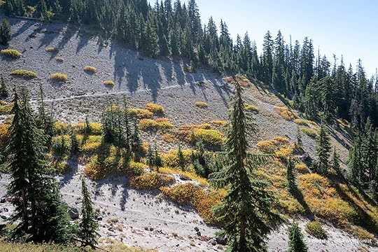
At the top, the trail winds through another incredibly scenic section filled with fall color before entering the forest for the final ascent to the main Silver Star Trail. Marked with a large cairn, we turned here for the last half mile to the summit.
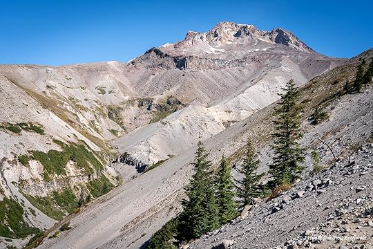
There are two summits at Silver Star, connected by a saddle. After visiting the lower one, we took a long break on the higher summit to enjoy the expansive panoramic views.
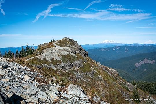
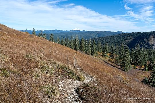
Looking down at the last section of Ed’s Trail from the summit of Silver Star.
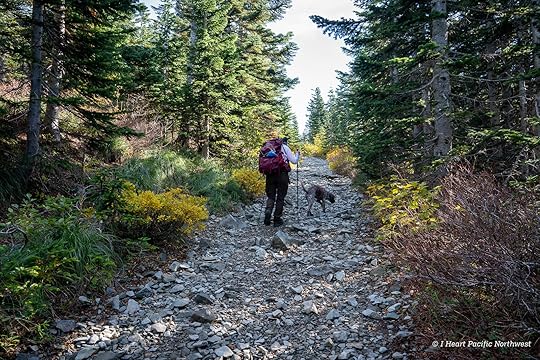
Instead of returning via Ed’s Trail, we followed the main Silver Star Trail back to the trailhead. For me, going down the scrambles would have been much harder than climbing up. The rest of the trail is rocky, so I was glad to have shoes with plenty of cushioning.
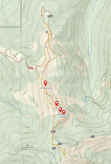
While I absolutely loved hiking Ed’s Trail, next time I’ll probably turn around at the rock arch and take a connector trail back to the main route to skip the scramble sections. See the map below that shows where the crossover trail, rock arch, and scramble sections are located.
The post Silver Star Mountain via Ed’s Trail Loop Hike appeared first on I Heart Pacific Northwest.
October 15, 2025
Twin Lakes Loop Hike – Mount Hood
distance: 8.3 miles (loop)
elevation gain: 1,185 ft.
high point: 4,560 ft.
difficulty: moderate
drive time from Portland: 1 hour 20 minutes
parking pass: NW Forest Pass
more info: OregonHikers – Twin Lakes loop hike
I’ve hiked this area in the winter on snowshoes, but this was my first time here without snow. The Frog Lake trailhead is a convenient starting point, and the hike is popular year-round — summer for day hikers and backpackers, and winter for snowshoers and cross-country skiers.
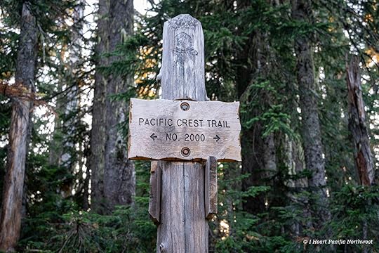
From the trailhead, we took a short side trail to begin the hike going northbound on the Pacific Crest Trail.
The first section of trail is filled with rhododendrons, which typically bloom in June and July.
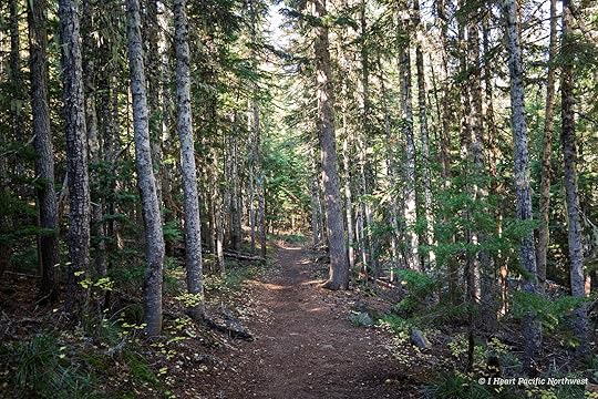
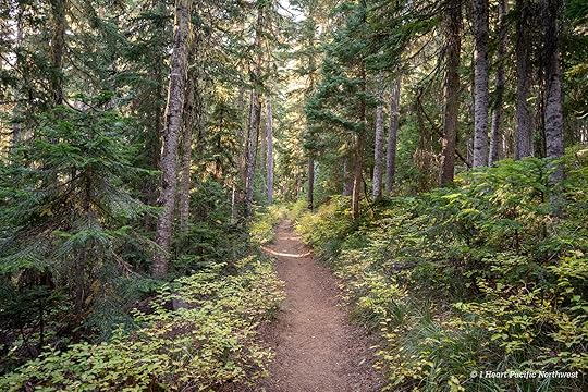
Throughout the hike, the trail is mostly on a wide, well-maintained path that makes for easy hiking.
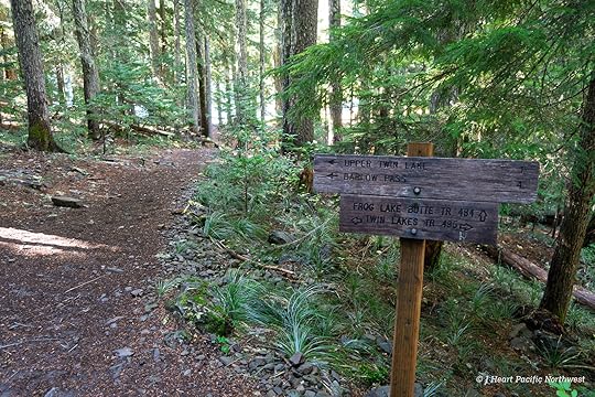
At about 1.4 miles from the trailhead, we reached the Twin Lakes Trail and turned right to head to Lower Twin Lake.
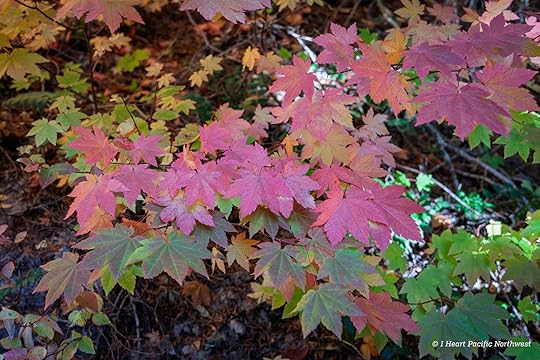
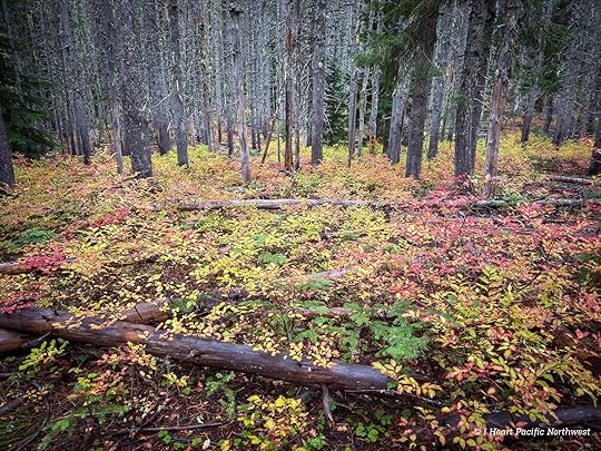
Vine maples and huckleberry shrubs were glowing in shades of yellow, orange, and red, creating a vibrant forest understory.
At Lower Twin Lake, we took a well-defined trail all the way around the lake, passing quite a few backcountry campsites along the way.
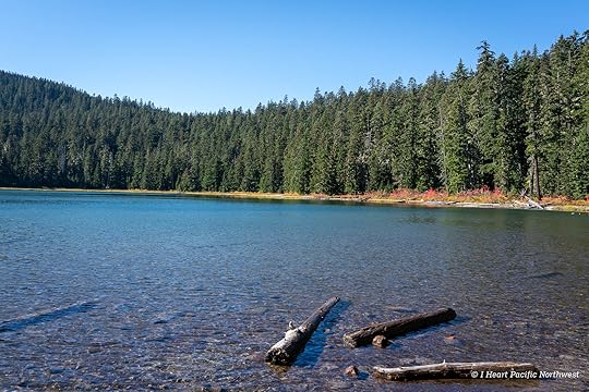
From Lower Twin Lake we continued for a mile on the Twin Lakes Trail to Upper Twin Lake.
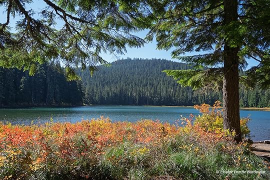
At Upper Twin Lake, the top of Mount Hood is visible above the forest.
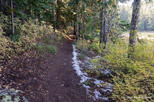
After a long snack break at the Upper Lake, we continued to the where the Twin Lakes Trail ends at a junction with the PCT. Small patches of snow lingered here and there, but the trail was clear.
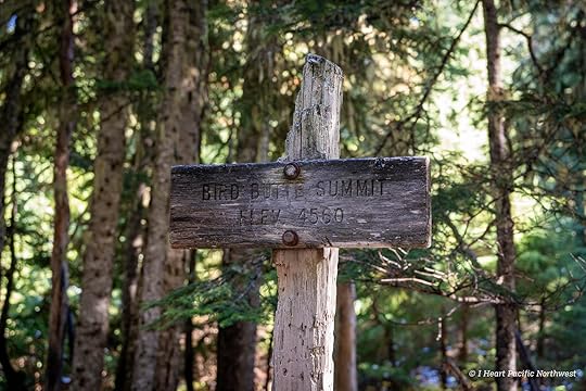
This sign marks the high point of the trail as it wraps around Bird Butte, but it’s not the actual summit, which has no established trail.
The final stretch returned us to the trailhead, closing a beautiful loop that mixes forest, lakes, and classic Mount Hood scenery.
The post Twin Lakes Loop Hike – Mount Hood appeared first on I Heart Pacific Northwest.
October 4, 2025
Devils Half Acre & Palmateer Point Loop Hike
distance: 6.3 miles (loop)
elevation gain: 1,130 ft.
high point: 4,575 ft.
difficulty: moderate
drive time from Portland: 1 hour 20 minutes
parking pass: NW Forest Pass
more info: OregonHikers – Devils Half Acre-Palmateer Point hike
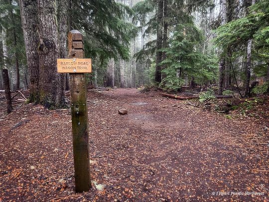
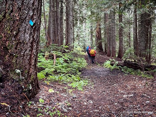
This loop hike begins at Barlow Pass on the south side of Mount Hood. We followed the Barlow Road Wagon Trail, connected with the Devils Half Acre Trail, and continued to the Palmateer Trail. From there, we hiked to Palmateer Point before returning via the Palmateer Trail to the Pacific Crest Trail and back to the trailhead.
The first section through Devils Half Acre had several unmarked junctions, so I used Gaia GPS to stay on track — though we still took a few wrong turns and had to backtrack.
Rich in Oregon history, Devils Half Acre was once an important stop along the Barlow Road, where pioneers left wagons and supplies before crossing the Cascades to the Willamette Valley. Built in 1846 as the final stretch of the Oregon Trail, the Barlow Road offered a safer alternative to the Columbia River route. Today, parts of it live on as hiking trails, including this section near Devils Half Acre.
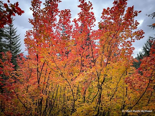
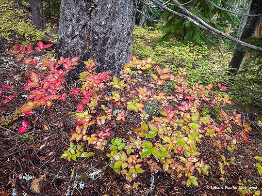
Fog and light rain greeted us at the start of the hike, making the fall colors in the vine maples and huckleberry shrubs appear even more vibrant.
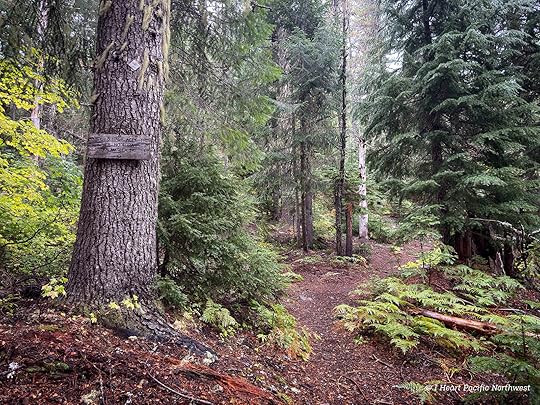
After a steep section of trail, we reached the Palmateer Trail and turned left to head to Palmateer Point.
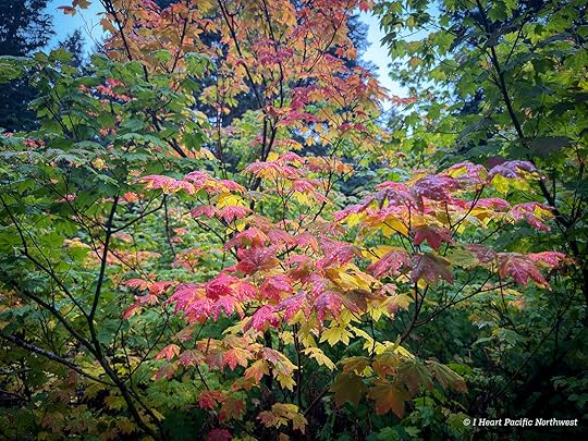
There’s usually a great view of Mount Hood from here, but it was completely hidden by clouds. In its place, the slopes of Barlow Butte glowed with bright fall color.
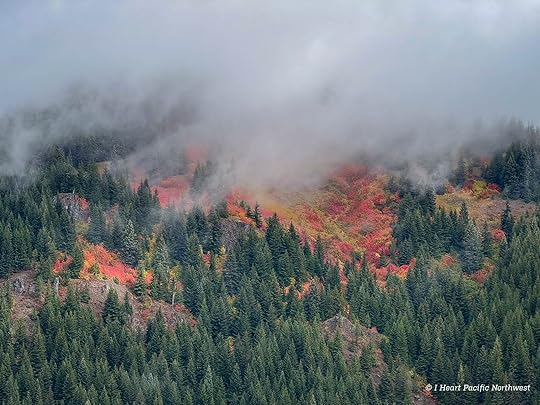
The forest understory was filled with huckleberry shrubs in various shades of yellow, orange and red. I was surprised at how much fall color there was here… normally the fall color isn’t as strong in forested areas.
Once we reached the Pacific Crest Trail, the hike became an easy descent through the forest back to the trailhead. You can also extend the route with side trails to Twin Lakes or Barlow Butte.
The post Devils Half Acre & Palmateer Point Loop Hike appeared first on I Heart Pacific Northwest.
September 27, 2025
Zigzag Canyon Overlook Hike – Mount Hood
distance: 5 miles (out & back)
elevation gain: 950 ft.
high point: 6,052 ft.
difficulty: moderate
drive time from Portland: 1 hour 20 minutes
parking pass: none needed May 1 – Oct. 31; SnoPark pass needed Nov. 1 – April 30
more info: OregonHikers – Zigzag Overlook Hike
This hike begins on the Pacific Crest Trail at Timberline Lodge, the highest access point on Mount Hood and a popular destination for hikers, mountain bikers, and tourists. From the parking lot, views of the Cascade ridges stretch to the horizon with Mount Jefferson in the distance.
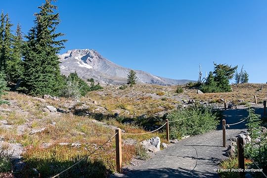
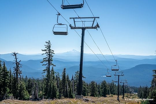
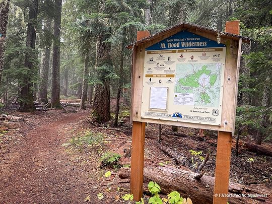
Heading north on the PCT, the trail passes beneath ski lifts before entering the Mount Hood Wilderness. Normally, hikers would stop here to complete a self-issued wilderness permit, but this year permits weren’t available — likely due to limited Forest Service staffing.
The only other time I’ve hiked in this area was to go up to Silcox Hut on the Mountaineer Trail. This time, we stayed on the PCT to head towards Paradise Park, which I’ve never been to. It’s been on my list for a long time and I hope to go backpacking there soon.
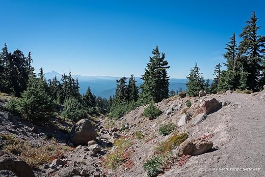
Along the way, I loved the constant views of Mount Hood from the ravines and canyons.
Before reaching Zigzag Canyon, the trail dips into Little Zigzag Canyon via a few easy switchbacks. In late summer and fall it’s usually dry, but earlier in the season a small creek runs through here.
From Portland, Mount Hood looks like a perfect cone, but up close its craggy ridges and canyons give the mountain much more character.
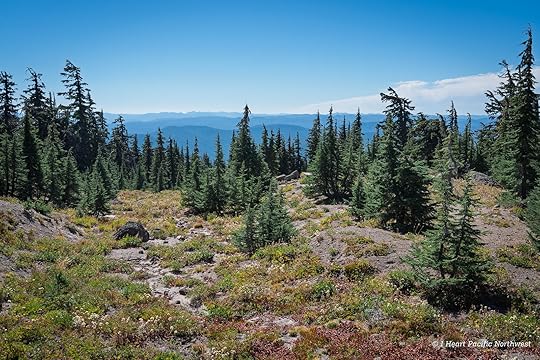
One of the reasons I chose this hike in late September was for fall color — and it didn’t disappoint.
This section of the PCT is popular, and we passed plenty of backpackers heading into Paradise Park for the night, and there were just as many day hikers like us enjoying the trail.
After a final stretch of rolling trail, we reached the Zigzag Canyon Overlook — a wide, open area with spectacular views of both the canyon and Mount Hood. We continued a bit farther down the trail to see where it descends into the canyon, but turned around to make it back to Portland in the afternoon.
The post Zigzag Canyon Overlook Hike – Mount Hood appeared first on I Heart Pacific Northwest.
September 18, 2025
Junction Lake Backpacking Trip – Indian Heaven Wilderness
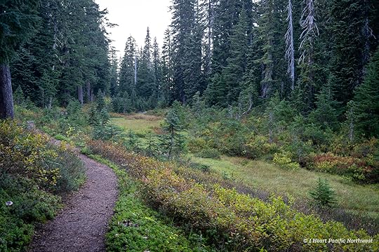
For the first backpacking experience for two of my friends, I chose Indian Heaven in the fall for its beauty and beginner-friendly terrain, with the East Crater Trail providing one of the easiest access points into the wilderness.
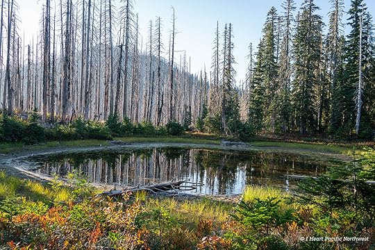
We got a late start on the East Crater Trail, passing through a section of forest burned in the 2017 East Crater wildfire that adds an eerie feel to the hike. A couple of tarns in this area still had some water, while others were dried up.
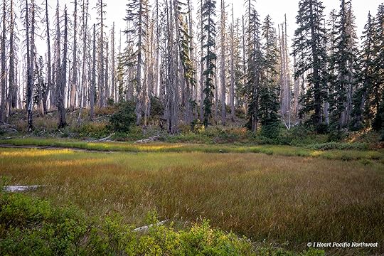
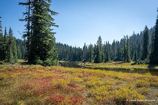
Getting closer to Junction Lake, we passed by meadows with colorful huckleberry shrubs.
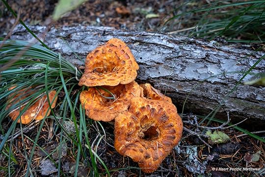
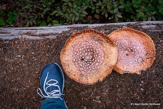
Mushrooms were plentiful along the trail, including these giant specimens — freshly emerged and big enough to dwarf my shoe.
The East Crater Trail ends at the Pacific Crest Trail, just before Junction Lake.
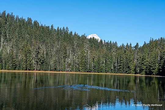
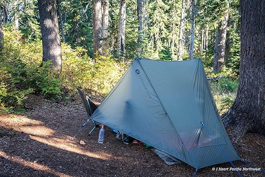
We reached Junction Lake just before dark and found a site I’d camped at before — tucked just off the Pacific Crest Trail and more private than other spots nearby. My friends all set up hammocks while I pitched my tent, and we settled in for the weekend. With lake levels lower than usual, finding water took a bit more effort, but we managed to filter enough for dinner before turning in. The night was incredibly quiet, with only the sound of birds circling overhead in the morning.
On our second day, we hiked the Lakes Basin loop counterclockwise, passing Lemei Lake and colorful meadows that still held hints of fall.
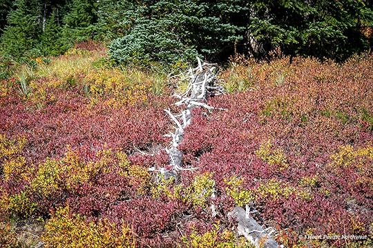
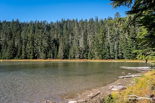
Most of the huckleberries were past their peak, but we stopped often to take in the views. At Clear Lake, we enjoyed a long lunch and filtered water to carry back to camp rather than relying on shallow Junction Lake. I always make time to look for pikas in the talus above Clear Lake, and this time I spotted two, their high-pitched calls echoing across the rocks. I love pikas!
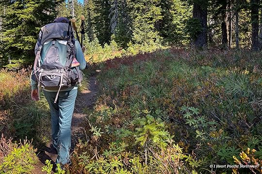
photo credit: M. Koenig
On this trip, I was much more focused on spending time with my friends than taking photos, so I don’t have any more from the trip to share other than this parting shot on the hike out. We finished the trip with a stop at the White Salmon bakery for pastries, a perfect way to end the weekend.
The post Junction Lake Backpacking Trip – Indian Heaven Wilderness appeared first on I Heart Pacific Northwest.
September 10, 2025
Camping at Carl Washburne State Park
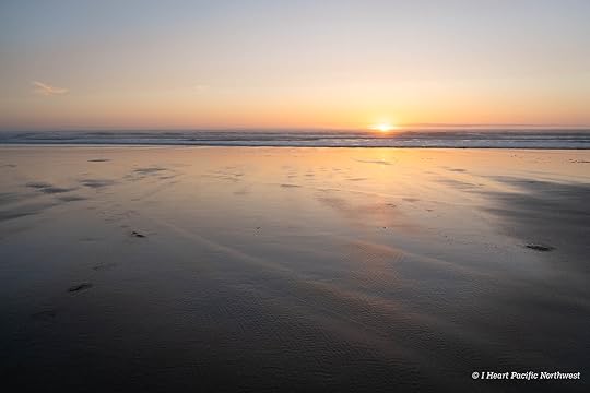
For this trip, we reserved a campsite for three nights at Carl G. Washburne State Park. It was my third time camping here, but my husband’s first — he’d been eager to return to this area ever since he found jaspers on the beach at Muriel Ponsler Wayside over ten years ago while we were staying in Yachats.
From Portland, we drove south on I-5, then followed Highway 20 through Corvallis and Philomath to Newport. I love coastal drives, so it’s always a treat to catch that first glimpse of the ocean. From Newport, Highway 101 took us south across the Alsea Bay Bridge into Waldport, through the artsy town of Yachats, and past Cape Perpetua to Carl Washburne State Park campground. Along the way, scenic outlooks, waysides, and state recreation sites offer plenty of options for side trips from camp.
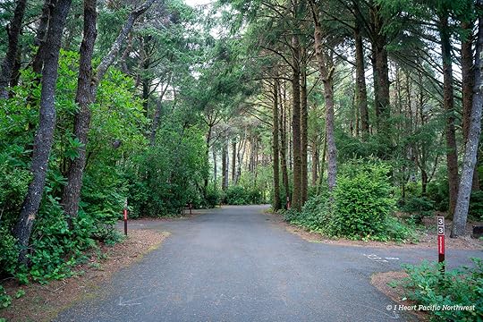
Day 1Our campsite was in a section once used for RVs until a storm damaged the hookups; it’s now reopened for tents. For a state park campground, Washburne feels small, quiet and friendly, mostly filled with RVs and vans. I also discovered a walk-in tent loop unlike any I’ve seen, with spacious, private sites tucked in the forest.
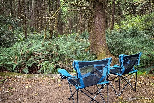
Our site backed up to a scenic section of sitka spruce forest where native squirrels entertained us as we relaxed.
That evening, I used a small flatpack grill (UCO Flatpack Portable Grill & Firepit) to cook dinner before we headed to the beach. I’m trying to mix up what I cook on camping trips, and the grill was fun to use. I learned that next time I’ll need more charcoal to fill the grill so it stays hot longer. I ended up finishing the chicken and mushrooms in the skillet along with the potatoes and carrots. I really enjoyed this dinner — the chicken, seasoned with a sesame seed spice mix, paired perfectly with the grill’s smoky flavor.


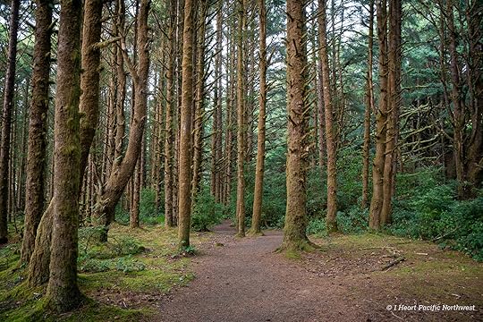
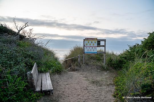
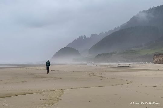
After dinner, we did a short loop hike from camp to the beach. The China Creek trail begins at the north end of the campground, and leads under the highway (no road crossing required) to the beach.
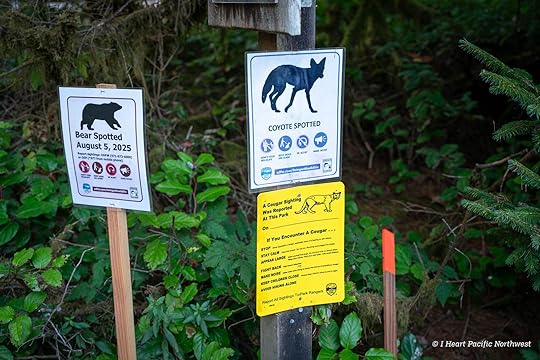
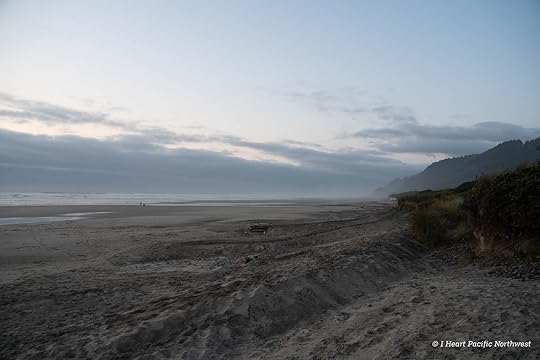
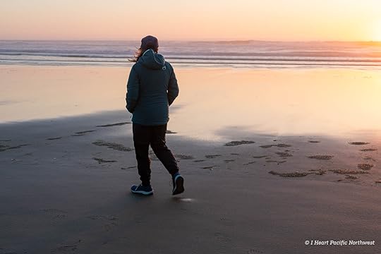
Signs at the trailhead warned of bear, cougar, and coyote sightings, which made us slightly nervous hiking at dusk – especially after crossing under the highway where the trail goes through a tunnel of dense thicket. We never heard or saw anything, though, and reached the beach in time for sunset.
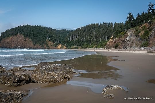
Once we reached the beach, we headed south toward the Washburne day-use area before looping back to camp.
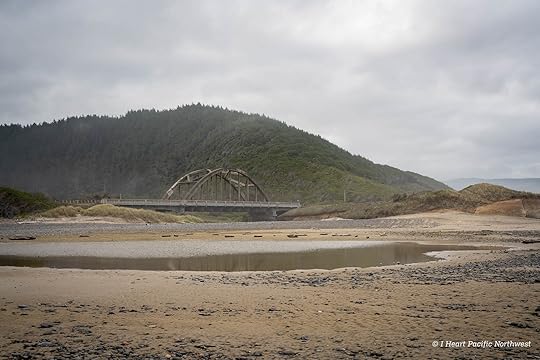
In the morning, we walked north along the China Creek Trail to the beach, hoping to find rocks to hunt. Unlike the last time we were here, the beach at Muriel Ponsler Wayside was surprisingly sandy, so we kept going and finally discovered a large rocky stretch near Big Creek.
My husband could happily rock hunt all day — on this trip, he found several nice jaspers and agates to polish in his tumbler.
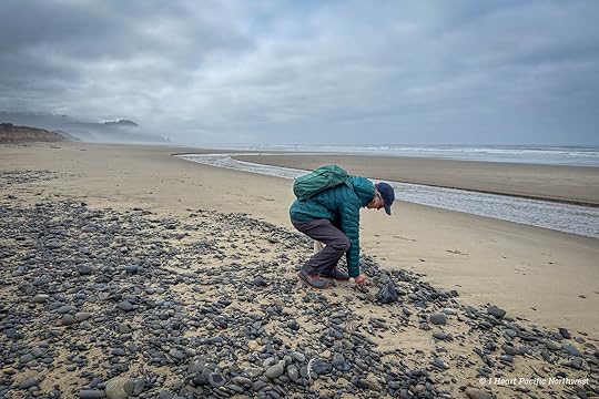
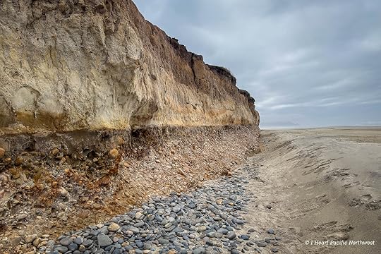
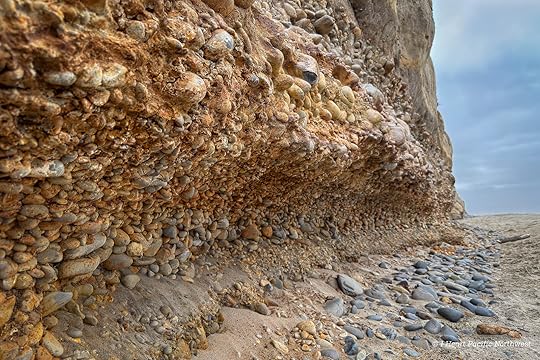
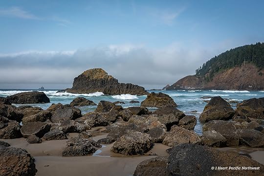
The cliffs here are eroding, revealing the layers that show where those beach stones come from.
Later, we drove north to Cape Perpetua to watch waves crash into the rocky shoreline, then enjoyed a seafood dinner in Yachats.
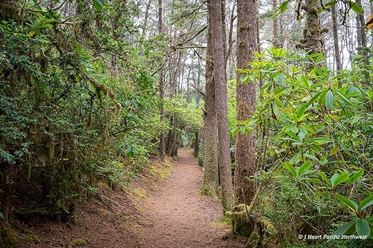
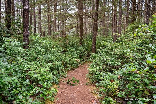
Day 3On our third day, we hiked a loop directly from camp: taking the Valley Trail to the Hobbit Trail, down to Hobbit Beach where we explored the north side of Heceta Head. Then we walked north on the beach for several miles to the day-use area, and back to camp. The hike featured forests filled with Sitka spruce, gradually blending into shore pines as you near the beach.
At the end of the Valley Trail, we crossed the highway to take the Hobbit Trail to the beach.
At the Hobbit Beach entry, visitors have turned shells and other beach finds into a playful, ever-changing public art display along the side walls.
It was low tide so we spent some time exploring the base of Heceta Head before continuing for several miles up the beach back to the Washburne day use area.
At the day-use area, twisted shore pines create an eerie, tunnel-like passage — a bit creepy to walk through at night but incredibly beautiful in the light of day.
Rain fell lightly overnight, so we lingered in camp, drying gear before packing up. On the way home, we stopped in Yachats for pastries at Bread & Roses Bakery (highly recommended!).
The post Camping at Carl Washburne State Park appeared first on I Heart Pacific Northwest.
September 4, 2025
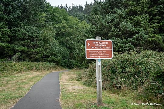
Ecola Point to Indian Beach Hike
distance: 4.7 miles (round trip)
elevation gain: 850 ft.
difficulty: easy
drive time from Portland: 1.5 hours
parking pass: Oregon State Parks Pass
tide tables: TidesChart – Cannon Beach
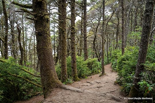
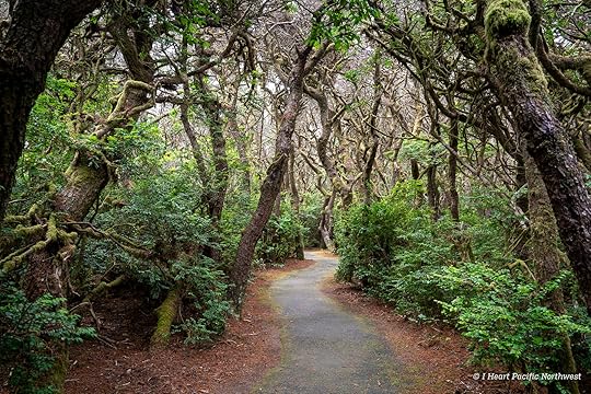
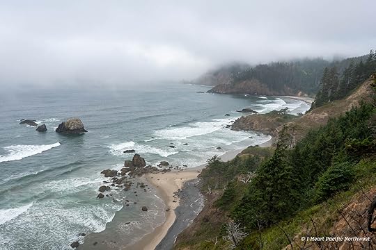
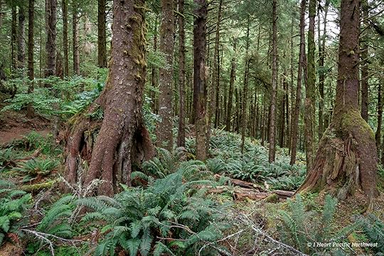
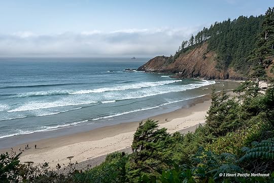
Ecola State Park is located at the north end of Cannon Beach, a small coastal town known for its shops, restaurants, and art galleries. Developed in the 1930s by the Civilian Conservation Corps, the park has two main parking areas: Ecola Point and Indian Beach. While you can drive directly to Indian Beach, the hike from Ecola Point is a rewarding option for views of the coastline and the trail’s scenic stretch through dense Sitka spruce forest.
This trail has seen its share of landslides. A major slide in 2016 forced a long-term closure, and the rerouted trail finally reopened in 2020. The original path clung to the cliffs, but the new route heads inland, making the hike a bit longer. I hadn’t done this hike since 2013, when earlier storm damage and slides made it a muddy obstacle course.
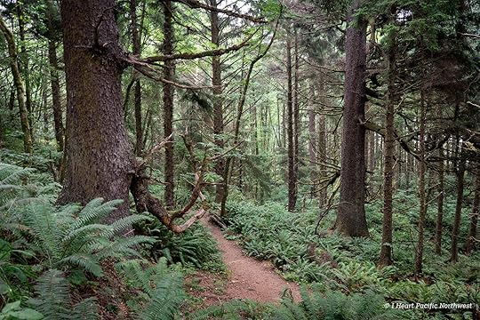
From the parking area, the trail crosses a small bridge and climbs through the forest, reaching the first overlook of Indian Beach in less than a quarter mile. It was foggy when we started the hike but was supposed to clear mid-day.
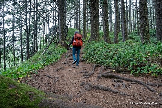
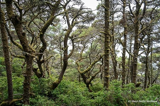
From the viewpoint, the trail continues uphill before leveling onto a wide path that roughly parallels the road. This section of forest is filled with nurse logs – old stumps and fallen trees slowly decaying, yet supporting new growth as younger trees take root on top of them.
Around the one-mile mark, the trail swings back toward the coast, where closed side paths mark old routes lost to slides.
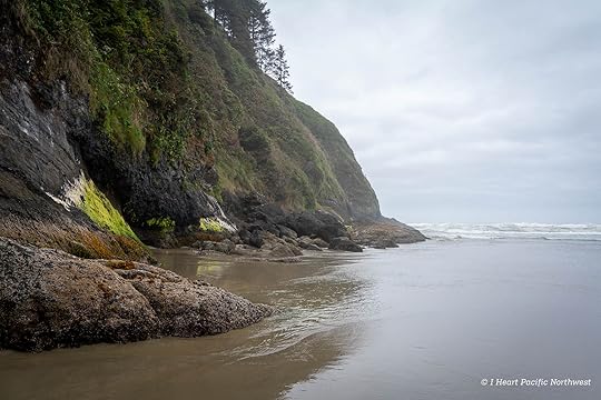
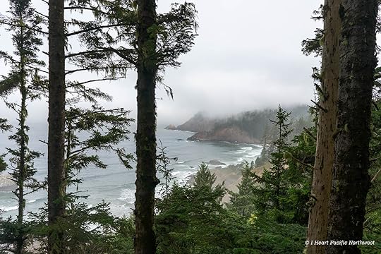
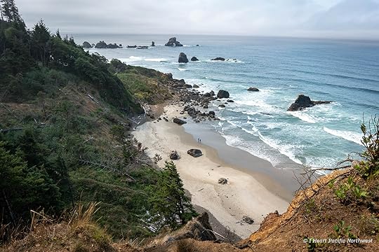
As the trail nears Indian Beach, there are several scenic views of the coastline, including Tillamook Rock Lighthouse about a mile offshore, perched on rugged rocks. Nicknamed “Terrible Tilly” for the dangerous seas that battered it, the lighthouse operated from 1881 to 1957.
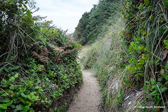
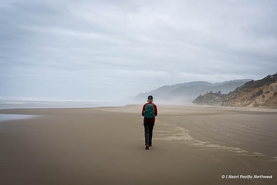
Eventually the trail drops toward Indian Beach, with several options leading to the sand. Taking the left fork brings you down quickly, where the beach stretches south to the rocky base of Bald Point.
What started out as a foggy day ended up being warm and sunny when we reached the beach, where we took a long break before retracing our steps on the trail back to Ecola Point.
The post Ecola Point to Indian Beach Hike appeared first on I Heart Pacific Northwest.
Hike: Ecola Point to Indian Beach
distance: 4.7 miles (round trip)
elevation gain: 850 ft.
difficulty: easy
drive time from Portland: 1.5 hours
parking pass: Oregon State Parks Pass
tide tables: TidesChart – Cannon Beach
Ecola State Park is located at the north end of Cannon Beach, a small coastal town known for its shops, restaurants, and art galleries. Developed in the 1930s by the Civilian Conservation Corps, the park has two main parking areas: Ecola Point and Indian Beach. While you can drive directly to Indian Beach, the hike from Ecola Point is a rewarding option for views of the coastline and the trail’s scenic stretch through dense Sitka spruce forest.
This trail has seen its share of landslides. A major slide in 2016 forced a long-term closure, and the rerouted trail finally reopened in 2020. The original path clung to the cliffs, but the new route heads inland, making the hike a bit longer. I hadn’t done this hike since 2013, when earlier storm damage and slides made it a muddy obstacle course.
From the parking area, the trail crosses a small bridge and climbs through the forest, reaching the first overlook of Indian Beach in less than a quarter mile. It was foggy when we started the hike but was supposed to clear mid-day.
From the viewpoint, the trail continues uphill before leveling onto a wide path that roughly parallels the road. This section of forest is filled with nurse logs – old stumps and fallen trees slowly decaying, yet supporting new growth as younger trees take root on top of them.
Around the one-mile mark, the trail swings back toward the coast, where closed side paths mark old routes lost to slides.
As the trail nears Indian Beach, there are several scenic views of the coastline, including Tillamook Rock Lighthouse about a mile offshore, perched on rugged rocks. Nicknamed “Terrible Tilly” for the dangerous seas that battered it, the lighthouse operated from 1881 to 1957.
Eventually the trail drops toward Indian Beach, with several options leading to the sand. Taking the left fork brings you down quickly, where the beach stretches south to the rocky base of Bald Point.
What started out as a foggy day ended up being warm and sunny when we reached the beach, where we took a long break before retracing our steps on the trail back to Ecola Point.
The post Hike: Ecola Point to Indian Beach appeared first on I Heart Pacific Northwest.
July 20, 2025
Camping at Crater Lake National Park
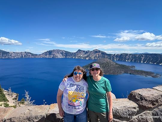
I recently took a quick trip to Crater Lake with my sister, who was visiting from Kansas City. She had never been to the park before, so we planned a few days of camping at Mazama Campground to give her a good introduction to the area. While we were there, we fit in a couple of short hikes and explored the Visitor Center and Rim Village.
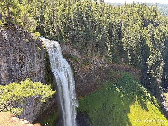
We drove down from Portland, taking I-5 south before heading east on Highway 58 across the Cascades. Along the way, we made a stop at Salt Creek Falls — Oregon’s second tallest waterfall — which is always worth the short detour.
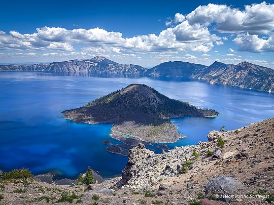
After what felt like a long day in the car, we finally reached Crater Lake National Park. There was a bit of a line at the entrance gate, but it moved quickly. It takes a few miles of driving past the entrance before you actually see the lake, but we pulled over at the first viewpoint to take in that unforgettable first look. Even though I’ve been before, that moment when the lake finally comes into view is always something special — especially seeing my sister’s reaction to it for the first time.
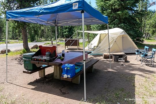
We drove to Mazama Village to find our campsite, got everything set up — including the tent and kitchen area—and then walked over to the nearby restaurant for dinner. The campground is big, with 214 sites, and it fills up quickly during the summer months. There’s also a small grocery store and gas station in Mazama Village, which makes it a convenient base for exploring the park.
Even midweek, Crater Lake can draw a crowd, and this trip was no exception. I found that getting an early start made a big difference—popular spots like the Visitor Center and Rim Village were much easier to navigate in the morning, with better parking and quieter trails.
On our second day, we spent the morning exploring the Rim Village area, including a visit to the Crater Lake Lodge, which has that classic national park lodge charm. After a quick lunch back at camp, we headed to the Steel Visitor Center to watch the park film and browse the gift shop.
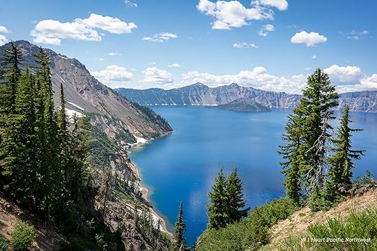
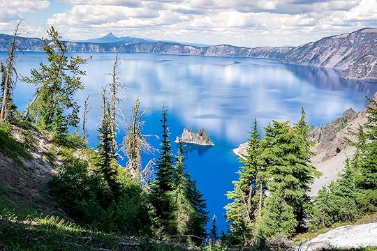
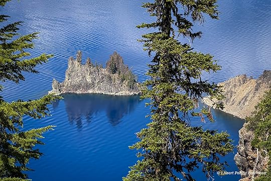
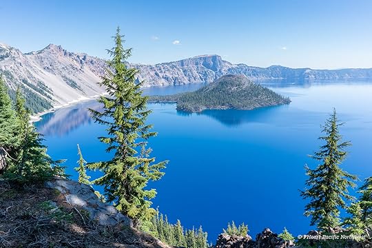
That afternoon, we drove part of the East Rim Drive and hiked the Sun Notch Trail for iconic views of Phantom Ship.
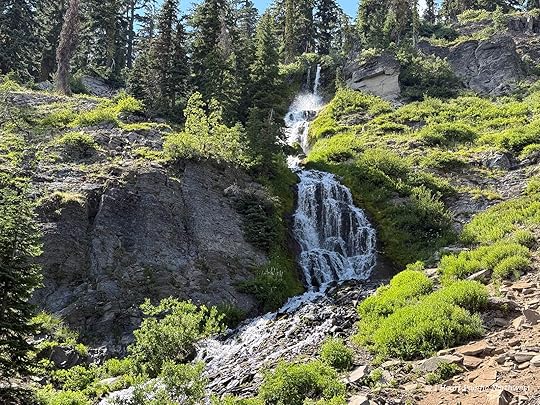
On the way back, we made a short stop at Vidae Falls, an easy roadside viewpoint worth pulling over for. Due to construction, the East Rim Road is closed from Sun Notch to Reflection Point for most of 2025, so we weren’t able to drive the full loop—but we still managed to see many of the park’s highlights.
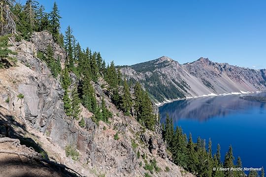
On our final morning, we returned to Rim Village and hiked a short stretch of the Discovery Point Trail, which runs along the lake’s west rim for about six miles. We turned around after a mile or so, but the views were incredible — this trail gets you remarkably close to the lake’s edge, and it’s worth being cautious near the cliffs.
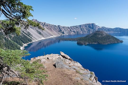
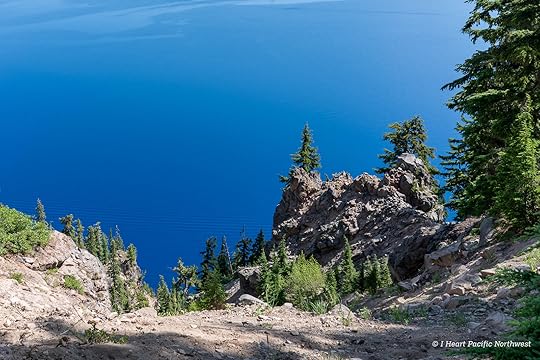
After packing up camp, we made one last stop at Watchman Overlook for a final view of Crater Lake — always a breathtaking way to end the trip.
The post Camping at Crater Lake National Park appeared first on I Heart Pacific Northwest.