Silver Star Mountain via Ed’s Trail Loop Hike
distance: 4.8 miles (loop)
elevation gain: 1,240 ft
difficulty: moderate to difficult (based on scramble sections)
best season: summer to fall
drive time from Portland: 1 hr 45 min
parking pass: none
hike description: OregonHikers: Silver Star via Ed’s Trail hike
The road to the North Silver Star trailhead has long been known for being rough. I’d only driven it once before, back in 2014, and after scraping the bottom of my car several times, I swore I wouldn’t do it again. A few years ago, the volunteer group Friends of Road 4109 began working to improve access to this trailhead, which is considered the best starting point for hiking in this area. When I heard the road work had been completed, I wanted to check it out — and finally hike the infamous Ed’s Trail. My friend drove her Honda CR-V and didn’t have any issues. The road is so much better now — huge thanks to everyone who helped make that happen!
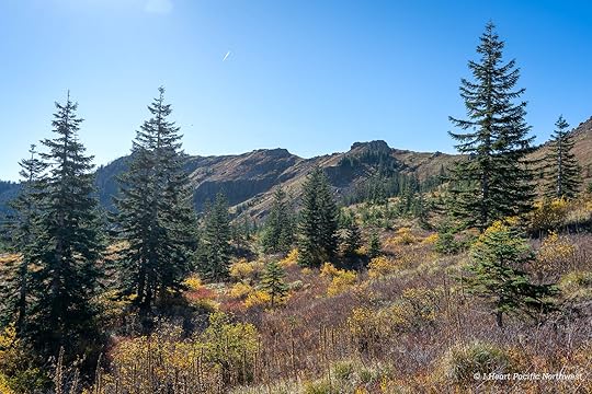
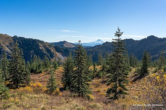
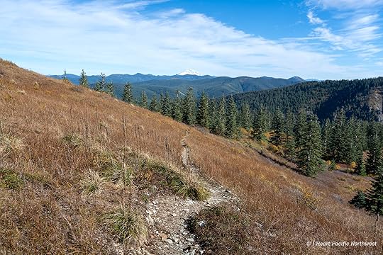
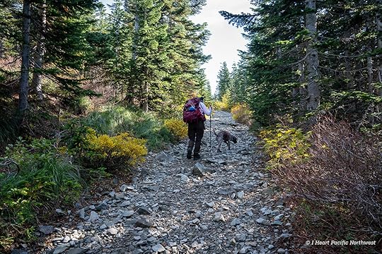
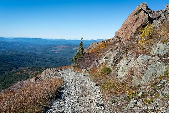
Even from the parking lot, the views extend to several Cascade peaks. We began on the main Silver Star Trail, then branched off onto Ed’s Trail — a more rugged and far more scenic alternate route that parallels the main trail.

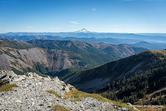
This was my first time hiking Ed’s Trail, and it was absolutely spectacular. The views are incredible — Mount St. Helens, Mount Rainier, Mount Adams, Mount Hood, and even Mount Jefferson fill the horizon. From higher points on the trail, we could also see fresh snow on Goat Rocks. And while I have hiked to Silver Star numerous times via the Grouse Vista trailhead during prime wildflower season, this was my first time here in the fall.
While the hike is just under five miles, it’s definitely a bit challenging due to the rugged terrain and two sections that require scrambling. I’m not a big fan of scrambling, especially with exposure, so I was curious how I’d handle it.
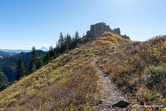

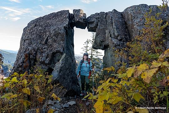
After traversing an incredibly scenic ridge, we reached the famous rock arch. I’d seen countless photos of it, and it was great to finally see it in person.
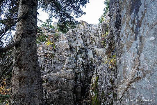
Beyond the arch, the trail continues along the base of several cliffs before reaching the first scramble. Staying to the left makes it easier to find the route — use your hands to pull yourself up to the continuation of the trail. Unfortunately, I didn’t take any photos of the first scramble.
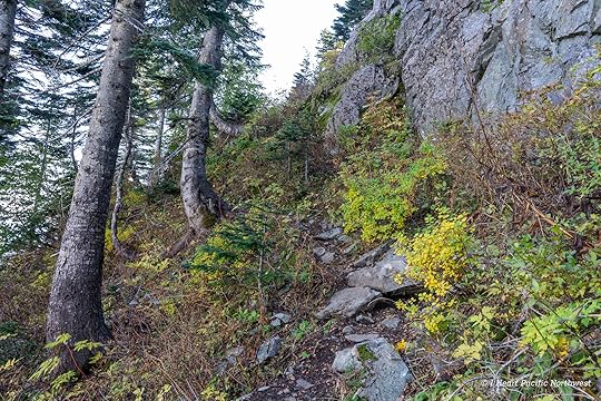
The trail remains rough and narrow for a bit, leading to a second scramble that climbs a 15-foot rock wall. Fortunately, there are plenty of good hand and footholds, though some are a long reach for short legs (I’m 5’1″).
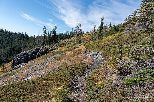
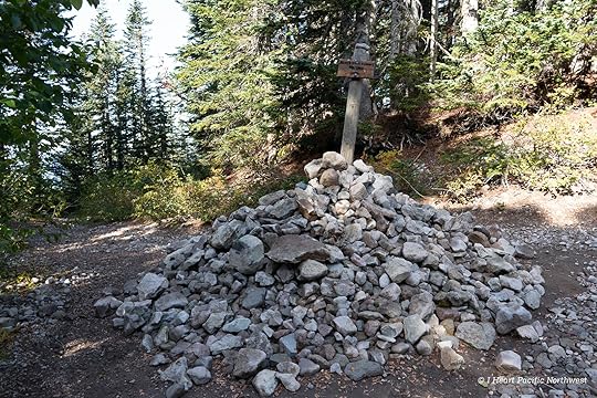
At the top, the trail winds through another incredibly scenic section filled with fall color before entering the forest for the final ascent to the main Silver Star Trail. Marked with a large cairn, we turned here for the last half mile to the summit.
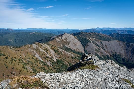
There are two summits at Silver Star, connected by a saddle. After visiting the lower one, we took a long break on the higher summit to enjoy the expansive panoramic views.

Looking down at the last section of Ed’s Trail from the summit of Silver Star.

Instead of returning via Ed’s Trail, we followed the main Silver Star Trail back to the trailhead. For me, going down the scrambles would have been much harder than climbing up. The rest of the trail is rocky, so I was glad to have shoes with plenty of cushioning.

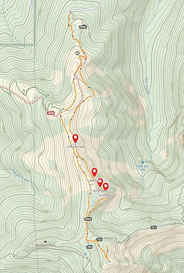
While I absolutely loved hiking Ed’s Trail, next time I’ll probably turn around at the rock arch and take a connector trail back to the main route to skip the scramble sections. See the map below that shows where the crossover trail, rock arch, and scramble sections are located.
The post Silver Star Mountain via Ed’s Trail Loop Hike appeared first on I Heart Pacific Northwest.