
Putting Australia on the Map
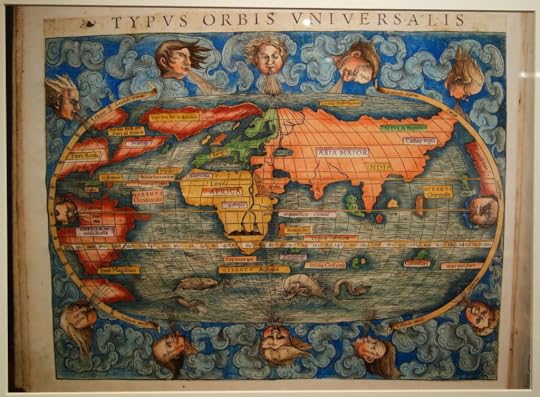 1540 map of the world showing sea monsters in the southern oceans, but no sign of Australia
I’ve been so busy getting my next book ready to go to the printers, I forgot to celebrate the “book birthday” of my latest book which has been in the shops since 1 March.
It’s a non-fiction book called Putting Australia on the Map. Australia is the 6th largest country in the world, but no one but our First Nations People new it existed until 1606. That was when Dutch mariner Willem Janzoon sailing a small ship called the Duyfken mapped about 300 kms of a coast he thought was part of New Guinea. Actually it was the western coast of Cape York.
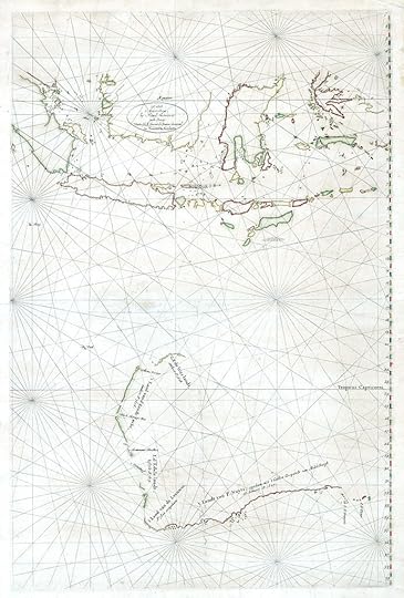 Chart of Australia consisting of pieces of the western and southern coasts mapped by eight Dutch sailors between 1616 and 1828
It was another 200 years before the map of Australia was put together piece by piece, like a puzzle, by many mariners.
Putting Australia on the Map tells the story of accidental discoveries, shipwreck and never-ending desire to find the world’s riches that led to the completion of the map of Australia. It is illustrated by some of the gorgeous old maps of the world that people hung on their walls, as well as historic sea charts drawn by the intrepid sailors who risked their lives to put Australia on the map.


Carole Wilkinson's Blog

- Carole Wilkinson's profile
- 291 followers

