Another Sunday, Another Ridge
I started out planning to traverse the exposed slope of a spectacular rocky canyon not far from town. But I got a late start, and as I approached the turnoff, I realized doing that hike now would push my lunch back until mid-afternoon. So I decided to keep driving north and have lunch in the alpine village across the Arizona border, then do a hike from the volcanic plateau in the afternoon.
Once the highway entered the mountains, I began to pass big burly pickup trucks, hauling heavy-duty full-length trailers, each carrying a side-by-side 4-seater UTV. One after another after another, dozens of them heading south, to the point where I was laughing hysterically each time I met one on this road where I used to drive a half hour at a time without meeting another vehicle.
All the pickups were different makes and colors – it was no kind of organized convoy – what the hell are these guys doing moving all these UTVs south in the fall? It is hunting season – maybe they live in the south, and are returning from hunts in the north, all at once on Sunday.
But after my long drive north through those dark forested mountains, cresting one pass after another, the village grill turned out to be closed, with no explanation. I could turn back, to less interesting options a half hour down the road. Or I could drive 40 minutes farther up onto the plateau, to the lodge that claims to open at noon but rarely sticks to a schedule.
I decided on the latter – any excuse to visit that plateau. Reaching 9,000 feet, with some aspens flaming red, I began to pass road cyclists struggling through the thin air in their garish skin-tight nylon outfits. A sight I hadn’t seen here before.
More cyclists were waiting on the veranda and inside the lodge, where I was the first diner at 12:15. As usual, the laid-back staff was multi-tasking – taking orders, cooking, cleaning rooms, doing paperwork – but my burger, served a half hour later, met my needs. While waiting and eating, I watched and overheard the cyclists – half young and half my age or older. Some were from Minneapolis – rich doctors, as is common in this expensive pastime. The clacking sound of their cleated shoes on the wood floor preceded them, and when I looked up, the first thing I noticed was that they walked bent sharply forward at the waist like “dunking birds”, from riding bent over for hours on stiff old joints. Impressively, they were making a loop of almost 300 miles and god knows how many thousands of feet in elevation, beginning and ending in Safford, and crossing all those high mountain passes in between. Impressive if you call operating an expensive machine on paved highways an achievement.
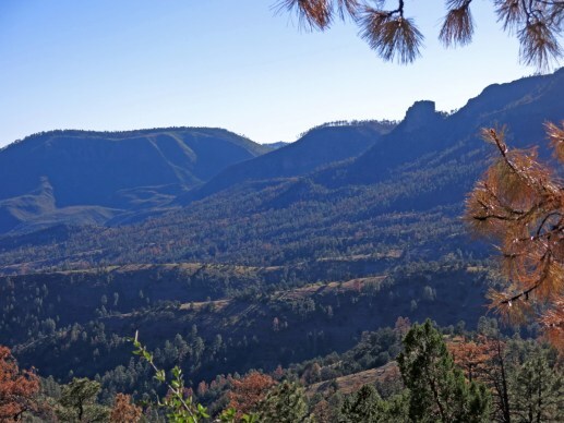
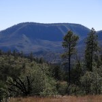
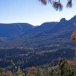
The trails along this eastern rim of the plateau all head down into the “lost world” – the broad, wild canyon of a tiny river, a hard-to-reach area known to few outsiders. I’d hiked the upper half of a nearby trail last spring, and wanted to get another taste of this unique habitat.
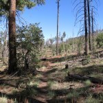
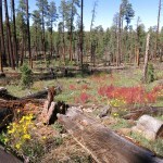
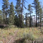
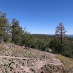
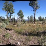
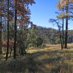
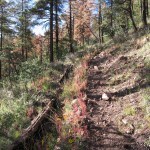
The trailhead, accessed by a long, meandering track through parklike ponderosa pine forest, was only occupied by a quad bike when I arrived. The trailhead log was such a bizarre jumble of dates that I couldn’t even tell what year they referred to. Air temperature was in the mid-60s in the forest, but I found that walking kept me plenty warm even in shorts. The first half mile emerged into and led gradually upwards through burn scar to the western rim of the big valley at 8,300 feet.
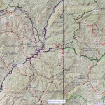
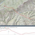
My topo map showed the trail dropping a few hundred feet onto a long east-trending ridge, similar to my previous hike here. I’d previewed it without zooming in, and the landmark where I planned to turn back appeared as a sharp bend south.
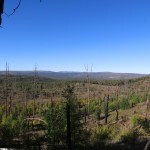
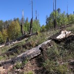
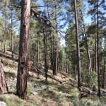
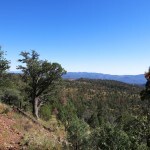
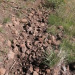
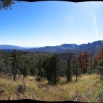
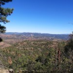
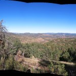
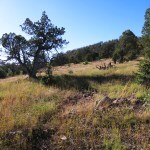
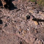
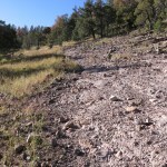
As before, the trail started in forest and became rockier and more exposed as it descended onto the ridge. On an open saddle, I had spectacular views up and down the big, wild valley, but I could also see the massive die-off in progress in the ponderosa pine forest, similar to what I’ve seen elsewhere in my corner of the Southwest, new in the past season.
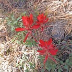
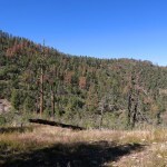
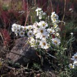
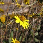
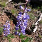
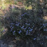
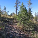
From here the trail followed the ridge top, like a gentle roller-coaster over thin soil and a lot of bare rock. The trail and the “meadows” around were choked with cosmos, my old nemesis – an annual with tiny daisy-like flowers that produces burs that stick to and are carried widely by clothes and animal fur. On my way up one of these gentle rises I suddenly faced a tall, slender man in garish, skin-tight nylon running down the trail toward me.
He stopped and asked me if I’d “seen anything”. I smiled and said I’d only gone a mile so far, and he exclaimed, “Wildlife! Have you seen any wildlife?”
I laughed and said it was mid-afternoon, so the animals were all sleeping. He said he was not familiar with this habitat, he lives in Durango, Colorado. I asked him what kind of wildlife he was expecting, and he said “Oles!”, the way Cockneys pronounce “Holes” without the “H”. There followed a long, frustrating exchange, which ended in him spelling “W – O – L – F” twice before I realized he had the remnants of, perhaps, a German accent, and had trouble with our consonant “W”.
I explained that people here hike all their lives without seeing a wolf, and described the megafauna he did have a chance of spotting – if he ever decided to live here year-round. He said he’d just arrived from the nearest county seat – a tiny village – over in New Mexico, where he’d explored a certain obscure, almost totally unknown creek it had taken me almost 20 years to find on maps, and which I was still only dreaming about exploring. We had an enthusiastic conversation, but it was only later that I regretted not questioning about his travels.
After the first mile the little-used trail mostly disappeared, and I found my route mainly by means of sporadic sawn logs and vague corridors through rocks, cosmos, and brush. Then I came upon an obvious switchback, which had not appeared on the map, where the trail clearly began a steep descent onto a lower ridge marked with a big cairn. I didn’t think I’d gone far enough, and the paper map I had didn’t show enough detail. I descended a few hundred yards, captured my position on GPS, and decided to head back.
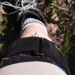
Returning, I had all that pine mortality in my face. I’d never seen anything like it. But with my knee brace, hiking uphill was easier, especially on the hated volcanic cobbles.
The sun was setting rapidly – it’s October – and the final descent from the rim to the trailhead seemed to take forever, as I pondered what this solo Germanic trail runner from Colorado was doing, accessing this trail on a “redneck” quad bike. Even less likely, how had he learned about this obscure trail all the way from Colorado, when it had taken me almost 20 years to learn about it from 2-1/2 hours away? And strangest of all, how had he learned about that creek, that only runs a few miles from an extremely remote dirt ranch road, through a box canyon that few have heard of and no one can access without prior arrangement at a remote, obscure Buddhist retreat? Box canyon and creek show up on no guidebooks and virtually no information is available online. Was he confused, talking about something completely different? The bigger the data, the less we know…