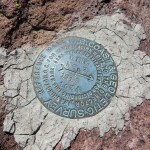
Defiance
My last hike was three weeks ago, and the corresponding Dispatch was titled “Last Hike”. Although my right knee finally seemed to be okay, the chronic inflammation in my left foot wasn’t responding to treatment, and I believed I might have to return to the Bay Area for a new exam and more ultrasound.
Plus, my right shoulder seemed to be getting worse. Using trekking poles and reaching for rocks while hiking was hard on it, and I’d also developed pain in my left forearm and injured my left elbow, so both arms were much less functional. And finally, the new surgeon in Tucson agreed that the best solution for the right shoulder is surgery – with a six-month recovery and the first 4-6 weeks of that immobilized.
I’d avoided all exercise for weeks, and now I fell into depression. I’d had two years of largely putting my life on hold while taking care of my family, and before that I’d spent almost a decade doing intensive rehab for surgery, injuries, and degenerative conditions. Plus – surviving a few near-death traumas.
My grandpa died at this age. You’re saying, instead of enjoying my new freedom and having fun for a change, I immediately need to be disabled for another six months?
With nothing to look forward to, feeling weak and fragile, losing the last shreds of my self-confidence, I was about ready to give up on life itself.
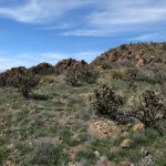
But meanwhile, I’d continued treating the foot, and it felt like it could maybe handle a few easy miles. So on Sunday morning, I drove south toward a stretch of the national trail that meanders across open, level country dotted with junipers. And along the way, I started daydreaming about a rocky peak I’d been wanting to climb over on the Arizona border.
I’d never tried it in the past because on paper it wasn’t enough of a challenge – only a mile and a quarter and 1,400 feet of elevation gain. But it’s in a really beautiful area. I figured if it turned out to be easy, I’d climb it. Otherwise I’d end up in a spectacular spot instead of stuck between junipers with no view.
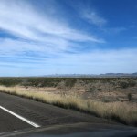
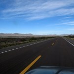
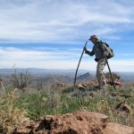
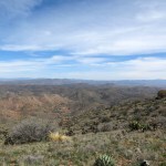
Blue skies with high, wispy clouds, and a fire weather forecast for the entire Southwest – warm, dry, and windy. The climb would start at 5,300 feet and top out at almost 6,800 feet, and I set out in my shirtsleeves.
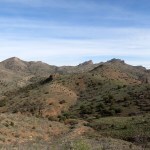
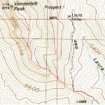
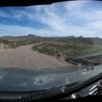
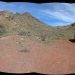
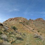
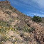
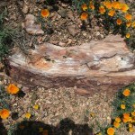
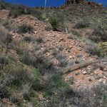
No trails in these mountains – seldom visited, the only roads built for mines and ranches – but since the peaks look striking from the distant highway, a handful of peakbaggers have ventured over here. I’d studied their routes for years, the shortest beginning on an old dead-end mine road in a pass. But of course, changing my mind at the last minute, I hadn’t brought a map. The mine road turned out to be obvious but clearly undriveable, so I parked and started up it.
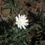
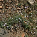
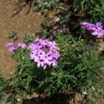
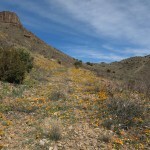
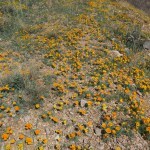
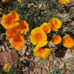
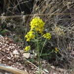
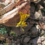
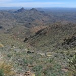
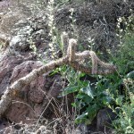
The road overlooks a pretty canyon coming down from the north, dividing a ridge leading to today’s peak on my left, and a lower ridge opposite that. Below a saddle in the ridge on my side, the road turns right, and although deeply washed out, past there it was carpeted with poppies – so pretty I hated to walk on them.
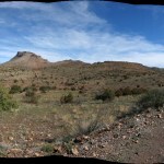
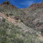
I could see mine works high on the slope above, and midway up the traverse I passed the remains of a side road that leads to that earlier saddle. Ahead, a steep side canyon comes down from what appeared to be the peak, and I figured that would be my route.
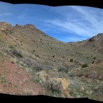
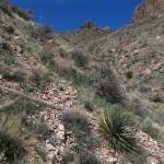
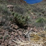
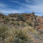
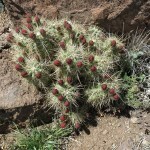
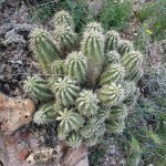
The opposite slope of the canyon appeared to be mostly loose rock, so I started up the more vegetated, and slightly less steep, left slope. Near the road it was fairly gentle, although rocky and choked with yuccas, cholla, and thorns. But once I got into the canyon proper I was on nothing but loose rock at the angle of repose – talus colonized by various small perennials.
I soon came upon animal tracks, and although in the loose dirt I couldn’t tell what they were, I tried to follow them. Until they got too steep or disappeared.
I crossed deep gullies, kept slipping on loose rock, grabbed a fallen yucca stalk for balance, and eventually I reached a slope of bare talus. This is ridiculous, I thought. You’re going to destroy your foot, and maybe your knee too. Remember why you came here – to take it easy and enjoy the scenery.
But after a few minutes’ rest, staring up ahead where the canyon made a right turn, I felt obligated to continue at least that far. Maybe it would get easier.
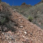
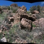
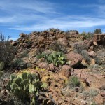
Of course, where the canyon turned right, another deep gully came down from the left, and the main canyon was choked with boulders, with a high bank of loose rock to climb out of. And on top of that, just more talus colonized by spikes and thorns.
But of course, now I’d passed that milestone, the peak appeared to be a straight shot above me. Straight shot! Hah!
Now, instead of traversing a steep talus slope colonized by spikes and thorns, I was climbing one. I grabbed a second yucca stalk and now had two walking sticks, but they kept getting stuck between loose rocks or caught in shrubs. At first I regretted not bringing my trekking poles, then soon realized they’d get stuck even worse in this habitat.
Hoping the footing would be better higher to my left, below the rimrock, I kept clambering in that direction, only to be turned away by denser vegetation. And eventually, I found myself only a hundred feet or so below the apparent saddle that divided the apparent peak from the rimrock on my left.
The only juniper in this vicinity loomed to the right of the saddle, and I climbed toward it.
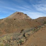
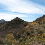
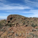
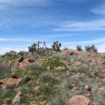
But once past the juniper, I found myself facing jagged ramparts of stone. And when I climbed up into them, I spotted a higher rise, quite a bit farther north of me. Shit. As usual, I was on a false peak.
I picked my way through this long ridge of rock outcrops, then down onto another scrubby talus slope toward the rise I’d spotted earlier.
But it turned out to be yet another false peak. As I traversed around it, I saw what I hoped was the real peak, rising quite a bit higher in the distance.
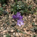
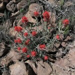
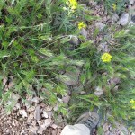
Finally reaching a saddle below the final peak, in a greener area featuring grasses and annuals, I suddenly stepped out into a small, level clearing, just big enough for a campsite. It was the only level place I found in the entire hike! But of course, a gale force wind was blowing across from the west.
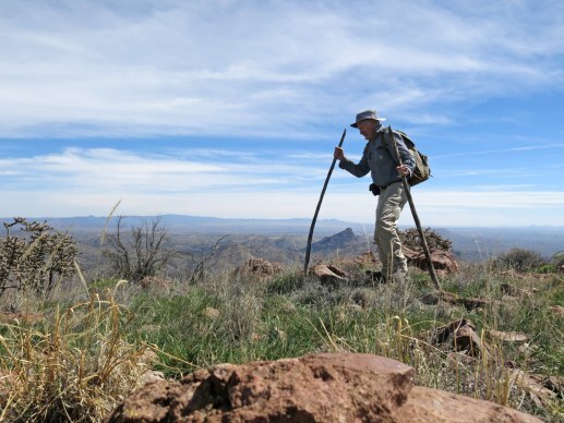
Windy or not, I was elated to reach the peak, while trying to ignore the perilous descent I faced on my return. Fortunately, I had plenty of time, and walking sticks to lean on.
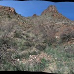
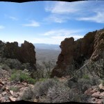
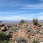
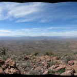
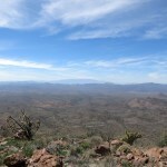
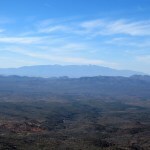
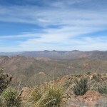
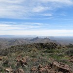
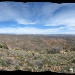
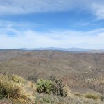
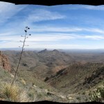
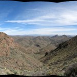
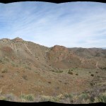
As expected, the view was amazing. I could see mountains I’d hiked and peaks I’d climbed to east, south, and west, up to fifty miles away, and a big dust storm was stirring up across the playa forty miles to the south.
Unusually, I got lost among those jagged rocks on the way down the summit ridge, but managed to get turned back at the end, to the head of the right canyon. And it wasn’t a sight I looked forward to.
Again, I tried to stay close to the rimrock on the west side, but had to zigzag constantly to avoid boulders and thorns. My yucca stalks kept breaking on the way down, leaving me with only one until I could find another the right size. This time, I wanted to stay high. The slope above the lower canyon also featured rimrock, and I figured I might be able to cross above the talus up there.
Higher up the slope, I found longer stretches of game trails that helped a little. This appeared ideal bighorn habitat, but the only clear-cut tracks I saw all day looked to be from deer, and the only scat from rabbits.
When I reached the lower canyon, I was able to traverse above some of the larger bare talus slopes. But the trade-off was denser vegetation in my way, and in some cases, deeper gullies to cross. I stayed high as long as possible, finally cutting under the last rimrock outcrop, where I spotted the old mine road a couple hundred feet below.
The descent never got any easier. As I mentioned earlier, this entire landscape consisted of loose rock sparsely colonized by perennials that mostly didn’t even offer good hand-or-footholds. In that final descent from the rimrock both my ankles were worn out and aching from trying to keep my balance. I’d fallen once, a while back, and now I was leaning on the yucca stalks whenever possible to stay upright.
Back at the vehicle, I immediately downed a couple pain pills. My foot was aching and my knee pain had returned after a couple months’ reprieve. It had taken me five hours to go less than 2-1/2 miles. What I’d done was both idiotic and exhilarating.
I remembered that some time in the past decade, when disabled and unable to hike, I’d assured friends that if necessary, I would “crawl on my bloody stumps” to reach my beloved desert. Meaning I would never give up. That’s what today had been about.
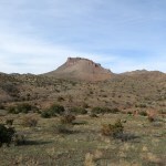
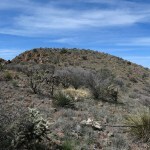
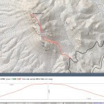
On the way out, I stopped to look back. And realized that if I’d simply remembered the western profile of the mountain, I would’ve known that the actual peak was far to the north of where I topped out of that canyon. And at home, checking the peakbagger route, I discovered they climbed away from the mine road below that first, low saddle, and followed the ridgetop high above the canyon I hiked.
Their footing would’ve been no different, but the average grade would’ve been less. My average grade for the day was 40 percent, across more than a mile – one of the hardest climbs I’ve ever done, if not the hardest.