Jerusalem: the Center of the World?
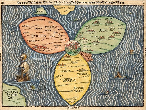
The Bünting cloverleaf map, created in 1581 by the German Protestant pastor and theologian Heinrich Bünting. Drawing from Medieval traditions, it placed Jerusalem at the center of the world. But is it, really?
Reposted from “Chimeras” 10 Oct 2025
By Ugo Bardi
In Medieval Europe, Jerusalem was considered to be the center of the world. It was probably the result of a line by Ezekiel 5:5: “This is Jerusalem; I have set her in the center of the nations, with countries all around her.” And that was taken seriously. Not only Jerusalem was considered at the actual center of the world, but it stood just above Hell, while the Garden of Even was a real place, located just nearby, near the opening of the Gihon Spring. This spring, which is today a mere trickle compared to what it once was, originates just outside of what is now the Old City of Jerusalem.
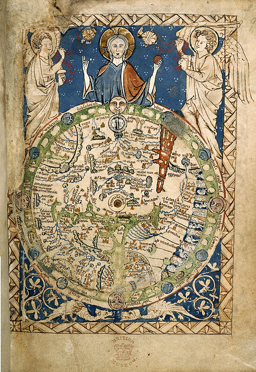
You can see below a map of the world that’s much older than Bünting’s cloverleaf. It is more difficult to read, but you can note Jerusalem exactly at the center. It is the “Psalter World Map” found in a psalter. It was created during the 13th century.
But where is the real center of the world? And how should we define it? In physics, you have the concept of “center of mass,” the average position of the mass distribution in an object or system. You can also use the term “centroid” for the average position of all the points of a system. For a physical object, it is the balance point if the shape were made of a thin, uniform sheet of material, where it would balance perfectly on a pin.
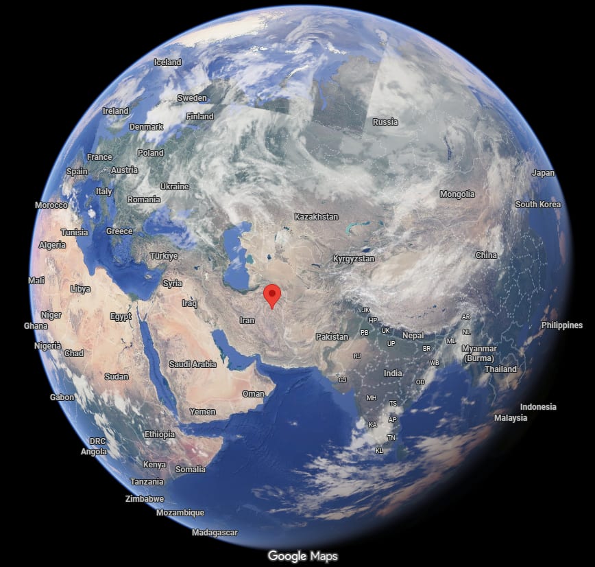
You can easily define the centroid for the land mass of Earth. For instance, the centroid of the Afro-Eurasian block is located somewhere in Iran. If you want to know precisely, it is at 34.4° N, 58.6° E. Here is the Afro-Eurasian centroid point, shown in Google Maps, not terribly far from Jerusalem, but not close, either.
The closest city to the centroid is Gonabad, a place that you have probably never heard of, but, curiously, it turned out to be a place I had some affinity with. It is there that the last king of the Sasanian empire, Yazdegerd III, took refuge before being killed, it is said, by a miller. His death signaled the collapse of the Sasanian Empire. If you are interested in Iranian history, you can see an eerie and fascinating movie on Yazdegerd (or Yazdigerd) III at this link.
If we consider all the continents, including Antarctica, the point moves to somewhere in Sudan, but that’s not so interesting. A purely geographic average doesn’t tell us what the real “center of the world” is. It should be, rather, based on the distribution of people over the continents.
If we look for the “people’s centroid” of the Afro-Eurasian bloc, the result is different. I asked Grok-4 to do the calculation, and here are the results.
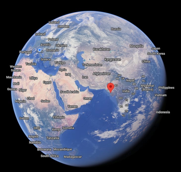
Now, the distribution is dominated by the huge population of India and East/South East Asia. The result is that the centroid moves to the Western coast of India. Here are the coordinates: 23°15’36.0”N 69°40’48.0”E. I didn’t check Grok’s calculation, but it seems to be a reasonable result. The centroid location is heavily influenced by the large populations of India and Southeast Asia.
The population centroid is in the Indian state of Gujarat, of which I must confess, I only vaguely knew the existence. The closest city is Bhuij, which I had never known to exist. Anyway, it is in the Gujarat state. According to Wikipedia:
Kutch (Kachchh) was ruled by the Nāga chieftains in the past. Sagai, a queen of Sheshapattana, who was married to King Bheria Kumar, rose up against Bhujanga, the last chieftain of Naga. After the battle, Bheria was defeated and Queen Sagai committed sati. The hill where they lived later came to be known as Bhujia Hill and the town at the foothill as Bhuj. Bhujang was later worshiped by the people as snake god, Bhujanga, and a temple was constructed to revere him.
Which, I’d say, sounds like a fitting legend for a place that turns out to be the center of the Afro-Eurasian bloc.
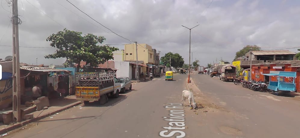
What kind of place is that? Well, the Google mobile didn’t exactly reach the population centroid, although it could get within just a few tens of meters from it, as you see here.
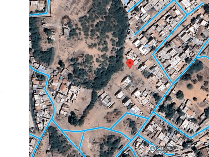
That’s what you can see from the closest place where the Googlemobile arrived, about 30 m away.
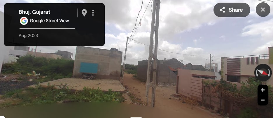
This is the center of the world. Honestly, the area doesn’t look very impressive in architectural terms, but I suppose the people who live there see it as their sweet home.
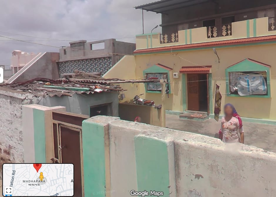
I’ve never been to Gujarat, but from what I could see from Google Maps, Bhuj looks not unlike other places I saw in India, around New Delhi. Dogs, cows, small shops, and the ubiquitous tuc-tucs moving around.
I wonder what it would be to enter one of those small shops, buy a Coke or something like that, and ask, “Do you people know you are at the population centroid of the Afro-Eurasian bloc?” Who knows? They could answer, “Yes, we know. We read it in the blog of a weird Italian guy.”